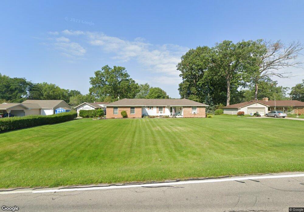
4821 Reed Rd Fort Wayne, IN 46835
Greentree NeighborhoodEstimated Value: $252,000 - $270,830
3
Beds
2
Baths
1,835
Sq Ft
$141/Sq Ft
Est. Value
About This Home
This home is located at 4821 Reed Rd, Fort Wayne, IN 46835 and is currently estimated at $259,458, approximately $141 per square foot. 4821 Reed Rd is a home located in Allen County with nearby schools including Robert C. Harris Elementary School, Lane Middle School, and R Nelson Snider High School.
Ownership History
Date
Name
Owned For
Owner Type
Purchase Details
Closed on
Aug 27, 2021
Sold by
Redding Wayne D
Bought by
Redding Madelyn I
Current Estimated Value
Purchase Details
Closed on
Apr 12, 2021
Sold by
Stedge Enterprises
Bought by
Redding Wayne D
Home Financials for this Owner
Home Financials are based on the most recent Mortgage that was taken out on this home.
Original Mortgage
$75,608
Outstanding Balance
$68,265
Interest Rate
3%
Mortgage Type
New Conventional
Estimated Equity
$191,193
Purchase Details
Closed on
Aug 18, 2005
Sold by
Stedge Donald D and Stedge Anthony Michael
Bought by
Stedge Enterprises
Purchase Details
Closed on
Jun 6, 2005
Sold by
Stedge Donald D and Stedge Anthony Michael
Bought by
Stedge Enterprises
Create a Home Valuation Report for This Property
The Home Valuation Report is an in-depth analysis detailing your home's value as well as a comparison with similar homes in the area
Home Values in the Area
Average Home Value in this Area
Purchase History
| Date | Buyer | Sale Price | Title Company |
|---|---|---|---|
| Redding Madelyn I | -- | None Available | |
| Redding Wayne D | $100,000 | None Available | |
| Stedge Enterprises | -- | -- | |
| Stedge Enterprises | -- | -- |
Source: Public Records
Mortgage History
| Date | Status | Borrower | Loan Amount |
|---|---|---|---|
| Open | Redding Wayne D | $75,608 |
Source: Public Records
Tax History Compared to Growth
Tax History
| Year | Tax Paid | Tax Assessment Tax Assessment Total Assessment is a certain percentage of the fair market value that is determined by local assessors to be the total taxable value of land and additions on the property. | Land | Improvement |
|---|---|---|---|---|
| 2024 | $2,853 | $266,000 | $28,700 | $237,300 |
| 2022 | $2,405 | $202,300 | $28,700 | $173,600 |
| 2021 | $4,138 | $186,500 | $28,700 | $157,800 |
| 2020 | $3,777 | $170,000 | $28,700 | $141,300 |
| 2019 | $3,724 | $168,000 | $28,700 | $139,300 |
| 2018 | $3,418 | $152,800 | $28,700 | $124,100 |
| 2017 | $3,036 | $133,700 | $28,700 | $105,000 |
| 2016 | $2,743 | $122,300 | $28,700 | $93,600 |
| 2014 | $2,661 | $124,800 | $28,700 | $96,100 |
| 2013 | $2,856 | $134,000 | $28,700 | $105,300 |
Source: Public Records
Map
Nearby Homes
- 4721 Ottawa Dr
- 4617 Innsbruck Dr
- 4408 Tamarack Dr
- 4823 Manistee Dr
- 5002 Wheaton Ct
- 5019 Woodlea Ave
- 5229 Wyndemere Ct
- 5145 Woodlea Ave
- 4893 Woodway Dr
- 5030 Stellhorn Rd
- 5317 Stellhorn Rd
- 5410 Butterfield Dr
- 4979 Mamie Dr
- 5510 Pine Oak Ct
- 4734 Dutchess Ln
- 5414 Stellhorn Rd
- 4654 Schmucker Dr
- 5307 Eicher Dr
- 5214 Eicher Dr
- 5622 Sawmill Woods Blvd
- 4839 Reed Rd
- 4777 Reed Rd
- 4808 Innsbruck Dr
- 4816 Innsbruck Dr
- 4744 Innsbruck Dr
- 4857 Reed Rd
- 4824 Innsbruck Dr
- 4736 Innsbruck Dr
- 4763 Reed Rd
- 4832 Innsbruck Dr
- 4838 Reed Rd
- 4728 Innsbruck Dr
- 4802 Reed Rd
- 4915 Reed Rd
- 4856 Reed Rd
- 4741 Reed Rd
- 4838 Innsbruck Dr
- 4770 Reed Rd
- 4805 Innsbruck Dr
- 4811 Innsbruck Dr