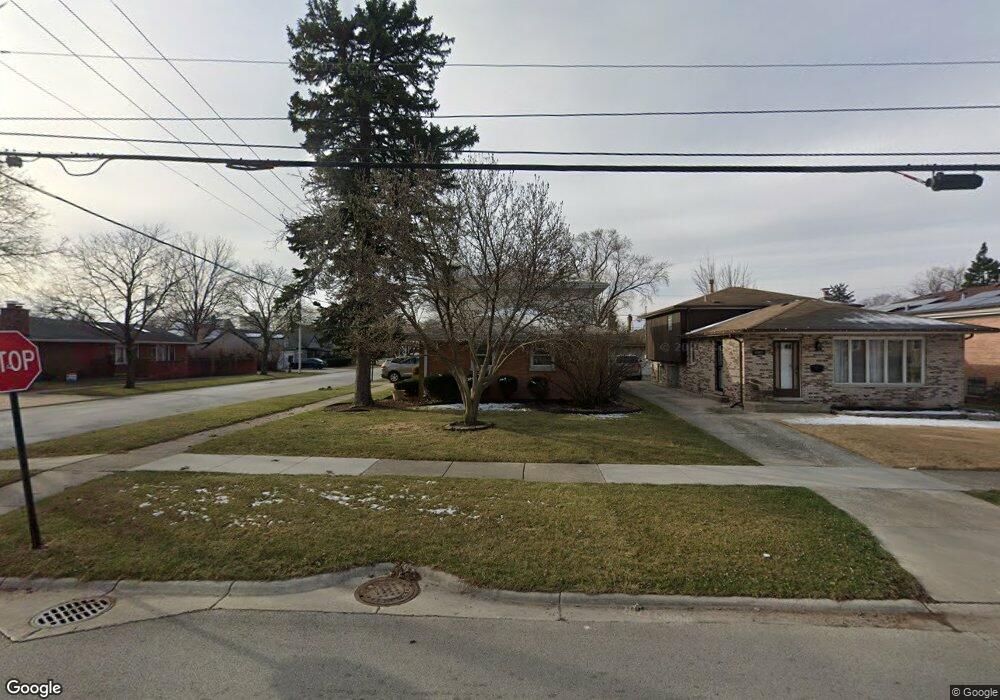
4821 W 91st St Oak Lawn, IL 60453
Estimated Value: $322,000 - $338,000
3
Beds
2
Baths
1,406
Sq Ft
$235/Sq Ft
Est. Value
About This Home
This home is located at 4821 W 91st St, Oak Lawn, IL 60453 and is currently estimated at $329,751, approximately $234 per square foot. 4821 W 91st St is a home located in Cook County with nearby schools including J Covington Elementary School, Hometown Elementary School, and Sward Elementary School.
Ownership History
Date
Name
Owned For
Owner Type
Purchase Details
Closed on
Jun 11, 2010
Sold by
Palos Bank & Trust Company
Bought by
Hamad Nazmy
Current Estimated Value
Home Financials for this Owner
Home Financials are based on the most recent Mortgage that was taken out on this home.
Original Mortgage
$182,541
Interest Rate
4.4%
Mortgage Type
FHA
Purchase Details
Closed on
Mar 6, 2001
Sold by
Bunting Betty J
Bought by
Palos Bank & Trust Company and Trust #1-5064
Create a Home Valuation Report for This Property
The Home Valuation Report is an in-depth analysis detailing your home's value as well as a comparison with similar homes in the area
Home Values in the Area
Average Home Value in this Area
Purchase History
| Date | Buyer | Sale Price | Title Company |
|---|---|---|---|
| Hamad Nazmy | $185,000 | Attorneys Title Guaranty Fun | |
| Palos Bank & Trust Company | -- | -- |
Source: Public Records
Mortgage History
| Date | Status | Borrower | Loan Amount |
|---|---|---|---|
| Previous Owner | Hamad Nazmy | $182,541 |
Source: Public Records
Tax History Compared to Growth
Tax History
| Year | Tax Paid | Tax Assessment Tax Assessment Total Assessment is a certain percentage of the fair market value that is determined by local assessors to be the total taxable value of land and additions on the property. | Land | Improvement |
|---|---|---|---|---|
| 2024 | $6,938 | $26,001 | $4,813 | $21,188 |
| 2023 | $6,291 | $26,001 | $4,813 | $21,188 |
| 2022 | $6,291 | $20,028 | $4,125 | $15,903 |
| 2021 | $6,186 | $20,028 | $4,125 | $15,903 |
| 2020 | $6,787 | $21,798 | $4,125 | $17,673 |
| 2019 | $6,830 | $22,262 | $3,781 | $18,481 |
| 2018 | $6,568 | $22,262 | $3,781 | $18,481 |
| 2017 | $6,601 | $22,262 | $3,781 | $18,481 |
| 2016 | $5,996 | $18,865 | $3,093 | $15,772 |
| 2015 | $5,885 | $18,865 | $3,093 | $15,772 |
| 2014 | $5,838 | $18,865 | $3,093 | $15,772 |
| 2013 | $6,414 | $22,565 | $3,093 | $19,472 |
Source: Public Records
Map
Nearby Homes
- 9001 S Cicero Ave Unit 6
- 9001 S Cicero Ave Unit 116
- 9005 S 49th Ct
- 9047 S 50th Ave
- 9212 S 49th Ct
- 9246 S 49th Ave
- 9330 S 50th Ave
- 4560 W 93rd St Unit 2D
- 4501 W 90th Place
- 4530 W 93rd St Unit 2B
- 9402 Sproat Ave
- 8737 Sproat Ave Unit 2
- 9317 S Kolmar Ave
- 8772 S Kolmar Ave
- 9336 Tulley Ave
- 5175 W 88th Place
- 5232 Cass St
- 8650 Laporte Ave Unit 2B
- 9135 S 53rd Ave
- 9221 Raymond Ave
- 4817 W 91st St
- 4825 W 91st St
- 4829 W 91st St
- 4820 W 91st Place
- 4816 W 91st Place
- 4824 W 91st Place
- 4833 W 91st St
- 4828 W 91st Place
- 4812 W 91st Place
- 9110 S Cicero Ave
- 4824 W 91st St
- 4832 W 91st Place
- 4830 W 91st St
- 4820 W 91st St
- 4832 W 91st St
- 4816 W 91st St
- 4834 W 91st St
- 4812 W 91st St
- 9033 S 49th Ave
- 4858 W 91st Place