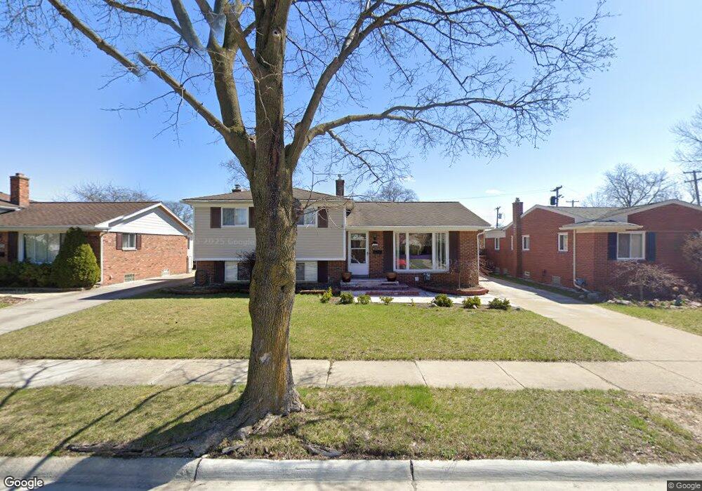
4822 Elmhurst Ave Royal Oak, MI 48073
Estimated Value: $401,777 - $478,000
4
Beds
2
Baths
1,808
Sq Ft
$247/Sq Ft
Est. Value
About This Home
This home is located at 4822 Elmhurst Ave, Royal Oak, MI 48073 and is currently estimated at $446,444, approximately $246 per square foot. 4822 Elmhurst Ave is a home located in Oakland County with nearby schools including Alfred E. Upton Elementary School, Royal Oak Middle School, and Royal Oak High School.
Ownership History
Date
Name
Owned For
Owner Type
Purchase Details
Closed on
Nov 20, 2009
Sold by
Greenpoint Mortgage Funding Inc
Bought by
Hsbc Bank Usa National Association
Current Estimated Value
Home Financials for this Owner
Home Financials are based on the most recent Mortgage that was taken out on this home.
Original Mortgage
$122,896
Outstanding Balance
$80,082
Interest Rate
4.96%
Mortgage Type
New Conventional
Estimated Equity
$366,362
Purchase Details
Closed on
Jun 17, 2008
Sold by
Pier Jon
Bought by
Greenpoint Mortgage Funding Inc
Purchase Details
Closed on
Feb 27, 2004
Sold by
Mithias Pier Susan L
Bought by
Pier Jon
Home Financials for this Owner
Home Financials are based on the most recent Mortgage that was taken out on this home.
Original Mortgage
$165,750
Interest Rate
5.77%
Mortgage Type
Purchase Money Mortgage
Purchase Details
Closed on
Jan 10, 1997
Sold by
Bishop Leo J
Bought by
Pier Jon
Create a Home Valuation Report for This Property
The Home Valuation Report is an in-depth analysis detailing your home's value as well as a comparison with similar homes in the area
Home Values in the Area
Average Home Value in this Area
Purchase History
| Date | Buyer | Sale Price | Title Company |
|---|---|---|---|
| Hsbc Bank Usa National Association | -- | Metropolitan | |
| Greenpoint Mortgage Funding Inc | $186,388 | None Available | |
| Pier Jon | $54,000 | -- | |
| Pier Jon | $137,500 | -- |
Source: Public Records
Mortgage History
| Date | Status | Borrower | Loan Amount |
|---|---|---|---|
| Open | Hsbc Bank Usa National Association | $122,896 | |
| Previous Owner | Pier Jon | $165,750 |
Source: Public Records
Tax History Compared to Growth
Tax History
| Year | Tax Paid | Tax Assessment Tax Assessment Total Assessment is a certain percentage of the fair market value that is determined by local assessors to be the total taxable value of land and additions on the property. | Land | Improvement |
|---|---|---|---|---|
| 2024 | $2,691 | $157,310 | $0 | $0 |
| 2022 | $3,179 | $142,140 | $0 | $0 |
| 2020 | $2,615 | $125,590 | $0 | $0 |
| 2018 | $3,179 | $101,250 | $0 | $0 |
| 2017 | $3,056 | $101,250 | $0 | $0 |
| 2015 | -- | $92,330 | $0 | $0 |
| 2014 | -- | $81,220 | $0 | $0 |
| 2011 | -- | $71,810 | $0 | $0 |
Source: Public Records
Map
Nearby Homes
- 2306 W 14 Mile Rd Unit 14
- 2356 W 14 Mile Rd Unit 1
- 4859 Mansfield Ave Unit H5
- 4830 Briarwood Ave Unit 2
- 4840 Briarwood Ave Unit 8
- 4820 Briarwood Ave Unit 4
- 2420 Parmenter Blvd Unit 101
- 4625 Leafdale Ave
- 2440 Parmenter Blvd Unit 112
- 2425 Torquay Ave Unit 101A
- 4921 Crooks Rd Unit M-10
- 4909 Crooks Rd Unit C7
- 4909 Crooks Rd Unit E8
- 4909 Crooks Rd Unit 4
- 4921 N Crooks Rd Unit N-10
- 1807 Samoset Rd
- 1823 Torquay Ave
- 2134 Wickham St
- 1936 Torquay Ave Unit 205
- 496 Langley Blvd
- 4826 Elmhurst Ave
- 4818 Elmhurst Ave
- 4832 Elmhurst Ave
- 4814 Elmhurst Ave
- 4823 Elmhurst Ave
- 4838 Elmhurst Ave
- 4819 Elmhurst Ave
- 4827 Elmhurst Ave
- 4815 Elmhurst Ave
- 4833 Elmhurst Ave
- 2230 W 14 Mile Rd Unit 27
- 2230 W 14 Mile Rd Unit 26-Bldg1
- 2230 W 14 Mile Rd Unit 31
- 2230 W 14 Mile Rd Unit 1, 26
- 2230 W 14 Mile Rd Unit 35
- 2230 W 14 Mile Rd Unit 30
- 2230 W 14 Mile Rd
- 2230 W 14 Mile Rd
- 2230 W 14 Mile Rd
- 2230 W 14 Mile Rd