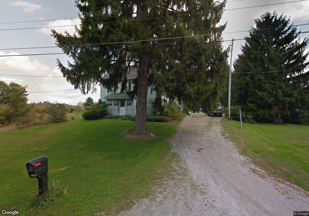
4822 Eshelman St Louisville, OH 44641
Estimated Value: $186,000 - $254,000
3
Beds
2
Baths
2,836
Sq Ft
$81/Sq Ft
Est. Value
About This Home
This home is located at 4822 Eshelman St, Louisville, OH 44641 and is currently estimated at $228,541, approximately $80 per square foot. 4822 Eshelman St is a home located in Stark County with nearby schools including Louisville High School and St. Thomas Aquinas High School & Middle School.
Ownership History
Date
Name
Owned For
Owner Type
Purchase Details
Closed on
Jun 29, 2005
Sold by
Pugh Eric D and Pugh Catherine J
Bought by
Nims Michael E and Nims Diane M
Current Estimated Value
Home Financials for this Owner
Home Financials are based on the most recent Mortgage that was taken out on this home.
Original Mortgage
$115,200
Outstanding Balance
$41,625
Interest Rate
1%
Mortgage Type
Fannie Mae Freddie Mac
Estimated Equity
$186,916
Purchase Details
Closed on
Mar 5, 1999
Sold by
Rodak Mark A
Bought by
Pugh Eric D and Pugh Catherine J
Home Financials for this Owner
Home Financials are based on the most recent Mortgage that was taken out on this home.
Original Mortgage
$98,100
Interest Rate
6.83%
Mortgage Type
Purchase Money Mortgage
Create a Home Valuation Report for This Property
The Home Valuation Report is an in-depth analysis detailing your home's value as well as a comparison with similar homes in the area
Home Values in the Area
Average Home Value in this Area
Purchase History
| Date | Buyer | Sale Price | Title Company |
|---|---|---|---|
| Nims Michael E | $144,000 | Quest Title Agency Inc | |
| Pugh Eric D | $109,000 | -- |
Source: Public Records
Mortgage History
| Date | Status | Borrower | Loan Amount |
|---|---|---|---|
| Open | Nims Michael E | $115,200 | |
| Closed | Pugh Eric D | $98,100 | |
| Closed | Nims Michael E | $28,800 |
Source: Public Records
Tax History Compared to Growth
Tax History
| Year | Tax Paid | Tax Assessment Tax Assessment Total Assessment is a certain percentage of the fair market value that is determined by local assessors to be the total taxable value of land and additions on the property. | Land | Improvement |
|---|---|---|---|---|
| 2025 | -- | $57,930 | $21,000 | $36,930 |
| 2024 | -- | $57,930 | $21,000 | $36,930 |
| 2023 | $2,135 | $43,580 | $14,840 | $28,740 |
| 2022 | $2,141 | $43,580 | $14,840 | $28,740 |
| 2021 | $2,147 | $43,580 | $14,840 | $28,740 |
| 2020 | $1,809 | $38,750 | $13,370 | $25,380 |
| 2019 | $1,817 | $38,750 | $13,370 | $25,380 |
| 2018 | $1,811 | $38,750 | $13,370 | $25,380 |
| 2017 | $1,780 | $36,370 | $13,480 | $22,890 |
| 2016 | $1,725 | $35,920 | $5,780 | $30,140 |
| 2015 | $1,729 | $35,920 | $5,780 | $30,140 |
| 2014 | $1,630 | $31,330 | $5,040 | $26,290 |
| 2013 | $819 | $31,330 | $5,040 | $26,290 |
Source: Public Records
Map
Nearby Homes
- 2015 E Main St
- 203 Brookfield St
- 5495 Meese Rd NE
- 1812 E Broad St
- 1715 High St
- 2110 Edmar St
- 5765 Maplegrove St
- 0 Michigan Blvd
- 6052 N Nickelplate St
- 308 Superior St
- 1170 Winding Ridge Ave
- 641 S Nickelplate St
- 910 Crosswyck Cir
- 3390 Meese Rd NE
- 520 S Silver St
- 728 E Broad St
- 325 Lincoln Ave
- 316 E Reno Dr
- 204 E Broad St
- 428 Honeycrisp Dr NE
- 4866 Eshelman St
- 4869 Eshelman St
- 4900 Eshelman St
- 4901 Eshelman St
- 4930 Eshelman St
- 4810 Eshelman St
- 4934 Eshelman St
- 4956 Eshelman St
- 4874 Stoner Ave
- 4887 Eshelman St
- 4963 Eshelman St
- 9305 Louisville St
- 9201 Louisville St
- 9144 Scott St
- 9144 Scott St
- 4870 Stoner Ave
- 9153 Scott St
- 9104 Scott St
- 4860 Stoner Ave
- 4894 Stoner Ave