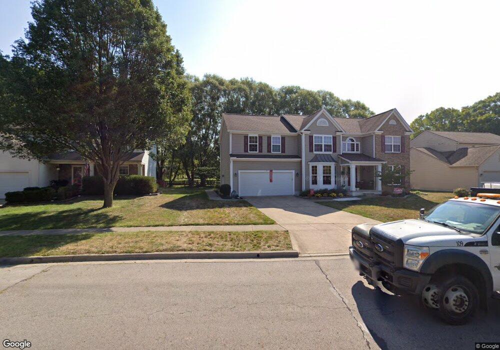
4822 Founders Dr Groveport, OH 43125
Estimated Value: $349,000 - $404,000
3
Beds
3
Baths
2,498
Sq Ft
$150/Sq Ft
Est. Value
About This Home
This home is located at 4822 Founders Dr, Groveport, OH 43125 and is currently estimated at $374,165, approximately $149 per square foot. 4822 Founders Dr is a home located in Franklin County with nearby schools including Groveport Madison High School, Groveport Community School, and Madison Christian School.
Ownership History
Date
Name
Owned For
Owner Type
Purchase Details
Closed on
Dec 11, 2003
Sold by
Rockford Homes Inc
Bought by
Longwell Charles A and Longwell Brenda J
Current Estimated Value
Home Financials for this Owner
Home Financials are based on the most recent Mortgage that was taken out on this home.
Original Mortgage
$172,972
Outstanding Balance
$80,879
Interest Rate
6.01%
Mortgage Type
Purchase Money Mortgage
Estimated Equity
$293,286
Create a Home Valuation Report for This Property
The Home Valuation Report is an in-depth analysis detailing your home's value as well as a comparison with similar homes in the area
Home Values in the Area
Average Home Value in this Area
Purchase History
| Date | Buyer | Sale Price | Title Company |
|---|---|---|---|
| Longwell Charles A | $216,300 | Midland Celtic Title |
Source: Public Records
Mortgage History
| Date | Status | Borrower | Loan Amount |
|---|---|---|---|
| Open | Longwell Charles A | $172,972 |
Source: Public Records
Tax History Compared to Growth
Tax History
| Year | Tax Paid | Tax Assessment Tax Assessment Total Assessment is a certain percentage of the fair market value that is determined by local assessors to be the total taxable value of land and additions on the property. | Land | Improvement |
|---|---|---|---|---|
| 2024 | $4,481 | $101,430 | $22,050 | $79,380 |
| 2023 | $4,472 | $101,430 | $22,050 | $79,380 |
| 2022 | $4,109 | $76,370 | $8,400 | $67,970 |
| 2021 | $4,124 | $76,370 | $8,400 | $67,970 |
| 2020 | $4,134 | $76,370 | $8,400 | $67,970 |
| 2019 | $3,723 | $62,440 | $7,000 | $55,440 |
| 2018 | $3,774 | $62,440 | $7,000 | $55,440 |
| 2017 | $3,762 | $62,440 | $7,000 | $55,440 |
| 2016 | $3,772 | $57,760 | $10,470 | $47,290 |
| 2015 | $3,805 | $57,760 | $10,470 | $47,290 |
| 2014 | $3,582 | $57,760 | $10,470 | $47,290 |
| 2013 | $1,527 | $57,750 | $10,465 | $47,285 |
Source: Public Records
Map
Nearby Homes
- 4822 Elmont Place
- 4868 Hendron Rd
- 111 Church St
- 5011 Hickory Grove Cir
- 537 Blacklick St
- 5086 Sand Ct
- 135 Front St
- 199 Mohr Ave
- 5652 Red Alder St
- 5156 Sand Ct
- 4835 Grove Pointe Dr
- 4870 Saw Grove Ct
- 287 College St
- 5777 Ebright Rd
- 324 West St
- 336 Lambert St
- 403 Tallman St
- 250 Green Ave
- 456 Benson Dr
- 5548 Harriet St
- 4822 Founders Dr Unit DRN
- 4830 Founders Dr
- 4814 Founders Dr
- 4810 Founders Way
- 4806 Founders Dr
- 4821 Founders Dr
- 4829 Founders Dr
- 4818 Founders Way
- 4798 Founders Dr
- 4473 Landings Rd
- 4465 Landings Rd
- 4846 Founders Dr
- 4845 Founders Dr
- 4825 S Hamilton Rd
- 4790 Founders Dr
- 4457 Landings Rd
- 4854 Founders Dr
- 4861 Founders Dr
- 4449 Landings Rd
- 4782 Founders Dr