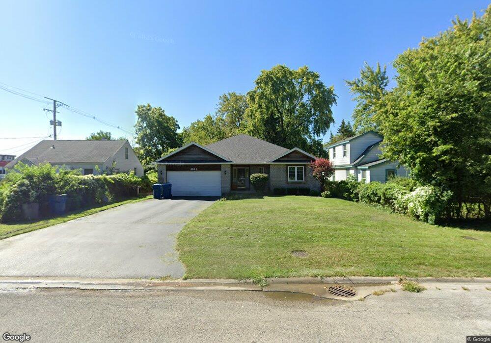
4823 142nd St Crestwood, IL 60418
Estimated Value: $377,000 - $404,000
4
Beds
3
Baths
1,831
Sq Ft
$214/Sq Ft
Est. Value
About This Home
This home is located at 4823 142nd St, Crestwood, IL 60418 and is currently estimated at $391,950, approximately $214 per square foot. 4823 142nd St is a home located in Cook County with nearby schools including Kerkstra Elementary School, Jack Hille Middle School, and Oak Forest High School.
Ownership History
Date
Name
Owned For
Owner Type
Purchase Details
Closed on
Sep 29, 2000
Sold by
First Alliance Mtg Company
Bought by
Wasik Michael and Wasik Lisa
Current Estimated Value
Purchase Details
Closed on
Mar 14, 2000
Sold by
Macgregor Robert
Purchase Details
Closed on
Feb 29, 2000
Sold by
Macgregor Robert
Bought by
First Alliance Mtg Company
Purchase Details
Closed on
Sep 22, 1995
Sold by
Macgregor Robert
Bought by
Macgregor Robert and Macgregor Susana
Home Financials for this Owner
Home Financials are based on the most recent Mortgage that was taken out on this home.
Original Mortgage
$32,700
Interest Rate
7.91%
Create a Home Valuation Report for This Property
The Home Valuation Report is an in-depth analysis detailing your home's value as well as a comparison with similar homes in the area
Home Values in the Area
Average Home Value in this Area
Purchase History
| Date | Buyer | Sale Price | Title Company |
|---|---|---|---|
| Wasik Michael | $50,000 | -- | |
| -- | -- | -- | |
| First Alliance Mtg Company | -- | -- | |
| Macgregor Robert | -- | -- |
Source: Public Records
Mortgage History
| Date | Status | Borrower | Loan Amount |
|---|---|---|---|
| Previous Owner | Macgregor Robert | $32,700 |
Source: Public Records
Tax History Compared to Growth
Tax History
| Year | Tax Paid | Tax Assessment Tax Assessment Total Assessment is a certain percentage of the fair market value that is determined by local assessors to be the total taxable value of land and additions on the property. | Land | Improvement |
|---|---|---|---|---|
| 2024 | $6,953 | $31,000 | $6,816 | $24,184 |
| 2023 | $7,340 | $31,000 | $6,816 | $24,184 |
| 2022 | $7,340 | $25,470 | $5,964 | $19,506 |
| 2021 | $7,209 | $25,469 | $5,964 | $19,505 |
| 2020 | $7,047 | $25,469 | $5,964 | $19,505 |
| 2019 | $6,628 | $24,236 | $5,538 | $18,698 |
| 2018 | $6,571 | $24,236 | $5,538 | $18,698 |
| 2017 | $6,739 | $24,236 | $5,538 | $18,698 |
| 2016 | $6,119 | $20,787 | $4,686 | $16,101 |
| 2015 | $5,969 | $20,787 | $4,686 | $16,101 |
| 2014 | $5,881 | $20,787 | $4,686 | $16,101 |
| 2013 | $6,634 | $25,410 | $4,686 | $20,724 |
Source: Public Records
Map
Nearby Homes
- 14309 Kilpatrick Ave
- 5018 Midlothian Turnpike Unit 1009
- 14348 Knox Ave
- 14455 Lamon Ave Unit 1S
- 14341 Kenton Ave
- 5041 139th Place Unit 406
- 14051 E Laramie Ct
- 13919 W Leamington Dr Unit 806
- 5204 Midlothian Turnpike Unit 222
- 4653 146th St
- 14244 Kostner Ave
- 14647 Lamon Ave
- 14602 Kenton Ave
- 13933 James Dr Unit 816
- 13933 James Dr Unit 820
- 14631 Knox Ave
- 4424 Midlothian Turnpike
- 5333 Waterbury Way Unit 503A
- 13706 Crestview Ct
- 13919 James Dr Unit 903
- 4831 142nd St
- 4819 142nd St
- 4833 142nd St
- 4845 142nd St
- 14170 Cicero Ave Unit 204
- 14170 Cicero Ave
- 14162 S Cicero Ave
- 14155 Lamon Ave
- 14162 Cicero Ave
- 14227 Lamon Ave
- 14200 Cicero Ave
- 4826 142nd St
- 4824 142nd St
- 14200 S Cicero Ave
- 14208 Lamon Ave
- 14154 Cicero Ave
- 14230 Cicero Ave Unit A
- 14230 Cicero Ave Unit J
- 14230 Cicero Ave Unit E
- 14230 Cicero Ave Unit F