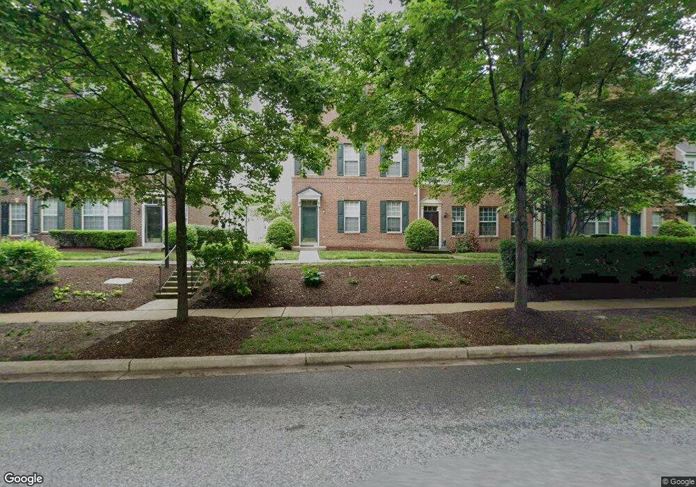
4823 Harcourt Rd Upper Marlboro, MD 20772
Estimated Value: $343,000 - $380,000
Studio
--
Bath
1,599
Sq Ft
$227/Sq Ft
Est. Value
About This Home
This home is located at 4823 Harcourt Rd, Upper Marlboro, MD 20772 and is currently estimated at $363,111, approximately $227 per square foot. 4823 Harcourt Rd is a home located in Prince George's County with nearby schools including Barack Obama Elementary School, James Madison Middle School, and Dr. Henry A. Wise Jr. High School.
Ownership History
Date
Name
Owned For
Owner Type
Purchase Details
Closed on
Sep 8, 2005
Sold by
Mcdonald Constance M
Bought by
Lewis Mark A and Unit 9
Current Estimated Value
Home Financials for this Owner
Home Financials are based on the most recent Mortgage that was taken out on this home.
Original Mortgage
$225,600
Outstanding Balance
$117,842
Interest Rate
5.67%
Mortgage Type
New Conventional
Estimated Equity
$245,269
Purchase Details
Closed on
Apr 17, 2000
Sold by
Coscan Highland Gate Inc
Bought by
Mcdonald Constance M
Create a Home Valuation Report for This Property
The Home Valuation Report is an in-depth analysis detailing your home's value as well as a comparison with similar homes in the area
Home Values in the Area
Average Home Value in this Area
Purchase History
| Date | Buyer | Sale Price | Title Company |
|---|---|---|---|
| Lewis Mark A | $292,000 | -- | |
| Mcdonald Constance M | $139,815 | -- |
Source: Public Records
Mortgage History
| Date | Status | Borrower | Loan Amount |
|---|---|---|---|
| Open | Lewis Mark A | $225,600 | |
| Closed | Lewis Mark A | $58,400 |
Source: Public Records
Tax History
| Year | Tax Paid | Tax Assessment Tax Assessment Total Assessment is a certain percentage of the fair market value that is determined by local assessors to be the total taxable value of land and additions on the property. | Land | Improvement |
|---|---|---|---|---|
| 2025 | $4,803 | $319,600 | $95,800 | $223,800 |
| 2024 | $4,803 | $296,667 | -- | -- |
| 2023 | $3,044 | $273,733 | $0 | $0 |
| 2022 | $2,789 | $250,800 | $75,200 | $175,600 |
| 2021 | $7,855 | $224,800 | $0 | $0 |
| 2020 | $6,696 | $198,800 | $0 | $0 |
| 2019 | $2,475 | $172,800 | $51,800 | $121,000 |
| 2018 | $2,647 | $158,800 | $0 | $0 |
| 2017 | $2,333 | $144,800 | $0 | $0 |
| 2016 | -- | $130,800 | $0 | $0 |
| 2015 | $3,303 | $130,800 | $0 | $0 |
| 2014 | $3,303 | $130,800 | $0 | $0 |
Source: Public Records
Map
Nearby Homes
- 13825 King Frederick Way
- 4707 King John Way
- 13900 Farnsworth Ln Unit 4301
- 13900 King George Way
- 14100 Farnsworth Ln Unit 2108
- 13805 Fareham Ln
- 5101 Back Stretch Blvd
- 14523 Hampshire Hall Ct
- 5200 Mapleshade Ln W
- 14218 Hampshire Hall Ct
- 14100 Old Marlboro Pike
- 5209 Mount Airy Ln
- 13542 Lord Baltimore Place
- 13500 Old Marlboro Pike
- 4808 Colonel Brooke Ct
- 4411 Beckenham Place
- 4720 Colonel Ashton Place
- 14404 Marlborough Dr
- 14412 Marlborough Dr
- 13616 Lord Sterling Place
- 4819 Harcourt Rd
- 4821 Harcourt Rd
- 4813 Harcourt Rd
- 4817 Harcourt Rd
- 4827 Harcourt Rd
- 4829 Harcourt Rd
- 4825 Harcourt Rd
- 4815 Harcourt Rd
- 4818 Harcourt Rd
- 14003 Barenton Dr
- 14009 Barenton Dr
- 14001 Barenton Dr
- 14007 Barenton Dr
- 4810 Harcourt Rd
- 4812 Harcourt Rd
- 4816 Harcourt Rd
- 4814 Harcourt Rd
- 4909 Harcourt Rd
- 4901 Harcourt Rd
- 4807 Stilton Ct