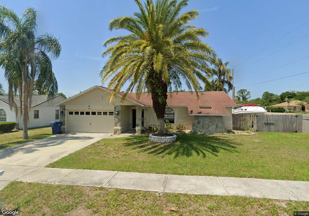
4823 Swallowtail Dr New Port Richey, FL 34653
South New Port Richey NeighborhoodEstimated Value: $318,000 - $375,000
3
Beds
2
Baths
2,579
Sq Ft
$138/Sq Ft
Est. Value
About This Home
This home is located at 4823 Swallowtail Dr, New Port Richey, FL 34653 and is currently estimated at $354,701, approximately $137 per square foot. 4823 Swallowtail Dr is a home located in Pasco County with nearby schools including Deer Park Elementary School, River Ridge High School, and River Ridge Middle School.
Ownership History
Date
Name
Owned For
Owner Type
Purchase Details
Closed on
Jun 11, 2015
Sold by
Colfin Ah-Florida 5 Llc
Bought by
Cah 2015-1 Borrower Llc
Current Estimated Value
Purchase Details
Closed on
Feb 25, 2014
Sold by
Perry William D
Bought by
Colfin Ah-Florida 5 Llc
Purchase Details
Closed on
Oct 8, 2002
Sold by
Coast Equities Inc
Bought by
Perry William D and Perry Christina R
Home Financials for this Owner
Home Financials are based on the most recent Mortgage that was taken out on this home.
Original Mortgage
$132,914
Interest Rate
6.27%
Mortgage Type
FHA
Purchase Details
Closed on
Jun 24, 2002
Sold by
Nham John D and Nham Donna L
Bought by
Coast Equities Inc
Create a Home Valuation Report for This Property
The Home Valuation Report is an in-depth analysis detailing your home's value as well as a comparison with similar homes in the area
Home Values in the Area
Average Home Value in this Area
Purchase History
| Date | Buyer | Sale Price | Title Company |
|---|---|---|---|
| Cah 2015-1 Borrower Llc | -- | Attorney | |
| Colfin Ah-Florida 5 Llc | $100,400 | None Available | |
| Perry William D | $134,000 | -- | |
| Coast Equities Inc | $88,201 | -- |
Source: Public Records
Mortgage History
| Date | Status | Borrower | Loan Amount |
|---|---|---|---|
| Previous Owner | Coast Equities Inc | $22,184 | |
| Previous Owner | Coast Equities Inc | $132,914 |
Source: Public Records
Tax History Compared to Growth
Tax History
| Year | Tax Paid | Tax Assessment Tax Assessment Total Assessment is a certain percentage of the fair market value that is determined by local assessors to be the total taxable value of land and additions on the property. | Land | Improvement |
|---|---|---|---|---|
| 2025 | $4,995 | $323,970 | $40,482 | $283,488 |
| 2024 | $4,995 | $324,278 | $40,482 | $283,796 |
| 2023 | $4,741 | $231,720 | $0 | $0 |
| 2022 | $3,830 | $265,334 | $33,910 | $231,424 |
| 2021 | $3,347 | $204,984 | $30,388 | $174,596 |
| 2020 | $3,008 | $177,697 | $25,363 | $152,334 |
| 2019 | $2,755 | $158,279 | $22,263 | $136,016 |
| 2018 | $2,657 | $152,057 | $22,263 | $129,794 |
| 2017 | $2,481 | $140,162 | $21,023 | $119,139 |
| 2016 | $2,246 | $124,913 | $17,613 | $107,300 |
| 2015 | $2,128 | $115,408 | $17,613 | $97,795 |
| 2014 | $1,880 | $105,182 | $16,683 | $88,499 |
Source: Public Records
Map
Nearby Homes
- 8110 Damara Dr
- 7838 Trail Run Loop
- 7902 Royal Hart Dr
- 8041 Blue Finch Way
- 7846 Royal Hart Dr
- 4644 Sawgrass Blvd
- 4532 Whitetail Ln
- 5036 Glenhurst Ln
- 4420 Northampton Dr
- 8122 Matthew Dr
- 8450 Royal Hart Dr
- 4529 Whitton Way Unit 214
- 7735 Deer Foot Dr
- 7803 Riverdale Dr
- 4434 Whitton Way
- 4432 Whitton Way
- 4429 Whitton Way
- 4237 Northampton Dr
- 4407 Whitton Way
- 8346 Shallow Creek Ct
- 4815 Swallowtail Dr
- 4822 Weasel Dr
- 4814 Weasel Dr
- 8111 Tarsier Ave
- 4807 Swallowtail Dr
- 4806 Weasel Dr
- 8110 Tarsier Ave
- 8119 Tarsier Ave
- 4753 Swallowtail Dr
- 4823 Weasel Dr
- 4815 Weasel Dr
- 8118 Tarsier Ave
- 4807 Weasel Dr
- 8008 Baytree Dr
- 4745 Swallowtail Dr
- 4750 Swallowtail Dr
- 4744 Weasel Dr
- 8001 Baytree Dr
- 8126 Tarsier Ave
- 4840 Tigertail Ct