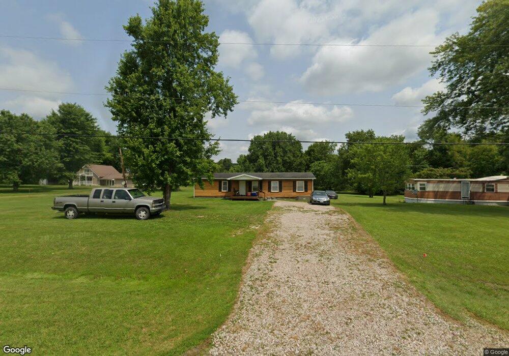
48246 Tornado Rd Racine, OH 45771
Estimated Value: $106,000 - $135,000
--
Bed
--
Bath
1,456
Sq Ft
$83/Sq Ft
Est. Value
About This Home
This home is located at 48246 Tornado Rd, Racine, OH 45771 and is currently estimated at $121,033, approximately $83 per square foot. 48246 Tornado Rd is a home with nearby schools including Southern Elementary School and Southern High School.
Ownership History
Date
Name
Owned For
Owner Type
Purchase Details
Closed on
Feb 28, 2020
Sold by
Rpg Oh Properties Llc
Bought by
Dunn Larry and Dunn Patti
Current Estimated Value
Home Financials for this Owner
Home Financials are based on the most recent Mortgage that was taken out on this home.
Original Mortgage
$70,695
Outstanding Balance
$64,125
Interest Rate
4.87%
Mortgage Type
FHA
Estimated Equity
$56,908
Purchase Details
Closed on
Oct 30, 2008
Sold by
Roush Debra J
Bought by
Roush Christopher
Purchase Details
Closed on
Aug 16, 2002
Bought by
Rpg Oh Properties Llc
Create a Home Valuation Report for This Property
The Home Valuation Report is an in-depth analysis detailing your home's value as well as a comparison with similar homes in the area
Home Values in the Area
Average Home Value in this Area
Purchase History
| Date | Buyer | Sale Price | Title Company |
|---|---|---|---|
| Dunn Larry | $72,000 | Bestitle Agency Inc | |
| Roush Christopher | $25,000 | None Available | |
| Rpg Oh Properties Llc | -- | -- |
Source: Public Records
Mortgage History
| Date | Status | Borrower | Loan Amount |
|---|---|---|---|
| Open | Dunn Larry | $70,695 |
Source: Public Records
Tax History Compared to Growth
Tax History
| Year | Tax Paid | Tax Assessment Tax Assessment Total Assessment is a certain percentage of the fair market value that is determined by local assessors to be the total taxable value of land and additions on the property. | Land | Improvement |
|---|---|---|---|---|
| 2024 | $734 | $21,550 | $4,380 | $17,170 |
| 2023 | $734 | $21,550 | $4,380 | $17,170 |
| 2022 | $725 | $21,550 | $4,380 | $17,170 |
| 2021 | $1,048 | $29,670 | $4,020 | $25,650 |
| 2020 | $1,175 | $30,170 | $4,020 | $26,150 |
| 2019 | $1,175 | $30,170 | $4,020 | $26,150 |
| 2018 | $1,106 | $28,740 | $2,590 | $26,150 |
| 2017 | $1,106 | $28,740 | $2,590 | $26,150 |
| 2016 | $1,094 | $28,740 | $2,590 | $26,150 |
| 2014 | $938 | $22,920 | $2,590 | $20,330 |
| 2013 | $938 | $22,920 | $2,590 | $20,330 |
Source: Public Records
Map
Nearby Homes
- 48328 Tornado Rd
- 30771 Bashan Rd
- 47592 Yellowbush Rd
- 806 Buckeye St
- 120 N Broadway St
- 0 Ohio River Scenic Byway Unit 939995
- 0 Ohio River Scenic Byway Unit 1849587
- 46635 Ohio 124
- 27342 Apple Grove-Dorcas Rd
- 0 Lot 10 State Route 124 Unit 2434060
- 0 Unit 2432331
- 0 Lot 11 State Route 124 Unit 2434061
- 7886 Graham Station Rd
- 0 Apple Grove-Dorcas Rd
- 205 Elm St
- 0 Morning Star Rd
- 45615 Ohio 124
- 25705 Apple Grove-Dorcas Rd
- 47065 Morning Star Rd
- 26255 Tanners Run Rd
- 48280 Tornado Rd
- 48230 Tornado Rd
- 48326 Tornado Rd
- 48164 Tornado Rd
- 48374 Tornado Rd
- 48175 Tornado Rd
- 28478 Bashan Rd
- 48512 Tornado Rd
- 48441 Tornado Rd
- 28505 County Road 28
- 48495 Tornado Rd
- 28471 County Road 28
- 28297 Apple Grove Dorcas Rd
- 28457 County Road 28
- 48021 Tornado Rd
- 48045 Tornado Rd
- 48019 Tornado Rd
- 48015 Tornado Rd
- 28595 County Road 28
- 48023 Tornado Rd