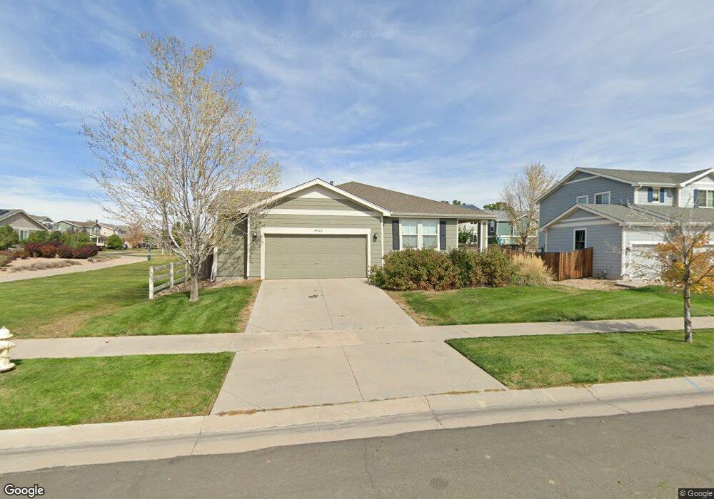
4825 Longs Peak St Brighton, CO 80601
Estimated Value: $475,000 - $490,000
3
Beds
2
Baths
1,580
Sq Ft
$305/Sq Ft
Est. Value
About This Home
This home is located at 4825 Longs Peak St, Brighton, CO 80601 and is currently estimated at $481,841, approximately $304 per square foot. 4825 Longs Peak St is a home located in Adams County with nearby schools including Overland Trail Middle School, Brighton High School, and Bromley East Charter School.
Ownership History
Date
Name
Owned For
Owner Type
Purchase Details
Closed on
Aug 23, 2016
Sold by
Robertson David W
Bought by
Robertson David W and Robertson Jessica
Current Estimated Value
Purchase Details
Closed on
Jun 23, 2006
Sold by
Kb Home Colorado Inc
Bought by
Robertson David W
Home Financials for this Owner
Home Financials are based on the most recent Mortgage that was taken out on this home.
Original Mortgage
$202,102
Outstanding Balance
$118,886
Interest Rate
6.58%
Mortgage Type
FHA
Estimated Equity
$362,955
Create a Home Valuation Report for This Property
The Home Valuation Report is an in-depth analysis detailing your home's value as well as a comparison with similar homes in the area
Home Values in the Area
Average Home Value in this Area
Purchase History
| Date | Buyer | Sale Price | Title Company |
|---|---|---|---|
| Robertson David W | -- | None Available | |
| Robertson David W | $205,275 | Security Title |
Source: Public Records
Mortgage History
| Date | Status | Borrower | Loan Amount |
|---|---|---|---|
| Open | Robertson David W | $202,102 |
Source: Public Records
Tax History Compared to Growth
Tax History
| Year | Tax Paid | Tax Assessment Tax Assessment Total Assessment is a certain percentage of the fair market value that is determined by local assessors to be the total taxable value of land and additions on the property. | Land | Improvement |
|---|---|---|---|---|
| 2024 | $5,075 | $29,940 | $7,190 | $22,750 |
| 2023 | $5,070 | $34,370 | $7,780 | $26,590 |
| 2022 | $4,268 | $25,270 | $6,390 | $18,880 |
| 2021 | $4,175 | $25,270 | $6,390 | $18,880 |
| 2020 | $4,187 | $25,440 | $6,580 | $18,860 |
| 2019 | $4,406 | $25,440 | $6,580 | $18,860 |
| 2018 | $4,087 | $21,920 | $6,840 | $15,080 |
| 2017 | $4,090 | $21,920 | $6,840 | $15,080 |
| 2016 | $3,269 | $17,470 | $3,660 | $13,810 |
| 2015 | $3,257 | $17,470 | $3,660 | $13,810 |
| 2014 | $2,743 | $14,810 | $2,870 | $11,940 |
Source: Public Records
Map
Nearby Homes
- 4864 Longs Peak St
- 376 Chardon Ave
- 432 Hedgerow Way
- 4776 Kipp Place
- 427 Silo Ct
- 4751 Ambrose Place
- 4649 Spinning Wheel Dr
- 535 Meadow Ln
- 238 Chardon Ave
- 226 Chardon Ave
- 4439 Boone Cir
- 5131 Delphinium Cir
- 214 Chardon Ave
- 4455 Boone Cir
- 4766 Hatcher Dr
- 4754 Hatcher Dr
- 4609 Thistle Dr
- 4479 Boone Cir
- 4589 Thistle Dr
- 4725 Singletree Ln
- 4845 Longs Peak St
- 4828 Spinning Wheel Dr
- 4858 Spinning Wheel Dr
- 4865 Longs Peak St
- 4878 Spinning Wheel Dr
- 4852 Longs Peak St
- 4798 Spinning Wheel Dr
- 4876 Longs Peak St
- 4898 Spinning Wheel Dr
- 4787 Longs Peak St
- 768 N 48th Ave
- 416 N 48th Ave
- 4788 Spinning Wheel Dr
- 4767 Longs Peak St
- 431 Baler Ct
- 4790 Longs Peak St
- 4768 Spinning Wheel Dr
- 393 Baler Ct
- 413 N 48th Ave
- 4747 Longs Peak St