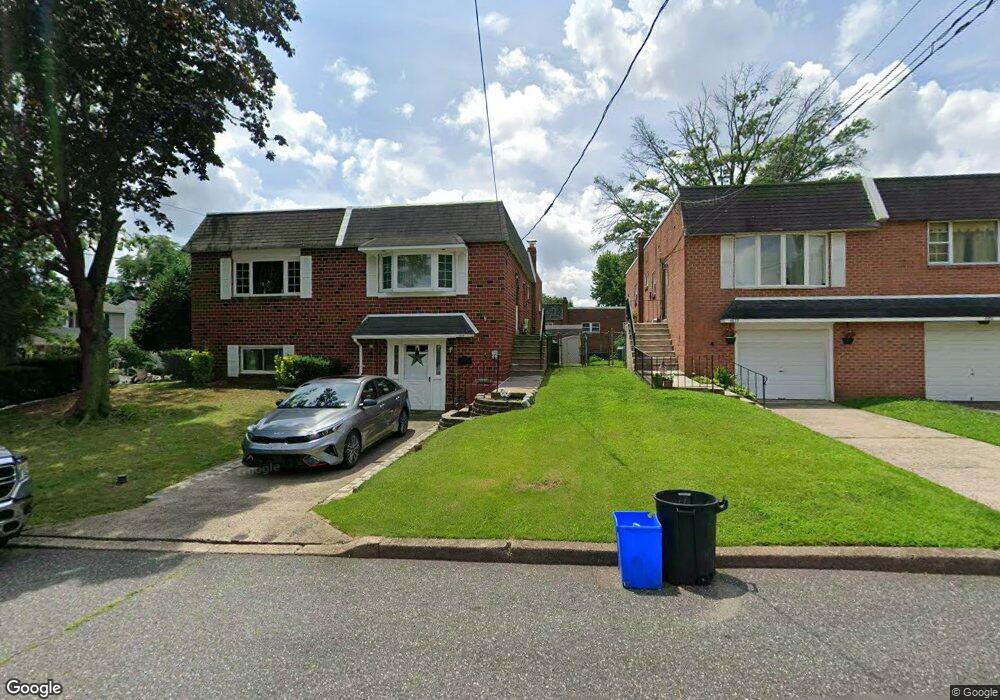
4828 Pearson Ave Philadelphia, PA 19114
Torresdale NeighborhoodEstimated Value: $273,000 - $340,000
--
Bed
--
Bath
908
Sq Ft
$335/Sq Ft
Est. Value
About This Home
This home is located at 4828 Pearson Ave, Philadelphia, PA 19114 and is currently estimated at $303,816, approximately $334 per square foot. 4828 Pearson Ave is a home located in Philadelphia County with nearby schools including Thomas Holme School, Lincoln High School, and Meehan Austin Middle School.
Ownership History
Date
Name
Owned For
Owner Type
Purchase Details
Closed on
Nov 15, 2004
Sold by
Himes Patricia and Estate Of William J Riley
Bought by
Riley Michael
Current Estimated Value
Home Financials for this Owner
Home Financials are based on the most recent Mortgage that was taken out on this home.
Original Mortgage
$84,000
Outstanding Balance
$41,835
Interest Rate
5.75%
Mortgage Type
Purchase Money Mortgage
Estimated Equity
$261,981
Purchase Details
Closed on
Jun 26, 1997
Sold by
Valletto Denise E
Bought by
Riley William J
Create a Home Valuation Report for This Property
The Home Valuation Report is an in-depth analysis detailing your home's value as well as a comparison with similar homes in the area
Home Values in the Area
Average Home Value in this Area
Purchase History
| Date | Buyer | Sale Price | Title Company |
|---|---|---|---|
| Riley Michael | $135,000 | First American Title Ins Co | |
| Riley William J | $87,000 | -- |
Source: Public Records
Mortgage History
| Date | Status | Borrower | Loan Amount |
|---|---|---|---|
| Open | Riley Michael | $84,000 |
Source: Public Records
Tax History Compared to Growth
Tax History
| Year | Tax Paid | Tax Assessment Tax Assessment Total Assessment is a certain percentage of the fair market value that is determined by local assessors to be the total taxable value of land and additions on the property. | Land | Improvement |
|---|---|---|---|---|
| 2025 | $3,476 | $281,000 | $56,200 | $224,800 |
| 2024 | $3,476 | $281,000 | $56,200 | $224,800 |
| 2023 | $3,476 | $248,300 | $49,660 | $198,640 |
| 2022 | $2,738 | $248,300 | $49,660 | $198,640 |
| 2021 | $2,738 | $0 | $0 | $0 |
| 2020 | $2,738 | $0 | $0 | $0 |
| 2019 | $2,578 | $0 | $0 | $0 |
| 2018 | $2,616 | $0 | $0 | $0 |
| 2017 | $2,616 | $0 | $0 | $0 |
| 2016 | $2,616 | $0 | $0 | $0 |
| 2015 | $2,504 | $0 | $0 | $0 |
| 2014 | -- | $186,900 | $40,250 | $146,650 |
| 2012 | -- | $21,664 | $2,057 | $19,607 |
Source: Public Records
Map
Nearby Homes
- 9401 Tulip St
- 9301 Ditman St
- 4512 Convent Ln
- 6311 00 Delaire Landing Rd Unit 311
- 3204 00 Delaire Landing Rd Unit 3204
- 68104 00 Delaire Landing Rd Unit 104
- 62004 00 Delaire Landing Rd Unit 4
- 59102 00 Delaire Landing Rd Unit 102
- 53304 00 Delaire Landing Rd Unit 304
- 9580 State Rd Unit 36A
- 9305 Cambridge St
- 60201 Delaire Landing Rd Unit 201
- 5008 N Convent Ln Unit 276
- 5024 N Convent Ln Unit (310)
- 5019 S Convent Ln Unit C
- 9321 Walker St
- 47201 00 Delaire Landing Rd Unit 201
- 57103 00 Delaire Landing Rd Unit 103
- 58201 00 Delaire Landing Rd Unit 201
- 4953 Fitler St Units #K & #L
- 4830 Pearson Ave
- 4826 Pearson Ave
- 4824 Pearson Ave
- 9342 Tulip St
- 4820 Pearson Ave
- 9340 Tulip St
- 9338 Tulip St
- 9347 Edmund St
- 4814 Pearson Ave
- 9336 Tulip St
- 9349 Tulip St
- 9345 Tulip St
- 9343 Edmund St
- 9353 Tulip St
- 9355 Tulip St
- 4835 Pearson Ave
- 4833 Pearson Ave
- 4831 Pearson Ave
- 9332 Tulip St
- 9341 Tulip St