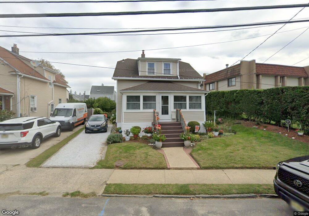
483 2nd Ave Long Branch, NJ 07740
Estimated Value: $484,000 - $913,000
3
Beds
2
Baths
1,202
Sq Ft
$524/Sq Ft
Est. Value
About This Home
This home is located at 483 2nd Ave, Long Branch, NJ 07740 and is currently estimated at $630,301, approximately $524 per square foot. 483 2nd Ave is a home located in Monmouth County with nearby schools including Long Branch High School, Holy Trinity School, and Bet Yaakov of the Jersey Shore.
Ownership History
Date
Name
Owned For
Owner Type
Purchase Details
Closed on
Sep 30, 2015
Sold by
Kunkle Kevin and Kunkle Shirley
Bought by
Kunkle Kevin and Kunkle Shirley
Current Estimated Value
Purchase Details
Closed on
Aug 15, 2005
Sold by
Skove John
Bought by
Kunkle Kevin and Kunkle Shirley
Home Financials for this Owner
Home Financials are based on the most recent Mortgage that was taken out on this home.
Original Mortgage
$309,900
Outstanding Balance
$162,795
Interest Rate
5.66%
Mortgage Type
New Conventional
Estimated Equity
$467,506
Purchase Details
Closed on
Sep 10, 2004
Sold by
Martin Violet
Bought by
Skove Cecilia and Skove John
Home Financials for this Owner
Home Financials are based on the most recent Mortgage that was taken out on this home.
Original Mortgage
$180,000
Interest Rate
6.02%
Create a Home Valuation Report for This Property
The Home Valuation Report is an in-depth analysis detailing your home's value as well as a comparison with similar homes in the area
Home Values in the Area
Average Home Value in this Area
Purchase History
| Date | Buyer | Sale Price | Title Company |
|---|---|---|---|
| Kunkle Kevin | -- | Attorney | |
| Kunkle Kevin | $387,400 | -- | |
| Skove Cecilia | $225,000 | -- |
Source: Public Records
Mortgage History
| Date | Status | Borrower | Loan Amount |
|---|---|---|---|
| Open | Kunkle Kevin | $309,900 | |
| Previous Owner | Skove Cecilia | $180,000 |
Source: Public Records
Tax History
| Year | Tax Paid | Tax Assessment Tax Assessment Total Assessment is a certain percentage of the fair market value that is determined by local assessors to be the total taxable value of land and additions on the property. | Land | Improvement |
|---|---|---|---|---|
| 2025 | $5,001 | $352,600 | $185,800 | $166,800 |
| 2024 | $4,862 | $325,400 | $165,800 | $159,600 |
Source: Public Records
Map
Nearby Homes
- 119 Avery Ave Unit H21
- 119 Avery Ave Unit E12
- 480 Ocean Ave Unit 2K
- 107 W End Ave
- 510 Ocean Ave N Unit 10
- 17 Tower Rd Unit D2
- 510 Ocean Ave Unit 25
- 422 Ocean Ave N Unit 3j
- 525 Ocean Blvd Unit 303
- 392 Ocean Ave N Unit 1203
- 392 Ocean Ave N Unit 1502
- 392 Ocean Ave N Unit 1703
- 392 Ocean Ave N Unit 1804
- 392 Ocean Ave Unit 1608
- 392 Ocean Ave Unit 1203
- 392 Ocean Ave Unit 1406
- 392 Ocean Ave Unit 1412
- 392 Ocean Ave Unit 1309
- 392 Ocean Ave Unit 1502
- 392 Ocean Ave Unit 1505
- 481 2nd Ave
- 479 2nd Ave
- 60 Matilda Terrace
- 460 Ocean Blvd Unit N
- 460 Ocean Blvd Unit H
- 460 Ocean Blvd Unit K
- 460 Ocean Blvd Unit B
- 460 Ocean Blvd Unit D
- 460 Ocean Blvd Unit L
- 460 Ocean Blvd Unit C
- 460 Ocean Blvd Unit A
- 460 Ocean Blvd Unit G
- 460 Ocean Blvd Unit J
- 460 Ocean Blvd Unit I
- 460 Ocean Blvd Unit F
- 460 Ocean Blvd Unit E
- 460 Ocean Blvd Unit 460C
- 460 Ocean Blvd Unit 460K
- 460 Ocean Blvd Unit 460a
- 476 2nd Ave
Your Personal Tour Guide
Ask me questions while you tour the home.