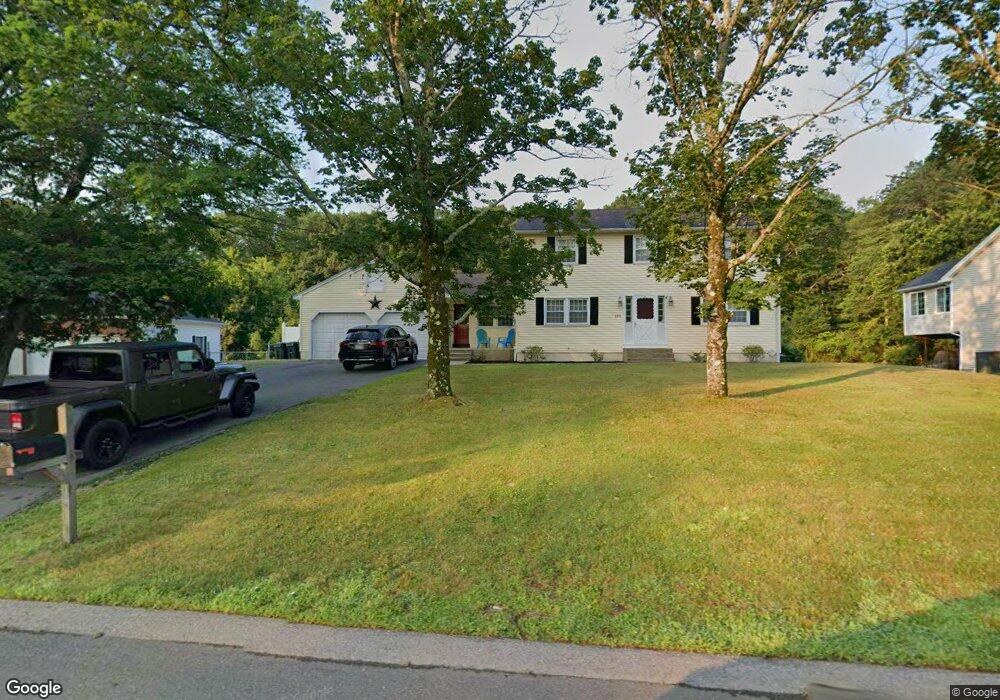
483 Arlington St Dracut, MA 01826
Estimated Value: $715,357 - $821,000
5
Beds
4
Baths
2,760
Sq Ft
$281/Sq Ft
Est. Value
About This Home
This home is located at 483 Arlington St, Dracut, MA 01826 and is currently estimated at $775,589, approximately $281 per square foot. 483 Arlington St is a home located in Middlesex County with nearby schools including Greenmont Avenue School, Richardson Middle School, and Dracut Senior High School.
Ownership History
Date
Name
Owned For
Owner Type
Purchase Details
Closed on
Feb 29, 2016
Sold by
Buchanan Julie A and Buchanan Glen A
Bought by
Delucia Martha M
Current Estimated Value
Purchase Details
Closed on
Mar 31, 2006
Sold by
Delucia Dennis and Delucia Martha
Bought by
Buchanan Glen A and Delucia-Buchanan Julie A
Home Financials for this Owner
Home Financials are based on the most recent Mortgage that was taken out on this home.
Original Mortgage
$220,000
Interest Rate
6.32%
Create a Home Valuation Report for This Property
The Home Valuation Report is an in-depth analysis detailing your home's value as well as a comparison with similar homes in the area
Home Values in the Area
Average Home Value in this Area
Purchase History
| Date | Buyer | Sale Price | Title Company |
|---|---|---|---|
| Delucia Martha M | $122,300 | -- | |
| Buchanan Glen A | -- | -- |
Source: Public Records
Mortgage History
| Date | Status | Borrower | Loan Amount |
|---|---|---|---|
| Previous Owner | Buchanan Glen A | $220,000 |
Source: Public Records
Tax History
| Year | Tax Paid | Tax Assessment Tax Assessment Total Assessment is a certain percentage of the fair market value that is determined by local assessors to be the total taxable value of land and additions on the property. | Land | Improvement |
|---|---|---|---|---|
| 2025 | $6,659 | $658,000 | $199,400 | $458,600 |
| 2024 | $6,562 | $627,900 | $190,100 | $437,800 |
| 2023 | $6,367 | $549,800 | $165,500 | $384,300 |
| 2022 | $6,295 | $512,200 | $150,600 | $361,600 |
| 2021 | $11,208 | $467,400 | $136,900 | $330,500 |
| 2020 | $5,867 | $439,500 | $132,900 | $306,600 |
| 2019 | $0 | $406,900 | $126,600 | $280,300 |
| 2018 | $9,237 | $394,900 | $126,600 | $268,300 |
| 2017 | $5,519 | $394,900 | $126,600 | $268,300 |
| 2016 | $5,341 | $359,900 | $121,800 | $238,100 |
| 2015 | $4,416 | $295,800 | $121,800 | $174,000 |
| 2014 | $4,179 | $288,400 | $121,800 | $166,600 |
Source: Public Records
Map
Nearby Homes
- 4 Hazelwood Ave Unit 12
- 10 Lanseigne St
- 15 Wildwood St Unit B10
- 89 Newbury St
- 35 Thissell Ave
- 675 Robbins Ave Unit 1
- 277 Loon Hill Rd
- 668 Robbins Ave Unit 1
- 700 Robbins Ave Unit 6
- 50 Cheever Ave
- 175 Willard St Unit 9
- 241 Humphrey St
- 40 Arlington Ave
- 330 Christian St
- 44 19th St
- 23 Blackberry Fields Rd
- 100 Merrimack Ave Unit 25
- 35 Whitney Ave Unit 33
- Lot 11 Christian St
- Lot 12 Christian St
- 489 Arlington St
- 475 Arlington St
- 506 Arlington St
- 486 Arlington St
- 467 Arlington St
- 497 Arlington St
- 459 Arlington St
- 526 Arlington St
- 470 Arlington St
- 505 Arlington St
- 50 Baldwin Rd
- 534 Arlington St
- 443 Arlington St
- 60 Baldwin Rd
- 450 Arlington St
- 40 Baldwin Rd
- 521 Arlington St
- 435 Arlington St
- 30 Baldwin Rd
- 10 Baldwin Rd