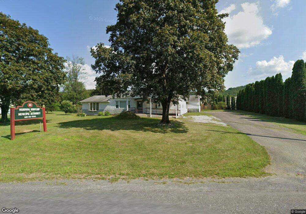
483 Ashtown Dr Lehighton, PA 18235
Estimated Value: $347,726
3
Beds
2
Baths
1,592
Sq Ft
$218/Sq Ft
Est. Value
About This Home
This home is located at 483 Ashtown Dr, Lehighton, PA 18235 and is currently estimated at $347,726, approximately $218 per square foot. 483 Ashtown Dr is a home located in Carbon County with nearby schools including Lehighton Area High School, Sts. Peter & Paul School, and Valley Ridge Academy.
Ownership History
Date
Name
Owned For
Owner Type
Purchase Details
Closed on
Dec 3, 2012
Sold by
Sheckler Michael A and Sheckler Ruth
Bought by
Mahoning Township Municipality Authority
Current Estimated Value
Purchase Details
Closed on
Dec 29, 2010
Sold by
Sheckler Mary M and Sheckler Michael A
Bought by
Lowes Home Centers Inc
Purchase Details
Closed on
Jun 27, 2007
Sold by
Sheckler Mary M and Sheckler Arthur W
Bought by
Sheckler Mary M and Sheckler Michael A
Create a Home Valuation Report for This Property
The Home Valuation Report is an in-depth analysis detailing your home's value as well as a comparison with similar homes in the area
Home Values in the Area
Average Home Value in this Area
Purchase History
| Date | Buyer | Sale Price | Title Company |
|---|---|---|---|
| Mahoning Township Municipality Authority | $150,000 | None Available | |
| Lowes Home Centers Inc | $60,000 | None Available | |
| Sheckler Mary M | -- | None Available |
Source: Public Records
Tax History Compared to Growth
Tax History
| Year | Tax Paid | Tax Assessment Tax Assessment Total Assessment is a certain percentage of the fair market value that is determined by local assessors to be the total taxable value of land and additions on the property. | Land | Improvement |
|---|---|---|---|---|
| 2025 | $3,068 | $40,100 | $7,800 | $32,300 |
| 2024 | $2,948 | $40,100 | $7,800 | $32,300 |
| 2023 | $2,918 | $40,100 | $7,800 | $32,300 |
| 2022 | $2,878 | $40,100 | $7,800 | $32,300 |
| 2021 | $2,793 | $40,100 | $7,800 | $32,300 |
| 2020 | $2,722 | $40,100 | $7,800 | $32,300 |
| 2019 | $2,582 | $40,100 | $7,800 | $32,300 |
| 2018 | $2,552 | $40,100 | $7,800 | $32,300 |
| 2017 | $2,552 | $40,100 | $7,800 | $32,300 |
| 2016 | -- | $40,100 | $7,800 | $32,300 |
| 2015 | -- | $40,100 | $7,800 | $32,300 |
| 2014 | -- | $40,100 | $7,800 | $32,300 |
Source: Public Records
Map
Nearby Homes
- 0 Fredericks Grove Rd Unit 691615
- 410 S 8th St
- 0 Emily Plan at Summit Point Unit PACC2005480
- 0 Copper Beech Plan at Summit Ridge Unit PACC2005478
- 0 Black Cherry Plan at Summit Ridge Unit PACC2005474
- 0 Ridge
- 408 Bridge St
- 639 Iron St
- 522 Iron St
- 0 Pine Hollow Unit PACC2006556
- 515 Mahoning St
- 260 S 3rd St
- 808 Coal St
- 196 S 3rd St
- 2516 Mahoning Mountain Rd
- 134 Bridge St
- 2093 Mahoning Dr E
- 6 Sage Ct
- 7 Sage Ct
- 9 Sage Ct
- 465 Ashtown Dr
- 427 Ashtown Dr
- 492 Ashtown Dr
- 0 Ashtown Dr Unit 6710811
- 417 Ashtown Dr
- 383 Ashtown Dr
- 414 Ashtown Dr
- 573 Ashtown Dr
- 158 Mall Rd
- 142 Mall Rd
- 583 Ashtown Dr
- 184 Mall Rd
- 360 Ashtown Dr
- 1235 Blakeslee Boulevard Dr E
- 336 Ashtown Dr
- 336 Ashtown Dr
- 307 Ashtown Dr
- 1080 Blakeslee Boulevard Dr E Unit SUITE 2
- 304 Ashtown Dr
- 271 Ashtown Dr