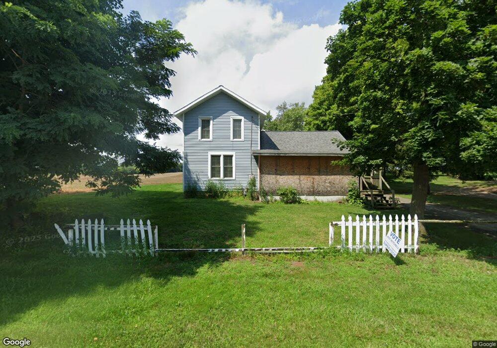
483 E Main St Springport, MI 49284
Estimated Value: $97,971 - $160,000
3
Beds
1
Bath
1,119
Sq Ft
$115/Sq Ft
Est. Value
About This Home
This home is located at 483 E Main St, Springport, MI 49284 and is currently estimated at $128,743, approximately $115 per square foot. 483 E Main St is a home located in Jackson County with nearby schools including Springport Elementary School, Springport Middle School, and Springport High School.
Ownership History
Date
Name
Owned For
Owner Type
Purchase Details
Closed on
Feb 16, 2016
Sold by
Riley Frederick Jay and Riley Kay E
Bought by
Bates James M and Bates Gary T
Current Estimated Value
Purchase Details
Closed on
Aug 29, 2011
Sold by
Coffman Karen
Bought by
Riley Frederick Jay and Riley Kay E
Purchase Details
Closed on
Aug 29, 2008
Sold by
Hsbc Bank Usa National Association
Bought by
Blue Spruce Entities Llc
Purchase Details
Closed on
Jul 14, 2006
Sold by
Sykes Virginia and Sykes Virginia M
Bought by
Moe Brandon and Moe Michele
Home Financials for this Owner
Home Financials are based on the most recent Mortgage that was taken out on this home.
Original Mortgage
$83,600
Interest Rate
10.99%
Mortgage Type
Purchase Money Mortgage
Create a Home Valuation Report for This Property
The Home Valuation Report is an in-depth analysis detailing your home's value as well as a comparison with similar homes in the area
Purchase History
| Date | Buyer | Sale Price | Title Company |
|---|---|---|---|
| Bates James M | $23,000 | At | |
| Riley Frederick Jay | $7,450 | None Available | |
| Blue Spruce Entities Llc | -- | None Available | |
| Go Invest Wisely Llc | -- | None Available | |
| Blue Spruce Entities Llc | -- | None Available | |
| Moe Brandon | $88,000 | Transnation |
Source: Public Records
Mortgage History
| Date | Status | Borrower | Loan Amount |
|---|---|---|---|
| Previous Owner | Moe Brandon | $83,600 |
Source: Public Records
Tax History
| Year | Tax Paid | Tax Assessment Tax Assessment Total Assessment is a certain percentage of the fair market value that is determined by local assessors to be the total taxable value of land and additions on the property. | Land | Improvement |
|---|---|---|---|---|
| 2025 | $555 | $36,700 | $0 | $0 |
| 2024 | $3 | $40,200 | $0 | $0 |
| 2023 | $332 | $35,100 | $0 | $0 |
| 2022 | $660 | $17,600 | $0 | $0 |
| 2021 | $499 | $16,800 | $0 | $0 |
| 2020 | $150 | $16,400 | $0 | $0 |
| 2019 | $696 | $14,600 | $0 | $0 |
| 2018 | $469 | $12,800 | $0 | $0 |
| 2017 | $450 | $12,800 | $0 | $0 |
| 2016 | $141 | $12,600 | $12,600 | $0 |
| 2015 | -- | $13,800 | $13,800 | $0 |
| 2014 | -- | $15,600 | $15,600 | $0 |
| 2013 | -- | $15,600 | $15,600 | $0 |
Source: Public Records
Map
Nearby Homes
- 598 E Main St
- 330 Grand St
- 16711 Stark Rd
- 29510 S Dr N
- 13025 Pope Church Rd
- 7295 N Gibbs Rd
- 12261 Pope Church Rd
- 9761 Brown Rd
- 19822 27 1 2 Mile Rd
- 12441 Town Rd
- 9733 Blue Heron
- 15394 Devereaux Rd
- 28660 E Baseline Hwy
- 6950 Brown Rd
- 6947 Brown Rd
- 9673 Spartan Ln
- 26854 Q-Drive N
- 8840 Houston Rd
- 26493 Anderson Rd
- 0 Springport Rd
Your Personal Tour Guide
Ask me questions while you tour the home.