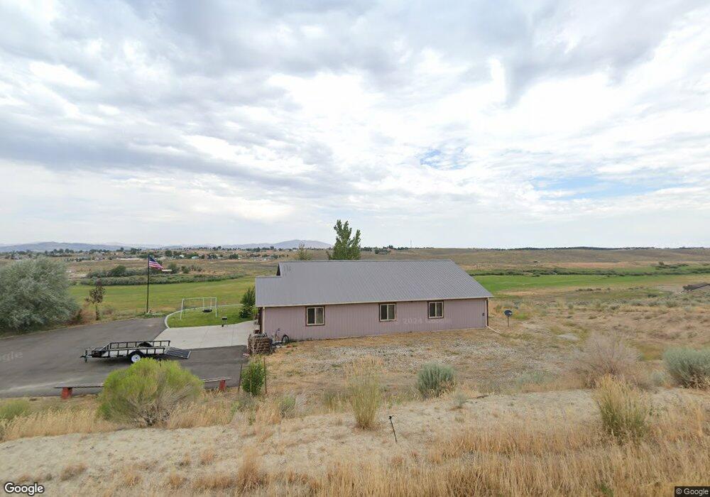
483 Foxridge Dr Spring Creek, NV 89815
Estimated Value: $382,000 - $432,192
3
Beds
2
Baths
1,632
Sq Ft
$250/Sq Ft
Est. Value
About This Home
This home is located at 483 Foxridge Dr, Spring Creek, NV 89815 and is currently estimated at $408,298, approximately $250 per square foot. 483 Foxridge Dr is a home with nearby schools including Spring Creek Elementary School, Spring Creek Middle School, and Spring Creek High School.
Ownership History
Date
Name
Owned For
Owner Type
Purchase Details
Closed on
Apr 13, 2015
Sold by
Forness James A and Forness Cindy Cooper
Bought by
Nelms Chad T and Nelms Teri A
Current Estimated Value
Home Financials for this Owner
Home Financials are based on the most recent Mortgage that was taken out on this home.
Original Mortgage
$200,700
Interest Rate
3.81%
Mortgage Type
New Conventional
Purchase Details
Closed on
Sep 11, 2014
Sold by
Greenwood Thomas and Greenwood Patricia
Bought by
Forness James A and Forness Cindy Cooper
Create a Home Valuation Report for This Property
The Home Valuation Report is an in-depth analysis detailing your home's value as well as a comparison with similar homes in the area
Home Values in the Area
Average Home Value in this Area
Purchase History
| Date | Buyer | Sale Price | Title Company |
|---|---|---|---|
| Nelms Chad T | $223,000 | First American Title Elko | |
| Forness James A | $17,500 | First American Title Elko |
Source: Public Records
Mortgage History
| Date | Status | Borrower | Loan Amount |
|---|---|---|---|
| Previous Owner | Nelms Chad T | $200,700 |
Source: Public Records
Tax History Compared to Growth
Tax History
| Year | Tax Paid | Tax Assessment Tax Assessment Total Assessment is a certain percentage of the fair market value that is determined by local assessors to be the total taxable value of land and additions on the property. | Land | Improvement |
|---|---|---|---|---|
| 2025 | $2,995 | $128,469 | $31,500 | $96,969 |
| 2024 | $2,995 | $129,897 | $31,500 | $98,397 |
| 2023 | $2,773 | $108,932 | $17,500 | $91,432 |
| 2022 | $2,421 | $90,362 | $17,500 | $72,862 |
| 2021 | $2,521 | $88,240 | $17,500 | $70,740 |
| 2020 | $2,480 | $88,972 | $17,500 | $71,472 |
| 2019 | $2,393 | $84,741 | $12,950 | $71,791 |
| 2018 | $2,363 | $84,975 | $12,950 | $72,025 |
| 2017 | $2,022 | $82,742 | $12,950 | $69,792 |
| 2016 | $1,907 | $76,834 | $12,950 | $63,884 |
| 2015 | $1,792 | $13,164 | $12,950 | $214 |
| 2014 | $151 | $13,164 | $12,950 | $214 |
Source: Public Records
Map
Nearby Homes
- 472 Foxridge Dr
- 489 Parkridge Pkwy
- 649 Bluegrass Dr
- 440 White Oak Dr
- 354 Oakmont Plaza
- 373 Royal Oak Dr
- 538 Balsam Dr
- 0 Turquoise Ave Unit 3626191
- 0 Turquoise Ave Unit 3625240
- 595 Abarr Dr
- 603 Palace Pkwy
- 482 Frisco Dr
- 768 Alpine Dr
- 549 Ashcroft Dr
- 720 Spring Creek Pkwy
- 611 Westcott Dr
- 697 Clover Dr
- 609 Westcott Dr
- 661 Burro Bay
- 339 Spring Creek Pkwy
- 477 Foxridge Dr
- 489 Foxridge Dr
- 488 Foxridge Dr
- 480 Foxridge Dr
- 464 Foxridge Dr
- 507 Foxridge Dr
- 456 Foxridge Dr
- 504 Foxridge Dr
- 669 Foxridge Place
- 459 Foxridge Dr
- 473 Parkridge Pkwy
- 457 Parkridge Pkwy
- 512 Foxridge Dr
- 481 Parkridge Pkwy
- 448 Foxridge Dr
- 453 Foxridge Dr
- 449 Parkridge Pkwy
- 497 Parkridge Pkwy
- 668 Foxridge Place
- 505 Parkridge Pkwy