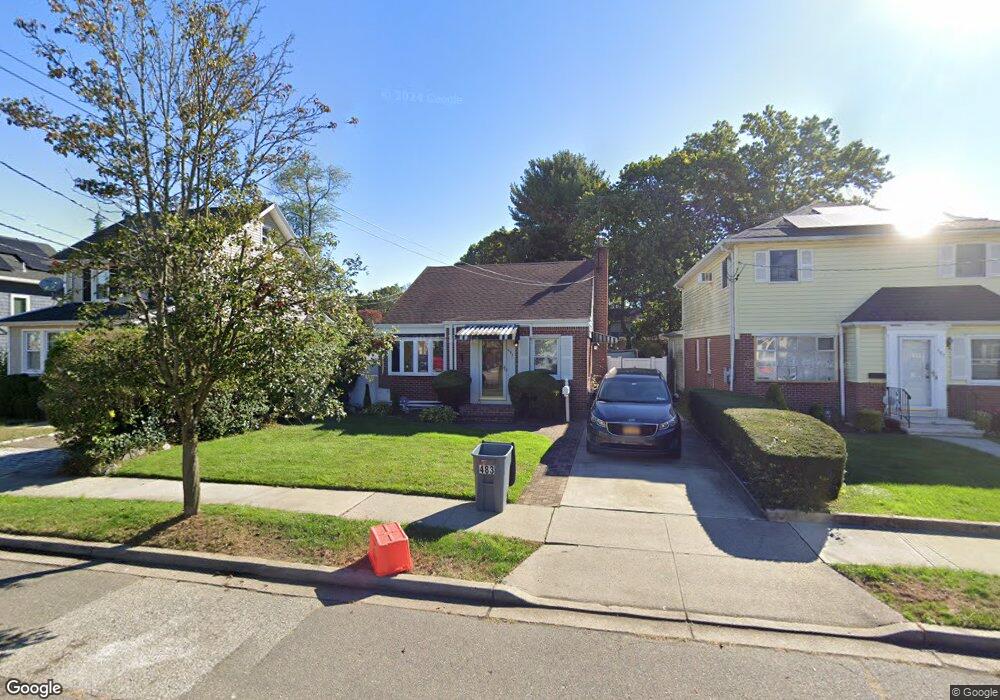
483 Locust Terrace West Hempstead, NY 11552
Estimated Value: $680,000 - $730,653
3
Beds
2
Baths
1,270
Sq Ft
$555/Sq Ft
Est. Value
About This Home
This home is located at 483 Locust Terrace, West Hempstead, NY 11552 and is currently estimated at $705,327, approximately $555 per square foot. 483 Locust Terrace is a home located in Nassau County with nearby schools including Chestnut Street School, West Hempstead Secondary School, and Hebrew Academy of Nassau County (HANC).
Ownership History
Date
Name
Owned For
Owner Type
Purchase Details
Closed on
Jan 27, 2017
Sold by
Moore Charlene D and Henry Lyndon A
Bought by
Dm Family Trust
Current Estimated Value
Purchase Details
Closed on
Oct 15, 2009
Sold by
Powers Timothy and Powers Michael
Bought by
Henry Lyndon A and Moore Charlene D
Home Financials for this Owner
Home Financials are based on the most recent Mortgage that was taken out on this home.
Original Mortgage
$308,302
Interest Rate
5.06%
Mortgage Type
Purchase Money Mortgage
Create a Home Valuation Report for This Property
The Home Valuation Report is an in-depth analysis detailing your home's value as well as a comparison with similar homes in the area
Home Values in the Area
Average Home Value in this Area
Purchase History
| Date | Buyer | Sale Price | Title Company |
|---|---|---|---|
| Dm Family Trust | $382,000 | New York Board Of Title | |
| Henry Lyndon A | $320,000 | -- |
Source: Public Records
Mortgage History
| Date | Status | Borrower | Loan Amount |
|---|---|---|---|
| Previous Owner | Henry Lyndon A | $308,302 |
Source: Public Records
Tax History Compared to Growth
Tax History
| Year | Tax Paid | Tax Assessment Tax Assessment Total Assessment is a certain percentage of the fair market value that is determined by local assessors to be the total taxable value of land and additions on the property. | Land | Improvement |
|---|---|---|---|---|
| 2025 | $12,172 | $431 | $212 | $219 |
| 2024 | $3,607 | $427 | $210 | $217 |
| 2023 | $10,571 | $455 | $224 | $231 |
| 2022 | $10,571 | $512 | $252 | $260 |
| 2021 | $15,628 | $489 | $241 | $248 |
| 2020 | $13,636 | $485 | $484 | $1 |
| 2019 | $2,731 | $485 | $484 | $1 |
| 2018 | $5,657 | $485 | $0 | $0 |
| 2017 | $4,153 | $515 | $508 | $7 |
| 2016 | $6,725 | $546 | $439 | $107 |
| 2015 | $2,683 | $576 | $463 | $113 |
| 2014 | $2,683 | $576 | $463 | $113 |
| 2013 | $2,926 | $671 | $539 | $132 |
Source: Public Records
Map
Nearby Homes
- 467 Susan Ct
- 590 Langley Ave
- 537 Madison Ave
- 613 Adams Ave
- 218 Colony St
- 635 Hempstead Ave
- 352 Hempstead Ave
- 686 Tanwood Dr
- 321 Oakford St
- 513 Washington Ave
- 303 Nassau Blvd
- 757 Harrison St
- 518 Nassau Blvd
- 19 Richard St
- 106 Sycamore St
- 126 Oakland Ave
- 474 Roy St
- 350 Paul Place
- 72 Spruce St
- 596 Lincoln Ave
- 487 Locust Terrace
- 479 Locust Terrace
- 491 Locust Terrace
- 475 Locust Terrace
- 495 Locust Terrace
- 484 Duryea Terrace
- 476 Duryea Terrace
- 469 Locust Terrace
- 490 Duryea Terrace
- 499 Locust Terrace
- 482 Locust Terrace
- 478 Locust Terrace
- 486 Locust Terrace
- 468 Duryea Terrace
- 474 Locust Terrace
- 490 Locust Terrace
- 463 Locust Terrace
- 496 Duryea Terrace
- 470 Locust Terrace
- 494 Locust Terrace