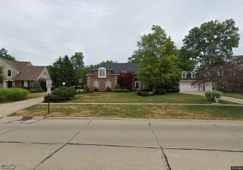
483 Long Pointe Dr Avon Lake, OH 44012
Estimated Value: $640,968 - $791,000
4
Beds
4
Baths
3,501
Sq Ft
$208/Sq Ft
Est. Value
About This Home
This home is located at 483 Long Pointe Dr, Avon Lake, OH 44012 and is currently estimated at $729,242, approximately $208 per square foot. 483 Long Pointe Dr is a home located in Lorain County with nearby schools including Eastview Elementary School, Troy Intermediate Elementary School, and Learwood Middle School.
Ownership History
Date
Name
Owned For
Owner Type
Purchase Details
Closed on
Mar 10, 1999
Sold by
Mccloud Ronald L
Bought by
Gottshall Timothy R and Gottshall Angela M
Current Estimated Value
Home Financials for this Owner
Home Financials are based on the most recent Mortgage that was taken out on this home.
Original Mortgage
$267,000
Interest Rate
6.78%
Create a Home Valuation Report for This Property
The Home Valuation Report is an in-depth analysis detailing your home's value as well as a comparison with similar homes in the area
Home Values in the Area
Average Home Value in this Area
Purchase History
| Date | Buyer | Sale Price | Title Company |
|---|---|---|---|
| Gottshall Timothy R | $355,000 | Midland Title |
Source: Public Records
Mortgage History
| Date | Status | Borrower | Loan Amount |
|---|---|---|---|
| Closed | Gottshall Timothy R | $267,000 |
Source: Public Records
Tax History Compared to Growth
Tax History
| Year | Tax Paid | Tax Assessment Tax Assessment Total Assessment is a certain percentage of the fair market value that is determined by local assessors to be the total taxable value of land and additions on the property. | Land | Improvement |
|---|---|---|---|---|
| 2024 | $8,693 | $183,719 | $57,624 | $126,095 |
| 2023 | $7,634 | $143,532 | $36,862 | $106,670 |
| 2022 | $7,555 | $143,532 | $36,862 | $106,670 |
| 2021 | $7,538 | $143,532 | $36,862 | $106,670 |
| 2020 | $6,960 | $122,780 | $31,530 | $91,250 |
| 2019 | $6,923 | $122,780 | $31,530 | $91,250 |
| 2018 | $6,914 | $122,780 | $31,530 | $91,250 |
| 2017 | $6,882 | $112,000 | $29,220 | $82,780 |
| 2016 | $6,848 | $112,000 | $29,220 | $82,780 |
| 2015 | $6,880 | $112,000 | $29,220 | $82,780 |
| 2014 | $6,676 | $103,560 | $27,010 | $76,550 |
| 2013 | $7,192 | $110,720 | $27,010 | $83,710 |
Source: Public Records
Map
Nearby Homes
- 401 Bounty Way Unit 239
- 505 Port Side Dr
- 31430 Pier W
- 522 S Port Dr
- 406 the Inlet
- 31670 Walker Rd
- 32005 Westview Trail
- Castleton Plan at Port Side - Estates
- Oakmont Plan at Port Side - Reserve
- Continental II Plan at Port Side - Crossings
- Willwood Plan at Port Side - Estates
- Pebble Beach Plan at Port Side - Reserve
- Mercer II Plan at Port Side - Crossings
- Waverly Plan at Port Side - Crossings
- Augusta Plan at Port Side - Reserve
- Newberry II Plan at Port Side - Crossings
- Allison II Plan at Port Side - Estates
- Woodside Plan at Port Side - Estates
- 372 Harbor Ct
- 502 Port Side Dr
- 473 Long Pointe Dr
- 493 Long Pointe Dr
- 31800 Walker Rd
- 469 Long Pointe Dr
- 492 Long Pointe Dr
- 476 Long Pointe Dr
- 401 Bounty Way
- 465 Long Pointe Dr
- 31840 Walker Rd
- 31790 Walker Rd
- 470 Long Pointe Dr
- 509 Bridgeside Dr
- 31850 Walker Rd
- 506 Bridgeside Dr
- 31782 Walker Rd
- 31781 Leeward Ct
- 464 Long Pointe Dr
- 31775 Leeward Ct
- 31860 Walker Rd
- 31780 Leeward Ct