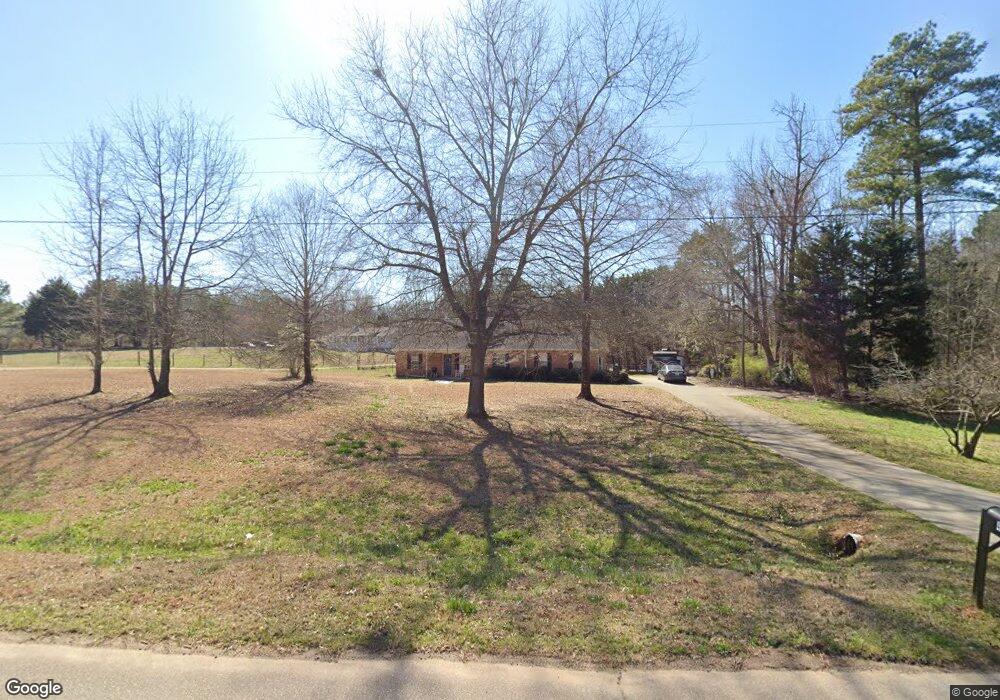
483 N Green Cir McDonough, GA 30252
Estimated Value: $282,579 - $321,000
3
Beds
2
Baths
1,546
Sq Ft
$190/Sq Ft
Est. Value
About This Home
This home is located at 483 N Green Cir, McDonough, GA 30252 and is currently estimated at $294,395, approximately $190 per square foot. 483 N Green Cir is a home located in Henry County with nearby schools including East Lake Elementary School, Union Grove Middle School, and Union Grove High School.
Ownership History
Date
Name
Owned For
Owner Type
Purchase Details
Closed on
Jan 7, 2022
Sold by
Tague Steven Paul
Bought by
Drummond Joseph and Drummond Cassandra
Current Estimated Value
Home Financials for this Owner
Home Financials are based on the most recent Mortgage that was taken out on this home.
Original Mortgage
$220,924
Outstanding Balance
$203,192
Interest Rate
3.11%
Mortgage Type
FHA
Estimated Equity
$91,203
Purchase Details
Closed on
May 21, 2018
Sold by
Hill Jonathan
Bought by
Tague Steven Paul
Home Financials for this Owner
Home Financials are based on the most recent Mortgage that was taken out on this home.
Original Mortgage
$163,214
Interest Rate
4.4%
Mortgage Type
VA
Purchase Details
Closed on
Mar 1, 2018
Sold by
Meeks Gary L
Bought by
Hill Jonathan
Purchase Details
Closed on
Sep 15, 2011
Sold by
Meeks Gary L
Bought by
Meeks Gary L
Create a Home Valuation Report for This Property
The Home Valuation Report is an in-depth analysis detailing your home's value as well as a comparison with similar homes in the area
Home Values in the Area
Average Home Value in this Area
Purchase History
| Date | Buyer | Sale Price | Title Company |
|---|---|---|---|
| Drummond Joseph | $225,000 | -- | |
| Tague Steven Paul | $158,000 | -- | |
| Hill Jonathan | $96,140 | -- | |
| Meeks Gary L | -- | -- |
Source: Public Records
Mortgage History
| Date | Status | Borrower | Loan Amount |
|---|---|---|---|
| Open | Drummond Joseph | $220,924 | |
| Previous Owner | Tague Steven Paul | $163,214 |
Source: Public Records
Tax History Compared to Growth
Tax History
| Year | Tax Paid | Tax Assessment Tax Assessment Total Assessment is a certain percentage of the fair market value that is determined by local assessors to be the total taxable value of land and additions on the property. | Land | Improvement |
|---|---|---|---|---|
| 2025 | $5,144 | $129,120 | $15,160 | $113,960 |
| 2024 | $5,144 | $123,920 | $13,680 | $110,240 |
| 2023 | $3,492 | $90,000 | $9,810 | $80,190 |
| 2022 | $3,521 | $90,760 | $12,160 | $78,600 |
| 2021 | $2,783 | $71,520 | $10,440 | $61,080 |
| 2020 | $2,589 | $66,440 | $9,800 | $56,640 |
| 2019 | $2,452 | $62,880 | $9,320 | $53,560 |
| 2018 | $2,130 | $54,480 | $8,600 | $45,880 |
| 2016 | $1,717 | $43,720 | $6,400 | $37,320 |
| 2015 | $1,551 | $38,200 | $7,200 | $31,000 |
| 2014 | $1,422 | $34,520 | $7,200 | $27,320 |
Source: Public Records
Map
Nearby Homes
- 507 N Green Cir
- 540 Indian Cotton Trail
- 407 River Forest Dr
- 502 Brookline Place
- 1832 Elliott Rd Unit (LOT 2)
- 1824 Elliott Rd Unit (LOT 3)
- 505 Lupin Cir
- 504 Lupin Cir
- 604 Clearwater Ct Unit 6
- 287 E Knight Rd
- 1098 E Lake Rd
- 297 E Knight Rd
- 656 E Lake Rd
- 1523 Bent River Cir
- 283 Osier Dr
- 2140 Airline Rd
- 451 Cotton Indian Creek Rd
- 1100 River Green Ct Unit 2
- 1710 Crumbley Rd
- 501 Owens Springs Ln
- 479 N Green Cir
- 481 N Green Cir
- 484 N Green Cir
- 474 N Green Cir
- 520 N Green Cir
- 495 N Green Cir
- N N Green Cir
- 414 N Green Cir
- 428 N Green Cir
- 464 N Green Cir
- 499 N Green Cir
- 401 Green Cir
- 475 N Green Cir
- 409 N Green Cir
- 477 Green Cir
- 454 N Green Cir
- 530 Indian Cotton Trail
- 431 Green Cir
- 505 Indian Cotton Trail
- 489 N Green Cir