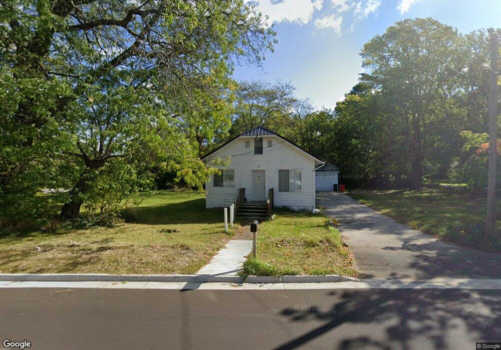
483 Paw Paw Ave Benton Harbor, MI 49022
Estimated Value: $74,000 - $134,000
3
Beds
1
Bath
1,058
Sq Ft
$104/Sq Ft
Est. Value
About This Home
This home is located at 483 Paw Paw Ave, Benton Harbor, MI 49022 and is currently estimated at $110,324, approximately $104 per square foot. 483 Paw Paw Ave is a home located in Berrien County with nearby schools including Fair Plain Middle School, Benton Harbor High School, and Benton Harbor Charter School Academy.
Ownership History
Date
Name
Owned For
Owner Type
Purchase Details
Closed on
Oct 23, 2020
Sold by
Hamilton Christopher L
Bought by
Diamond Estate Management Llc
Current Estimated Value
Purchase Details
Closed on
Oct 12, 2020
Sold by
Hamilton Christopher L
Bought by
Diamond Estate Management Llc
Purchase Details
Closed on
Oct 31, 2012
Sold by
Hamilton Cordia M
Bought by
Hamilton Christopher L
Purchase Details
Closed on
Sep 18, 2003
Sold by
Hamilton Larry Dale
Bought by
Hamilton C H and Hamilton Cordia
Purchase Details
Closed on
Sep 13, 2002
Purchase Details
Closed on
Sep 1, 1975
Create a Home Valuation Report for This Property
The Home Valuation Report is an in-depth analysis detailing your home's value as well as a comparison with similar homes in the area
Home Values in the Area
Average Home Value in this Area
Purchase History
| Date | Buyer | Sale Price | Title Company |
|---|---|---|---|
| Diamond Estate Management Llc | -- | Near North Title Group | |
| Diamond Estate Management Llc | $30,000 | Near Northe Title Group | |
| Hamilton Christopher L | $500 | None Available | |
| Hamilton C H | -- | -- | |
| -- | $100 | -- | |
| -- | $9,100 | -- |
Source: Public Records
Tax History Compared to Growth
Tax History
| Year | Tax Paid | Tax Assessment Tax Assessment Total Assessment is a certain percentage of the fair market value that is determined by local assessors to be the total taxable value of land and additions on the property. | Land | Improvement |
|---|---|---|---|---|
| 2025 | $1,114 | $34,900 | $0 | $0 |
| 2024 | $1,071 | $31,000 | $0 | $0 |
| 2023 | $857 | $22,400 | $0 | $0 |
| 2022 | $972 | $17,000 | $0 | $0 |
| 2021 | $1,260 | $15,600 | $700 | $14,900 |
| 2020 | $860 | $15,800 | $0 | $0 |
| 2019 | $1,167 | $14,000 | $0 | $0 |
| 2018 | $1,193 | $13,600 | $0 | $0 |
| 2017 | $1,178 | $12,600 | $0 | $0 |
| 2016 | $1,009 | $12,700 | $0 | $0 |
| 2015 | $681 | $12,200 | $0 | $0 |
| 2014 | $548 | $14,800 | $0 | $0 |
Source: Public Records
Map
Nearby Homes
- 470 N Mccord St
- 530 Rembert Ct
- 696 Highland Ave
- 6525 Territorial Rd
- 255 High St
- 309 High St
- 710 Buss Ave
- 293 Morning Walk Path
- 238 Pine St
- 137 Cornelia St
- 992 Highland Ave
- 255 Collins Ave
- 1069 E Main St
- 391 Pipestone St
- 378 Pipestone St
- VL Eighth Ninth Boughton St
- 937 Hall St
- 234 Walnut St
- 419 Packard St
- 585 Beachwood Path