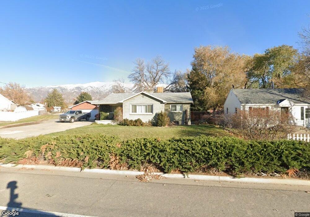
483 S Fort Ln Layton, UT 84041
Estimated Value: $474,000 - $497,040
3
Beds
2
Baths
1,249
Sq Ft
$389/Sq Ft
Est. Value
About This Home
This home is located at 483 S Fort Ln, Layton, UT 84041 and is currently estimated at $485,760, approximately $388 per square foot. 483 S Fort Ln is a home located in Davis County with nearby schools including Whitesides Elementary School, Fairfield Junior High School, and Layton High School.
Ownership History
Date
Name
Owned For
Owner Type
Purchase Details
Closed on
Aug 29, 2007
Sold by
Harding Terry L and Harding Michele L
Bought by
Harding Terry L and Harding Michele L
Current Estimated Value
Purchase Details
Closed on
Jun 9, 2003
Sold by
Harding Terry L and Harding Michele
Bought by
Harding Terry L and Harding Michele L
Home Financials for this Owner
Home Financials are based on the most recent Mortgage that was taken out on this home.
Original Mortgage
$56,175
Interest Rate
5.61%
Mortgage Type
Purchase Money Mortgage
Create a Home Valuation Report for This Property
The Home Valuation Report is an in-depth analysis detailing your home's value as well as a comparison with similar homes in the area
Home Values in the Area
Average Home Value in this Area
Purchase History
| Date | Buyer | Sale Price | Title Company |
|---|---|---|---|
| Harding Terry L | -- | None Available | |
| Harding Terry L | -- | Backman Stewart Title Servic |
Source: Public Records
Mortgage History
| Date | Status | Borrower | Loan Amount |
|---|---|---|---|
| Closed | Harding Terry L | $56,175 |
Source: Public Records
Tax History Compared to Growth
Tax History
| Year | Tax Paid | Tax Assessment Tax Assessment Total Assessment is a certain percentage of the fair market value that is determined by local assessors to be the total taxable value of land and additions on the property. | Land | Improvement |
|---|---|---|---|---|
| 2025 | $2,636 | $276,650 | $146,648 | $130,002 |
| 2024 | $2,543 | $268,950 | $165,789 | $103,161 |
| 2023 | $2,355 | $439,000 | $194,652 | $244,348 |
| 2022 | $2,494 | $252,450 | $117,547 | $134,903 |
| 2021 | $2,498 | $377,000 | $211,874 | $165,126 |
| 2020 | $2,313 | $335,000 | $157,270 | $177,730 |
| 2019 | $2,249 | $319,000 | $132,449 | $186,551 |
| 2018 | $2,009 | $286,000 | $132,449 | $153,551 |
| 2016 | $1,659 | $121,880 | $55,293 | $66,587 |
| 2015 | $1,581 | $110,275 | $55,293 | $54,982 |
| 2014 | $1,757 | $125,268 | $55,293 | $69,975 |
| 2013 | -- | $99,091 | $34,929 | $64,162 |
Source: Public Records
Map
Nearby Homes
- 457 E Alice Way Unit 102
- 493 E Alice Way
- 389 Morgan St
- 617 E 405 S
- 282 E 925 S
- 268 E 900 S
- 818 Creekside Dr
- 696 S Clearwater Falls Dr
- 110 Mill Rd
- 86 Mill Rd
- 877 S Main St Unit B
- 895 S Main St Unit E
- 917 S Main St Unit H
- 772 N Crimson Ln
- 174 W Dawson St
- 942 E Gentile St
- 142 Green Dr
- 1168 Holmes Creek Ln
- 267 S Melody St
- 424 W Creekside Ln
- 421 S Fort Ln
- 493 S Fort Ln
- 494 E 550 S Unit 116
- 488 E 550 S Unit 117
- 509 S Fort Ln
- 503 E 550 S Unit 110
- 507 E 550 S Unit 111
- 468 E 550 S Unit 119
- 460 E 405 S
- 510 E 405 S
- 458 E 550 S Unit 121
- 452 Kimball Dr
- 525 S Fort Ln
- 480 S Kimball Dr
- 452 E 550 S Unit 122
- 424 Kimball Dr
- 480 Kimball Dr
- 476 S Fort Ln
- 560 E 405 S
- 508 Kimball Dr