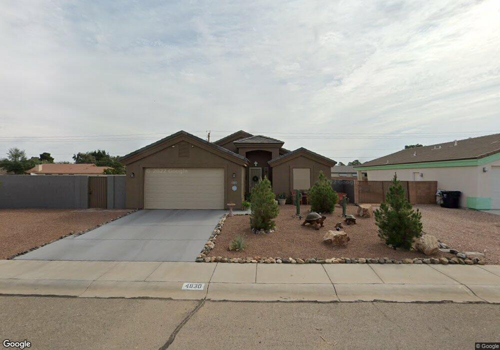
4830 N Anthony Ave Kingman, AR 86409
New Kingman-Butler NeighborhoodEstimated Value: $272,000 - $308,000
--
Bed
1
Bath
1,610
Sq Ft
$182/Sq Ft
Est. Value
About This Home
This home is located at 4830 N Anthony Ave, Kingman, AR 86409 and is currently estimated at $292,418, approximately $181 per square foot. 4830 N Anthony Ave is a home located in Mohave County with nearby schools including Desert Willow Elementary School, Kingman Middle School, and Kingman High School.
Ownership History
Date
Name
Owned For
Owner Type
Purchase Details
Closed on
Jul 30, 2019
Sold by
K Squared Development Inc
Bought by
Querio Michael D and Querio Diane C
Current Estimated Value
Home Financials for this Owner
Home Financials are based on the most recent Mortgage that was taken out on this home.
Original Mortgage
$202,929
Outstanding Balance
$177,728
Interest Rate
3.7%
Mortgage Type
New Conventional
Estimated Equity
$114,690
Purchase Details
Closed on
Sep 14, 2018
Sold by
Grove David M
Bought by
K Squared Development Inc
Purchase Details
Closed on
Jun 9, 2016
Sold by
Grove Mandy M
Bought by
Grove David M
Purchase Details
Closed on
Apr 5, 2016
Sold by
Kingman Meadows Llc
Bought by
Wissinger Construction Inc
Purchase Details
Closed on
May 14, 2013
Sold by
Meridian Land Holdings Llc
Bought by
Kingsman Meadows Llc
Create a Home Valuation Report for This Property
The Home Valuation Report is an in-depth analysis detailing your home's value as well as a comparison with similar homes in the area
Home Values in the Area
Average Home Value in this Area
Purchase History
| Date | Buyer | Sale Price | Title Company |
|---|---|---|---|
| Querio Michael D | $200,900 | Chicago Title Agency Inc | |
| K Squared Development Inc | $20,000 | Chicago Title Agency Inc | |
| Grove David M | -- | Chicago Title Agency Inc | |
| Wissinger Construction Inc | $40,000 | Pioneer Title Agency Inc | |
| Kingsman Meadows Llc | $927,500 | None Available |
Source: Public Records
Mortgage History
| Date | Status | Borrower | Loan Amount |
|---|---|---|---|
| Open | Querio Michael D | $202,929 |
Source: Public Records
Tax History Compared to Growth
Tax History
| Year | Tax Paid | Tax Assessment Tax Assessment Total Assessment is a certain percentage of the fair market value that is determined by local assessors to be the total taxable value of land and additions on the property. | Land | Improvement |
|---|---|---|---|---|
| 2026 | $864 | -- | -- | -- |
| 2025 | $1,676 | $24,226 | $0 | $0 |
| 2024 | $1,676 | $24,632 | $0 | $0 |
| 2023 | $1,676 | $22,221 | $0 | $0 |
| 2022 | $1,553 | $18,580 | $0 | $0 |
| 2021 | $1,558 | $16,732 | $0 | $0 |
| 2019 | $190 | $2,945 | $0 | $0 |
| 2018 | $193 | $2,709 | $0 | $0 |
| 2017 | $179 | $1,340 | $0 | $0 |
| 2016 | $179 | $1,340 | $0 | $0 |
| 2015 | $201 | $1,429 | $0 | $0 |
Source: Public Records
Map
Nearby Homes
- 4782 N Anthony Ave
- 3751 E Nicole Ave
- 3804 E Packard Ave
- 3756 E Thompson Ave
- 3664 E Koval Dr
- 3773 Lum Ave
- 3659 E Andrea Dr
- 3627 E Angelina Dr
- 3799 E Ames Ave
- 3850 E Thompson Ave
- 3847 E Potter Ave
- 3864 E Potter Ave
- 3704 E Hearne Ave
- 3903 E Nicole Ave
- 3919 E Snavely Ave
- 3844 E Mcvicar Ave
- 3868 E Suffock Ave
- 3600 Lum Ave
- 3850 E Mcvicar Ave
- 3933 E Packard Ave
- 4830 N Anthony Ave
- 4830 N Anthony Ave
- 4822 N Anthony Ave
- 4822 N Anthony Ave
- 17915 Marisol
- 4814 N Anthony Ave
- 4814 N Anthony Ave
- 4846 N Anthony Ave
- 3750 E Packard Ave
- 3724 E Koval Dr
- 3751 E Lass Ave
- 4806 N Anthony Ave
- 3726 E Mariscal Dr
- 4806 N Anthony Ave
- 3726 E Mariscal Dr
- 3725 E Mariscal Dr
- 3719 E Mariscal Dr
- 3751 E Packard Ave
- 4848 N Anthony Ave
- 3756 E Packard Ave