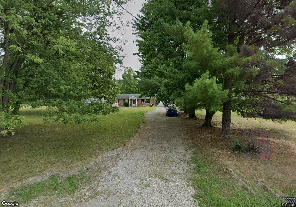
4832 Tealtown Rd Milford, OH 45150
Estimated Value: $264,000 - $297,000
3
Beds
2
Baths
1,269
Sq Ft
$218/Sq Ft
Est. Value
About This Home
This home is located at 4832 Tealtown Rd, Milford, OH 45150 and is currently estimated at $276,890, approximately $218 per square foot. 4832 Tealtown Rd is a home located in Clermont County with nearby schools including Willowville Elementary School, West Clermont Middle School, and West Clermont High School.
Ownership History
Date
Name
Owned For
Owner Type
Purchase Details
Closed on
Aug 2, 1999
Sold by
Vanlandingham Phillip
Bought by
Sharp Michael A and Rine Patricia L
Current Estimated Value
Home Financials for this Owner
Home Financials are based on the most recent Mortgage that was taken out on this home.
Original Mortgage
$89,468
Outstanding Balance
$25,790
Interest Rate
7.69%
Mortgage Type
FHA
Estimated Equity
$251,100
Purchase Details
Closed on
May 1, 1986
Create a Home Valuation Report for This Property
The Home Valuation Report is an in-depth analysis detailing your home's value as well as a comparison with similar homes in the area
Home Values in the Area
Average Home Value in this Area
Purchase History
| Date | Buyer | Sale Price | Title Company |
|---|---|---|---|
| Sharp Michael A | $97,500 | -- | |
| -- | $6,300 | -- |
Source: Public Records
Mortgage History
| Date | Status | Borrower | Loan Amount |
|---|---|---|---|
| Open | Sharp Michael A | $89,468 |
Source: Public Records
Tax History Compared to Growth
Tax History
| Year | Tax Paid | Tax Assessment Tax Assessment Total Assessment is a certain percentage of the fair market value that is determined by local assessors to be the total taxable value of land and additions on the property. | Land | Improvement |
|---|---|---|---|---|
| 2024 | $3,497 | $69,340 | $18,170 | $51,170 |
| 2023 | $3,502 | $69,340 | $18,170 | $51,170 |
| 2022 | $3,020 | $51,840 | $13,580 | $38,260 |
| 2021 | $3,033 | $51,840 | $13,580 | $38,260 |
| 2020 | $3,036 | $51,840 | $13,580 | $38,260 |
| 2019 | $2,330 | $46,520 | $13,480 | $33,040 |
| 2018 | $2,354 | $46,520 | $13,480 | $33,040 |
| 2017 | $2,242 | $46,520 | $13,480 | $33,040 |
| 2016 | $2,242 | $40,110 | $11,620 | $28,490 |
| 2015 | $2,176 | $40,110 | $11,620 | $28,490 |
| 2014 | $2,176 | $40,110 | $11,620 | $28,490 |
| 2013 | $2,113 | $38,540 | $9,700 | $28,840 |
Source: Public Records
Map
Nearby Homes
- 4820 Teal Ln
- 4820 Tomahawk Trail
- 1311 U S 50
- 1165 Village Glen Dr
- 4713 Shephard Rd
- 4597 Muirridge Ct
- 994 Shephard Woods Ct
- 1260 Timber Ridge Ct
- 4601 Shephard Rd
- 4579 Wood Forest Ln
- 4975 Rumpke Rd
- 4571 Carnoustie
- 1542 U S 50
- 4503 Eva Ln
- 1278 McGuffey Ln
- 4536 Tealtown Rd
- 4536 Treeview Ct
- 4466 Eva Ln
- 4600 Olive Branch Stonelick Rd
- 4455 Dogwood Dr
- 4828 Tealtown Rd
- 4836 Tealtown Rd
- 4840 Tealtown Rd
- 4855 Teal Ln
- 4820 Tealtown Rd
- 4816 Tealtown Rd
- 4842 Tealtown Rd
- 4833 Tealtown Rd
- 4815 Tealtown Rd
- 4865 Teal Ln
- 4813 Tealtown Rd
- 4846 Tealtown Rd
- 4827 Teal Ln
- 4837 Tealtown Rd
- 4831 Teal Ln
- 4819 Tealtown Rd
- 4812 Woodlawn Dr
- 4861 Teal Ln
- 4863 Teal Ln
- 4848 Tealtown Rd