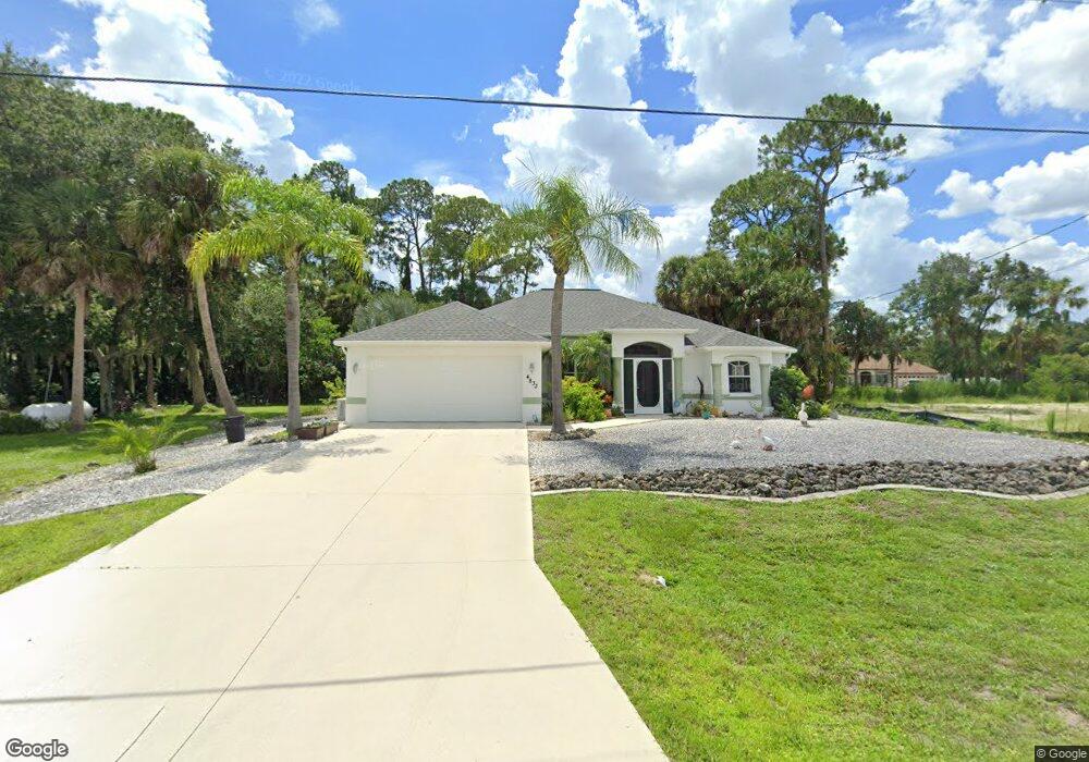
4833 Kenvil Dr North Port, FL 34288
Estimated Value: $393,000 - $456,000
3
Beds
2
Baths
2,038
Sq Ft
$207/Sq Ft
Est. Value
About This Home
This home is located at 4833 Kenvil Dr, North Port, FL 34288 and is currently estimated at $421,980, approximately $207 per square foot. 4833 Kenvil Dr is a home located in Sarasota County with nearby schools including Atwater Elementary School, North Port High School, and Woodland Middle School.
Ownership History
Date
Name
Owned For
Owner Type
Purchase Details
Closed on
Jan 19, 2009
Sold by
Lawrence Paul F and Lawrence Linda L
Bought by
Lawrence Paul F and Lawrence Linda L
Current Estimated Value
Purchase Details
Closed on
Nov 2, 2001
Sold by
Allstae Bldr Sw Fl Inc
Bought by
Lawrence Paul F and Lawrence Linda L
Purchase Details
Closed on
May 25, 2001
Sold by
T N R Co Inc
Bought by
Allstate Bldr Sw Fl Inc
Purchase Details
Closed on
Mar 13, 1998
Sold by
Clerk Circuit Court
Bought by
Est Lands Excavators
Create a Home Valuation Report for This Property
The Home Valuation Report is an in-depth analysis detailing your home's value as well as a comparison with similar homes in the area
Home Values in the Area
Average Home Value in this Area
Purchase History
| Date | Buyer | Sale Price | Title Company |
|---|---|---|---|
| Lawrence Paul F | -- | None Available | |
| Lawrence Paul F | $134,500 | -- | |
| Allstate Bldr Sw Fl Inc | $3,000 | -- | |
| Allstate Bldr Sw Fl Inc | $3,000 | -- | |
| Est Lands Excavators | $800 | -- |
Source: Public Records
Tax History Compared to Growth
Tax History
| Year | Tax Paid | Tax Assessment Tax Assessment Total Assessment is a certain percentage of the fair market value that is determined by local assessors to be the total taxable value of land and additions on the property. | Land | Improvement |
|---|---|---|---|---|
| 2024 | $496 | $153,928 | -- | -- |
| 2023 | $496 | $143,345 | $0 | $0 |
| 2022 | $596 | $145,270 | $0 | $0 |
| 2021 | $2,075 | $132,301 | $0 | $0 |
| 2020 | $2,023 | $130,474 | $0 | $0 |
| 2019 | $1,955 | $127,541 | $0 | $0 |
| 2018 | $0 | $125,163 | $0 | $0 |
| 2017 | $1,771 | $122,589 | $0 | $0 |
| 2016 | $1,758 | $166,100 | $9,500 | $156,600 |
| 2015 | $1,782 | $148,200 | $7,400 | $140,800 |
| 2014 | $1,711 | $114,388 | $0 | $0 |
Source: Public Records
Map
Nearby Homes
- 4819 Ariton Rd
- 4875 Ariton Rd
- 0 Ariton Rd Unit R11120962
- 0 Ariton Rd Unit MFRC7508875
- 0 NE Joyce Ave Unit MFRTB8345800
- 1610 Heath Ln
- 4683 Oakley Rd
- 1501 Marasco Ln
- 1469 Franklin Ln
- 1515 Marasco Ln
- 0 Oakley Rd Unit MFRC7505026
- 0 Brandon Terrace Unit A4516040
- 0 Brandon Terrace Unit 314993
- 1401 Pelican Ln
- 0 Sunnyvale Rd Unit MFRC7516263
- 0 Balmor Terrace Unit MFRC7513411
- 4097 Feather Terrace
- LOTS 7 & 8 Cardwell Ave
- Lot 8 Cardwell Ave
- Lot 7 Cardwell Ave
- 4813 Kenvil Dr
- 0 Ariton Rd Unit A4213128
- 0 Ariton Rd Unit C698347
- 0 Ariton Rd Unit A4190504
- 0 Ariton Rd Unit C7404574
- 0 Ariton Rd Unit C7402737
- 0 Ariton Rd Unit D6100947
- 0 Ariton Rd Unit D6100945
- 0 Ariton Rd Unit A4403618
- 0 Ariton Rd Unit MFRC7495598
- 0 Ariton Rd Unit MFRA4615636
- 0 Ariton Rd Unit MFRO6160909
- 0 Ariton Rd Unit C7463031
- 0 Ariton Rd Unit N6119564
- Ariton Rd
- 0 Ariton Rd Unit U8130602
- 0 Ariton Rd Unit C7445488
- Ariton Rd
- 0 Ariton Rd Unit C7439527
- 0 Ariton Rd Unit C7438833