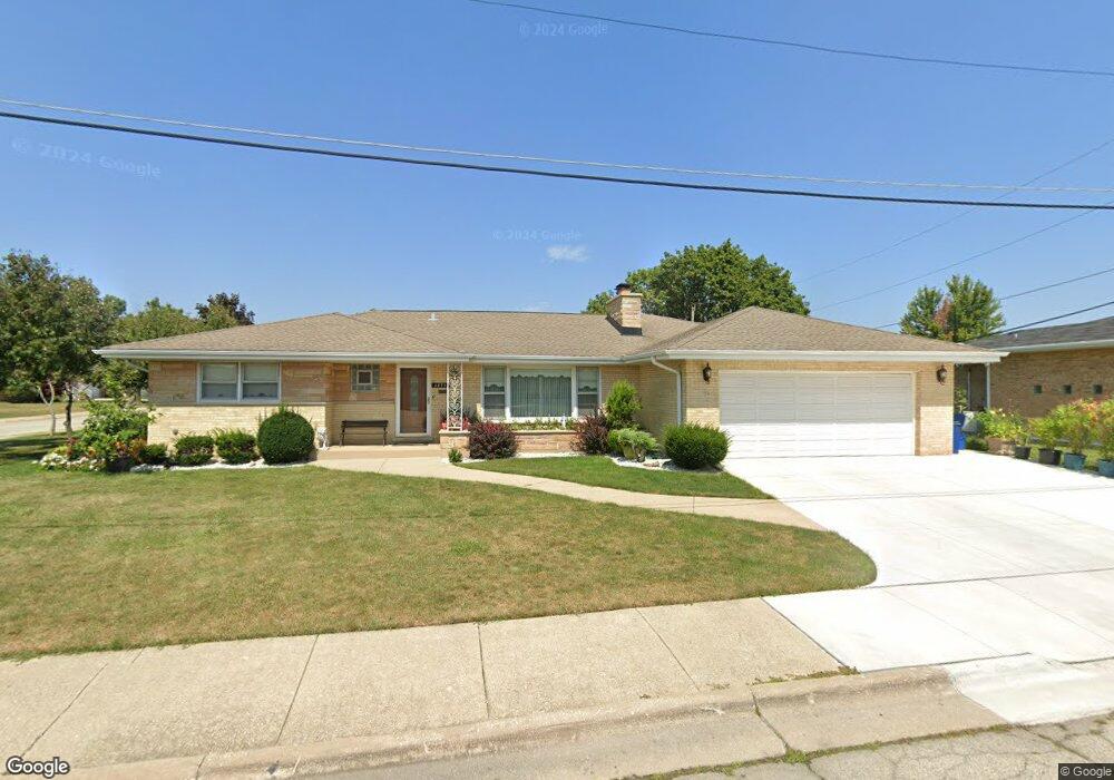
4833 N Frank Pkwy Norridge, IL 60706
Estimated Value: $468,000 - $694,000
4
Beds
3
Baths
2,341
Sq Ft
$259/Sq Ft
Est. Value
About This Home
This home is located at 4833 N Frank Pkwy, Norridge, IL 60706 and is currently estimated at $605,630, approximately $258 per square foot. 4833 N Frank Pkwy is a home located in Cook County with nearby schools including J Leigh Elementary School, Ridgewood Community High School, and St Eugene School.
Ownership History
Date
Name
Owned For
Owner Type
Purchase Details
Closed on
Jul 17, 2003
Sold by
Cosentino Frank D and Cosentino Rose C
Bought by
Cosentino Frank D and Cosentino Rose C
Current Estimated Value
Home Financials for this Owner
Home Financials are based on the most recent Mortgage that was taken out on this home.
Original Mortgage
$240,000
Interest Rate
5.62%
Mortgage Type
Unknown
Create a Home Valuation Report for This Property
The Home Valuation Report is an in-depth analysis detailing your home's value as well as a comparison with similar homes in the area
Home Values in the Area
Average Home Value in this Area
Purchase History
| Date | Buyer | Sale Price | Title Company |
|---|---|---|---|
| Cosentino Frank D | -- | -- |
Source: Public Records
Mortgage History
| Date | Status | Borrower | Loan Amount |
|---|---|---|---|
| Closed | Cosentino Frank D | $240,000 |
Source: Public Records
Tax History Compared to Growth
Tax History
| Year | Tax Paid | Tax Assessment Tax Assessment Total Assessment is a certain percentage of the fair market value that is determined by local assessors to be the total taxable value of land and additions on the property. | Land | Improvement |
|---|---|---|---|---|
| 2024 | $10,377 | $47,140 | $11,627 | $35,513 |
| 2023 | $10,077 | $51,000 | $11,627 | $39,373 |
| 2022 | $10,077 | $51,000 | $11,627 | $39,373 |
| 2021 | $9,376 | $40,190 | $10,285 | $29,905 |
| 2020 | $9,194 | $40,190 | $10,285 | $29,905 |
| 2019 | $9,162 | $45,107 | $10,285 | $34,822 |
| 2018 | $6,932 | $30,572 | $8,496 | $22,076 |
| 2017 | $6,776 | $30,572 | $8,496 | $22,076 |
| 2016 | $6,593 | $30,572 | $8,496 | $22,076 |
| 2015 | $7,024 | $30,203 | $7,378 | $22,825 |
| 2014 | $6,932 | $30,203 | $7,378 | $22,825 |
| 2013 | $7,265 | $32,185 | $7,378 | $24,807 |
Source: Public Records
Map
Nearby Homes
- 8025 W Giddings St
- 4846 N Crescent Ave
- 4937 N Ozanam Ave
- 4617 N Canfield Ave
- 5134 N Mission Dr
- 8024 W Charmaine Rd
- 4621 N Ozanam Ave
- 7650 W Lawrence Ave Unit 201
- 5161 N Moreland Ave
- 7641 W Ainslie St
- 7632 W Norridge St
- 7616 W Lawrence Ave Unit 3A
- 7636 W Strong St
- 8200 W Eastwood Ave
- 8268 W Lawrence Ave
- 7604 W Lawrence Ave Unit 1B
- 4436 N Osage Ave
- 7809 W Farragut Ave
- 7805 W Farragut Ave
- 4404 N Opal Ave
- 4839 N Frank Pkwy
- 4832 N Sunrise Ln
- 4838 N Sunrise Ln
- 7923 W Gunnison St
- 4832 N Frank Pkwy
- 7935 W Gunnison St
- 4845 N Frank Pkwy
- 4838 N Frank Pkwy
- 7911 W Gunnison St
- 4844 N Sunrise Ln
- 4844 N Frank Pkwy
- 7943 W Gunnison St
- 7916 W Lawrence Ave Unit A
- 7916 W Lawrence Ave
- 7916 W Lawrence Ave
- 7916 W Lawrence Ave
- 7916 W Lawrence Ave
- 7916 W Lawrence Ave
- 7916 W Lawrence Ave
- 7916 W Lawrence Ave