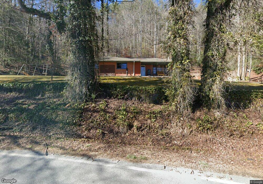
4833 Wolffork Rd Rabun Gap, GA 30568
Estimated Value: $232,868 - $530,000
3
Beds
2
Baths
1,608
Sq Ft
$210/Sq Ft
Est. Value
About This Home
This home is located at 4833 Wolffork Rd, Rabun Gap, GA 30568 and is currently estimated at $337,717, approximately $210 per square foot. 4833 Wolffork Rd is a home located in Rabun County with nearby schools including Rabun County Primary School, Rabun County High School, and Rabun Gap Nacoochee School.
Ownership History
Date
Name
Owned For
Owner Type
Purchase Details
Closed on
Feb 1, 1997
Bought by
Carpenter Eddie D
Current Estimated Value
Purchase Details
Closed on
Nov 1, 1995
Purchase Details
Closed on
Sep 1, 1995
Purchase Details
Closed on
Aug 1, 1993
Purchase Details
Closed on
Dec 1, 1991
Create a Home Valuation Report for This Property
The Home Valuation Report is an in-depth analysis detailing your home's value as well as a comparison with similar homes in the area
Home Values in the Area
Average Home Value in this Area
Purchase History
| Date | Buyer | Sale Price | Title Company |
|---|---|---|---|
| Carpenter Eddie D | $77,000 | -- | |
| Carpenter Eddie D | $77,000 | -- | |
| -- | -- | -- | |
| -- | -- | -- | |
| -- | $72,500 | -- | |
| -- | $72,500 | -- | |
| -- | $70,000 | -- | |
| -- | $70,000 | -- | |
| -- | -- | -- | |
| -- | -- | -- |
Source: Public Records
Tax History
| Year | Tax Paid | Tax Assessment Tax Assessment Total Assessment is a certain percentage of the fair market value that is determined by local assessors to be the total taxable value of land and additions on the property. | Land | Improvement |
|---|---|---|---|---|
| 2025 | $1,027 | $68,012 | $12,760 | $55,252 |
| 2024 | $999 | $64,260 | $12,760 | $51,500 |
| 2023 | $975 | $55,281 | $11,600 | $43,681 |
| 2022 | $944 | $53,566 | $11,600 | $41,966 |
| 2021 | $853 | $47,506 | $11,020 | $36,486 |
| 2020 | $825 | $44,548 | $11,020 | $33,528 |
| 2019 | $831 | $44,548 | $11,020 | $33,528 |
| 2018 | $834 | $44,548 | $11,020 | $33,528 |
| 2017 | $800 | $44,548 | $11,020 | $33,528 |
| 2016 | $802 | $44,548 | $11,020 | $33,528 |
| 2015 | $764 | $41,650 | $11,020 | $30,630 |
| 2014 | $768 | $41,650 | $11,020 | $30,630 |
Source: Public Records
Map
Nearby Homes
- 5019 Wolffork Rd
- 0 Blue Ridge Gap Rd Unit 10679893
- 5192 Wolffork Rd
- 786 Hope Haven Ln
- 6159 Wolffork Rd
- 133 Simms Way
- 1422 Wolffork Rd
- 243 Degroff Ln
- 190 Legendary Ln
- 373 Western Way
- 375 Western Way
- 0 Sylvan Lake Dr Unit 47,48 10485897
- 0 Pitts Way Unit 10592369
- 0 Crest Ln Unit LOT 5
- 513 Coleman Heights Ln
- 130 Ivy Trail
- LOT 121 Doolittle Dr
- 0 Alto Ln Unit 10669756
- 137 Olds Mountain Peak Rd
- 44 Cessna Ln
- 4893 Wolffork Rd
- 4761 Wolffork Rd
- 4761 Wolffork Rd Unit 101/2
- 4741 Wolffork Rd
- 750 Keener Rd
- 0 Keener Rd Unit 2937201
- 20 Dickerson Ln
- 4995 Wolffork Rd
- 4 Keener Rd
- 28 Keener Rd
- 4999 Wolffork Rd
- 123 Dickerson Ln
- 766 Allen Cove Ln
- 59 Keener Rd
- 5046 Wolffork Rd
- 5093 Wolffork Rd
- 136 Keener Rd
- 165 Dickerson Ln
- 187 Dickerson Ln
- 0 Allen Cove Rd Unit 10339822
Your Personal Tour Guide
Ask me questions while you tour the home.