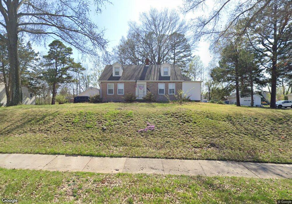
4836 Mattis Rd Saint Louis, MO 63128
Estimated Value: $327,000 - $378,000
4
Beds
3
Baths
1,479
Sq Ft
$241/Sq Ft
Est. Value
About This Home
This home is located at 4836 Mattis Rd, Saint Louis, MO 63128 and is currently estimated at $356,806, approximately $241 per square foot. 4836 Mattis Rd is a home located in St. Louis County with nearby schools including Kennerly Elementary School, Sperreng Middle School, and Lindbergh High School.
Ownership History
Date
Name
Owned For
Owner Type
Purchase Details
Closed on
Oct 8, 1997
Sold by
Fieser Conrad L and Fieser Loretta M
Bought by
Ruzicka George T and Ruzicka Beverly A
Current Estimated Value
Home Financials for this Owner
Home Financials are based on the most recent Mortgage that was taken out on this home.
Original Mortgage
$148,800
Outstanding Balance
$21,424
Interest Rate
6.25%
Estimated Equity
$335,382
Create a Home Valuation Report for This Property
The Home Valuation Report is an in-depth analysis detailing your home's value as well as a comparison with similar homes in the area
Home Values in the Area
Average Home Value in this Area
Purchase History
| Date | Buyer | Sale Price | Title Company |
|---|---|---|---|
| Ruzicka George T | -- | -- |
Source: Public Records
Mortgage History
| Date | Status | Borrower | Loan Amount |
|---|---|---|---|
| Open | Ruzicka George T | $148,800 |
Source: Public Records
Tax History Compared to Growth
Tax History
| Year | Tax Paid | Tax Assessment Tax Assessment Total Assessment is a certain percentage of the fair market value that is determined by local assessors to be the total taxable value of land and additions on the property. | Land | Improvement |
|---|---|---|---|---|
| 2025 | $3,504 | $61,220 | $20,460 | $40,760 |
| 2024 | $3,504 | $53,810 | $20,460 | $33,350 |
| 2023 | $3,495 | $53,810 | $20,460 | $33,350 |
| 2022 | $3,061 | $45,180 | $20,460 | $24,720 |
| 2021 | $2,953 | $45,180 | $20,460 | $24,720 |
| 2020 | $2,677 | $39,490 | $16,400 | $23,090 |
| 2019 | $2,670 | $39,490 | $16,400 | $23,090 |
| 2018 | $2,811 | $37,830 | $11,570 | $26,260 |
| 2017 | $2,780 | $37,830 | $11,570 | $26,260 |
| 2016 | $2,290 | $29,520 | $10,180 | $19,340 |
| 2015 | $2,255 | $29,520 | $10,180 | $19,340 |
| 2014 | $2,695 | $35,010 | $8,850 | $26,160 |
Source: Public Records
Map
Nearby Homes
- 4643 Littlebury Dr
- 4645 Tauneybrook Dr
- 4818 Chapel Hill Dr
- 4839 Hursley Dr
- 4833 Hursley Dr
- 4801 Langtree Dr
- 4942 Caribee Dr
- 4449 Pinyon Jay Ct
- 4829 Vermilion Dr
- 5135 Towne Centre Dr
- 5057 Peyton Place Ct
- 5100 Melitta Dr
- 4931 Theiss Rd
- 12055 Charwick Dr
- 4700 Theiss Rd
- 4642 Theiss Rd
- 4838 Dorsie Dr
- 4921 Kerth Rd
- 12015 Charwick Dr
- 5161 Butler Bend Dr
- 4830 Mattis Rd
- 4844 Mattis Rd
- 4684 Venarde Dr
- 4824 Mattis Rd
- 4833 Mattis Rd
- 4691 Venarde Dr
- 4852 Mattis Rd
- 4855 Stanhope Dr
- 4859 Stanhope Dr
- 4674 Venarde Dr
- 4734 Towne South Rd
- 4704 Towne South Rd
- 4819 Mattis Rd
- 4666 de Chantal Dr
- 4681 Venarde Dr
- 4734 Towne Rd S
- 4814 Mattis Rd
- 4851 Stanhope Dr
- 4680 Towne South Rd
- 4879 Stanhope Dr