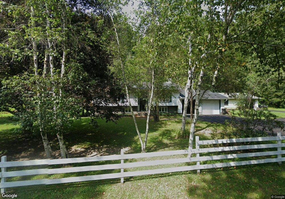
4836 State Route 212 Willow, NY 12495
Estimated Value: $615,000 - $942,000
3
Beds
2
Baths
2,665
Sq Ft
$279/Sq Ft
Est. Value
About This Home
This home is located at 4836 State Route 212, Willow, NY 12495 and is currently estimated at $742,416, approximately $278 per square foot. 4836 State Route 212 is a home with nearby schools including Reginald Bennett Elementary School, Phoenicia Elementary School, and Woodstock Elementary School.
Ownership History
Date
Name
Owned For
Owner Type
Purchase Details
Closed on
Dec 23, 2025
Sold by
Teramoto Wendy
Bought by
Teramoto Joel H and Teramoto Doran
Current Estimated Value
Purchase Details
Closed on
Apr 1, 2013
Sold by
Fischberg Leslie M
Bought by
Teramoto Joel and Teramoto Wendy
Purchase Details
Closed on
Dec 1, 2006
Sold by
Boxer Ivy J
Bought by
Fischberg Leslie M
Home Financials for this Owner
Home Financials are based on the most recent Mortgage that was taken out on this home.
Original Mortgage
$318,250
Interest Rate
6.36%
Mortgage Type
Purchase Money Mortgage
Purchase Details
Closed on
Apr 16, 1996
Create a Home Valuation Report for This Property
The Home Valuation Report is an in-depth analysis detailing your home's value as well as a comparison with similar homes in the area
Home Values in the Area
Average Home Value in this Area
Purchase History
| Date | Buyer | Sale Price | Title Company |
|---|---|---|---|
| Teramoto Joel H | -- | -- | |
| Teramoto Joel | -- | -- | |
| Fischberg Leslie M | $335,000 | Chicago Title Insurance Co | |
| Fischberg Leslie M | $335,000 | Chicago Title Insurance Co | |
| -- | -- | -- |
Source: Public Records
Mortgage History
| Date | Status | Borrower | Loan Amount |
|---|---|---|---|
| Previous Owner | Fischberg Leslie M | $318,250 |
Source: Public Records
Tax History
| Year | Tax Paid | Tax Assessment Tax Assessment Total Assessment is a certain percentage of the fair market value that is determined by local assessors to be the total taxable value of land and additions on the property. | Land | Improvement |
|---|---|---|---|---|
| 2024 | $7,018 | $247,000 | $86,500 | $160,500 |
| 2023 | $7,033 | $245,000 | $86,500 | $158,500 |
| 2022 | $6,003 | $245,000 | $86,500 | $158,500 |
| 2021 | $6,003 | $245,000 | $86,500 | $158,500 |
| 2020 | $9,342 | $245,000 | $86,500 | $158,500 |
| 2019 | $4,868 | $245,000 | $86,500 | $158,500 |
| 2018 | $7,270 | $245,000 | $86,500 | $158,500 |
| 2017 | $4,973 | $226,000 | $86,500 | $139,500 |
| 2016 | $4,868 | $226,000 | $86,500 | $139,500 |
| 2015 | -- | $226,000 | $86,500 | $139,500 |
| 2014 | -- | $226,000 | $86,500 | $139,500 |
Source: Public Records
Map
Nearby Homes
- TBD Cross Patch Rd
- 57 Vicino Dr
- 5355 New York 212
- 132 Valley View Way
- 125 Valley View Way
- 22 Riseley Rd
- 1311 Wittenberg Rd
- 15 Lake View Dr
- 55 Mountain Laurel Rd
- 626 Wittenberg Rd
- 420 Wittenberg Rd
- 233 Wittenberg Rd
- TBD MacDaniel Rd
- 16 Moggre Rd
- 20 Lion's Way
- 4192 State Route 28
- 0 Deerfield Rd Unit 20254253
- TBD New York 28
- 37 Mount Ava Maria Rd
- 14 Park Rd
- 4836 New York 212
- 4826 State Route 212
- 5485 New York 212
- TBA New York 212
- 4892 State Route 212
- 4868 212
- 4867 New York 212
- 4868 New York 212 Unit Willow
- 4868 New York 212
- 4867 State Route 212
- 4868 State Route 212 Unit Willow
- 4868 State Route 212
- 4797 State Route 212
- 4789 State Route 212
- 4894 State Route 212
- 4894 New York 212
- 4894 212
- 4781 212
- 4777 212
- 4777 New York 212
Your Personal Tour Guide
Ask me questions while you tour the home.