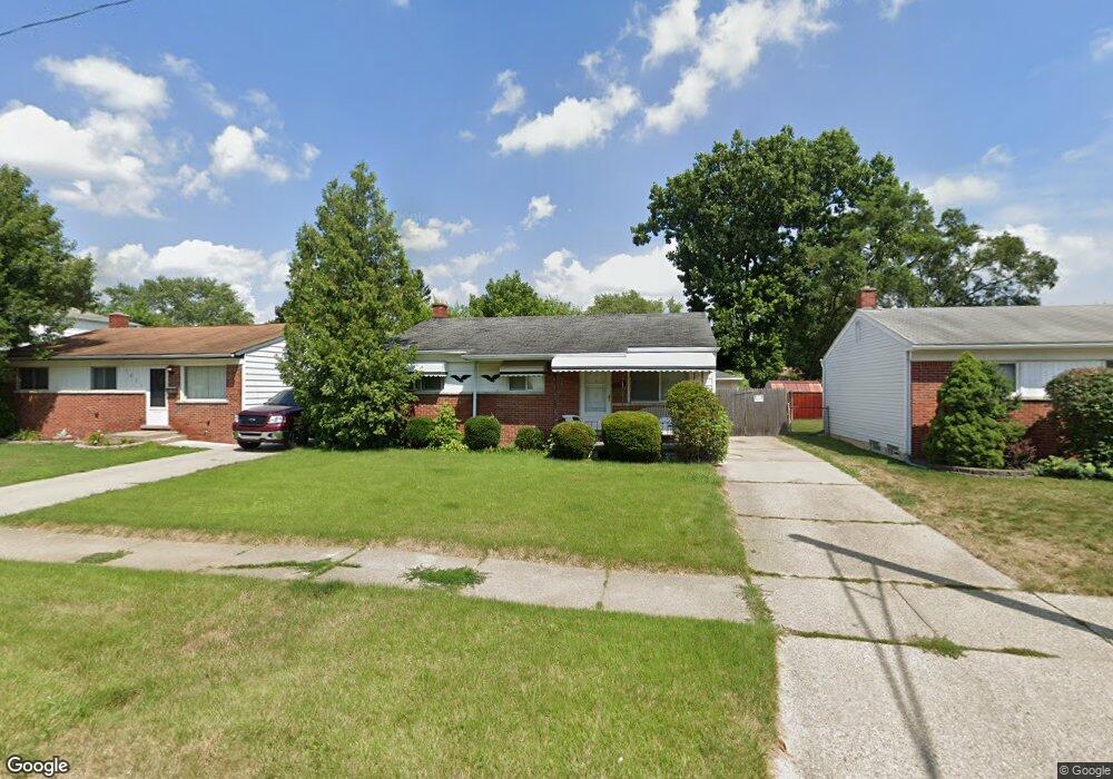
4839 Princess St Dearborn Heights, MI 48125
Estimated Value: $141,000 - $163,000
--
Bed
1
Bath
901
Sq Ft
$170/Sq Ft
Est. Value
About This Home
This home is located at 4839 Princess St, Dearborn Heights, MI 48125 and is currently estimated at $152,962, approximately $169 per square foot. 4839 Princess St is a home located in Wayne County with nearby schools including Taylor Parks Elementary School, Hoover Middle School, and Taylor High School.
Ownership History
Date
Name
Owned For
Owner Type
Purchase Details
Closed on
Jan 28, 2003
Sold by
Newton Lawrence F
Bought by
Gibson Laney B
Current Estimated Value
Purchase Details
Closed on
May 27, 1999
Sold by
Czen Genevieve and Czen Gregory
Bought by
Newton Lawrence
Purchase Details
Closed on
Sep 12, 1996
Sold by
Budach Dean and Budach Norma
Bought by
Czenezelewski Gregory and Czenezelewski Genevieve
Purchase Details
Closed on
Jul 13, 1995
Sold by
Sankovich Ronald
Bought by
Budach Dean and Budach Norma
Create a Home Valuation Report for This Property
The Home Valuation Report is an in-depth analysis detailing your home's value as well as a comparison with similar homes in the area
Home Values in the Area
Average Home Value in this Area
Purchase History
| Date | Buyer | Sale Price | Title Company |
|---|---|---|---|
| Gibson Laney B | -- | Midwest Title Corporation | |
| Newton Lawrence | $77,500 | -- | |
| Czenezelewski Gregory | $65,000 | -- | |
| Budach Dean | $59,900 | -- |
Source: Public Records
Tax History Compared to Growth
Tax History
| Year | Tax Paid | Tax Assessment Tax Assessment Total Assessment is a certain percentage of the fair market value that is determined by local assessors to be the total taxable value of land and additions on the property. | Land | Improvement |
|---|---|---|---|---|
| 2025 | $1,091 | $58,000 | $0 | $0 |
| 2024 | $1,091 | $55,000 | $0 | $0 |
| 2023 | $1,072 | $48,100 | $0 | $0 |
| 2022 | $1,424 | $38,500 | $0 | $0 |
| 2021 | $1,386 | $35,400 | $0 | $0 |
| 2019 | $1,342 | $27,300 | $0 | $0 |
| 2018 | $976 | $27,900 | $0 | $0 |
| 2017 | $809 | $27,800 | $0 | $0 |
| 2016 | $1,352 | $29,400 | $0 | $0 |
| 2015 | $2,790 | $27,900 | $0 | $0 |
| 2013 | $2,765 | $29,100 | $0 | $0 |
| 2010 | -- | $29,700 | $0 | $0 |
Source: Public Records
Map
Nearby Homes
- 4863 Glenis St
- 26532 Powers Ave
- 26439 Hopkins St
- 26458 Hopkins St
- 5526 Sylvia St
- 26225 McDonald St
- 26773 Colgate St
- 4110 John Daly St
- 27022 Colgate St
- 26106 Powers Ave
- 26860 Andover St
- 4061 Wellington St
- 26916 Andover St
- 26159 Stanford St
- 27285 Colgate St
- 26202 Colgate St
- 26231 Andover St
- 26653 Ross St
- 5970 John Daly St
- 25895 Annapolis St
- 4827 Princess St
- 4851 Princess St
- 4815 Princess St
- 4863 Princess St
- 4838 Glenis St
- 4803 Princess St
- 4850 Glenis St
- 4826 Glenis St
- 4814 Glenis St
- 4862 Glenis St
- 4773 Princess St
- 4913 Princess St
- 4802 Glenis St
- 4838 Princess St
- 4826 Princess St
- 4850 Princess St
- 4772 Glenis St
- 4814 Princess St
- 4912 Glenis St
- 4862 Princess St