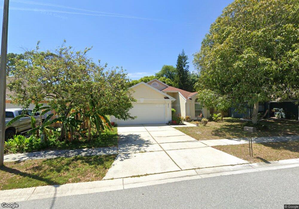
4839 Westerly Dr New Port Richey, FL 34653
Greater New Port Richey South NeighborhoodEstimated Value: $294,071 - $361,000
--
Bed
2
Baths
1,560
Sq Ft
$211/Sq Ft
Est. Value
About This Home
This home is located at 4839 Westerly Dr, New Port Richey, FL 34653 and is currently estimated at $329,518, approximately $211 per square foot. 4839 Westerly Dr is a home located in Pasco County with nearby schools including Cotee River Elementary School, Gulf Middle School, and Gulf High School.
Ownership History
Date
Name
Owned For
Owner Type
Purchase Details
Closed on
Jul 27, 2015
Sold by
Cash Kelli
Bought by
Bank Of America Na
Current Estimated Value
Purchase Details
Closed on
Jan 25, 2005
Sold by
Hayes Jeisel Y and Stettler Jeisel Y
Bought by
Hayes Edward and Hayes Jeisel Y
Home Financials for this Owner
Home Financials are based on the most recent Mortgage that was taken out on this home.
Original Mortgage
$69,855
Interest Rate
5.66%
Mortgage Type
Purchase Money Mortgage
Purchase Details
Closed on
Jun 10, 1993
Sold by
Lennar Homes Inc
Bought by
Stettler William I and Stettler Jeisel Y
Home Financials for this Owner
Home Financials are based on the most recent Mortgage that was taken out on this home.
Original Mortgage
$77,174
Interest Rate
7.44%
Mortgage Type
Purchase Money Mortgage
Create a Home Valuation Report for This Property
The Home Valuation Report is an in-depth analysis detailing your home's value as well as a comparison with similar homes in the area
Home Values in the Area
Average Home Value in this Area
Purchase History
| Date | Buyer | Sale Price | Title Company |
|---|---|---|---|
| Bank Of America Na | $135,100 | Attorney | |
| Hayes Edward | $35,000 | -- | |
| Stettler William I | $84,000 | -- |
Source: Public Records
Mortgage History
| Date | Status | Borrower | Loan Amount |
|---|---|---|---|
| Previous Owner | Hayes Edward | $69,855 | |
| Previous Owner | Stettler William I | $77,174 |
Source: Public Records
Tax History Compared to Growth
Tax History
| Year | Tax Paid | Tax Assessment Tax Assessment Total Assessment is a certain percentage of the fair market value that is determined by local assessors to be the total taxable value of land and additions on the property. | Land | Improvement |
|---|---|---|---|---|
| 2025 | $1,432 | $113,070 | -- | -- |
| 2024 | $1,432 | $109,890 | -- | -- |
| 2023 | $1,370 | $106,690 | $0 | $0 |
| 2022 | $1,224 | $103,590 | $0 | $0 |
| 2021 | $1,190 | $100,580 | $36,455 | $64,125 |
| 2020 | $1,164 | $99,200 | $26,042 | $73,158 |
| 2019 | $1,112 | $96,970 | $0 | $0 |
| 2018 | $1,083 | $95,171 | $0 | $0 |
| 2017 | $1,223 | $95,171 | $0 | $0 |
| 2016 | $1,015 | $91,297 | $0 | $0 |
| 2015 | $1,027 | $90,662 | $0 | $0 |
| 2014 | $994 | $93,244 | $24,807 | $68,437 |
Source: Public Records
Map
Nearby Homes
- 4830 Capron St
- 5140 Coquina Cir
- 5241 Poinciana Cir
- 5289 Poinciana Cir
- 5270 Wisteria Cir
- 5211 Wisteria Cir
- 5102 Pigeon Plum Cir
- 6604 Spring Flower Dr Unit 23
- 4916 Sunnybrook Dr Unit 14
- 6440 Spring Flower Dr Unit 14
- 6440 Spring Flower Dr Unit 11
- 6428 Gloria Dr Unit 26
- 6428 Gloria Dr Unit 15
- 4911 Sunnybrook Dr Unit 11
- 6433 Tina Dr Unit 12
- 4804 Myrtle Oak Dr Unit 11
- 7235 Sharpsburg Blvd
- 5496 Riverwalk Preserve Dr
- 5498 Riverwalk Preserve Dr
- 6424 Spring Flower Dr Unit 15
- 4845 Westerly Dr
- 4833 Westerly Dr
- 4851 Westerly Dr
- 4827 Westerly Dr
- 7020 Whittington Ct
- 4842 Capron St
- 4903 Westerly Dr
- 4821 Westerly Dr
- 7021 Whittington Ct
- 4820 Capron St
- 7021 Woodhall Ave
- 7026 Whittington Ct
- 4909 Westerly Dr
- 4815 Westerly Dr
- 7027 Whittington Ct
- 4904 Westerly Dr
- 7027 Woodhall Ave
- 7032 Whittington Ct
- 7033 Whittington Ct
- 4809 Westerly Dr