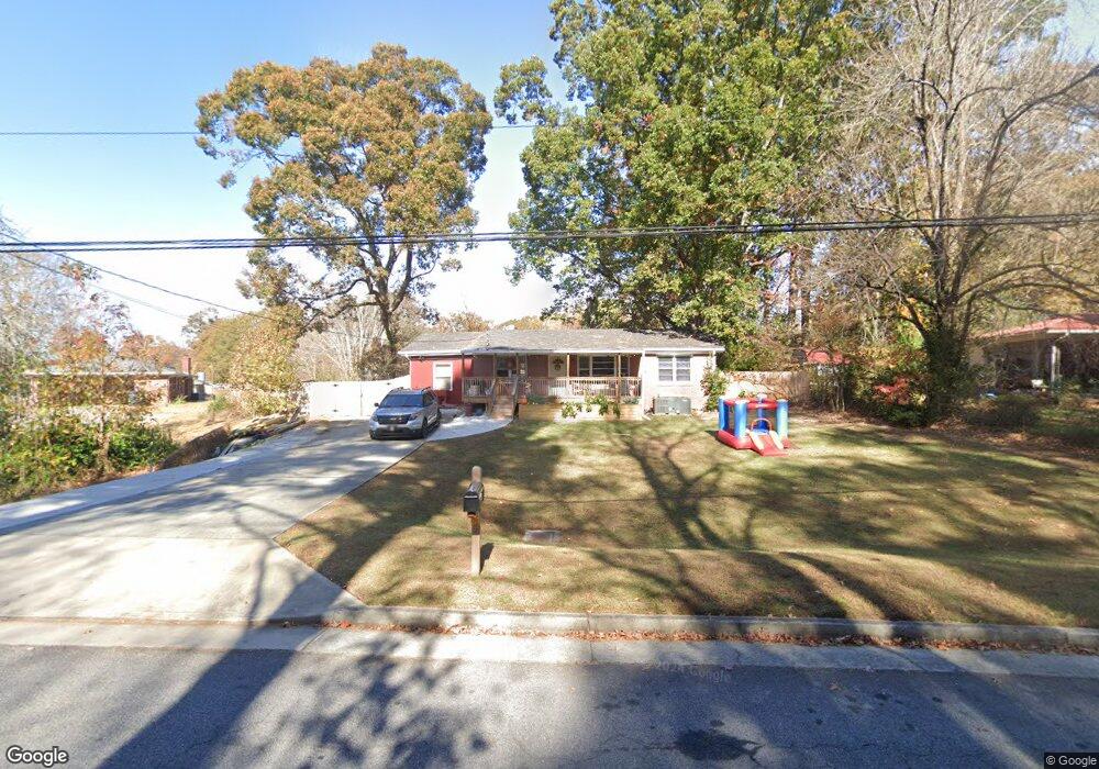
484 Allen Dr Unit 2 Lawrenceville, GA 30043
Estimated Value: $270,000 - $312,000
3
Beds
1
Bath
1,228
Sq Ft
$233/Sq Ft
Est. Value
About This Home
This home is located at 484 Allen Dr Unit 2, Lawrenceville, GA 30043 and is currently estimated at $285,545, approximately $232 per square foot. 484 Allen Dr Unit 2 is a home located in Gwinnett County with nearby schools including Dyer Elementary School, Twin Rivers Middle School, and Mountain View High School.
Ownership History
Date
Name
Owned For
Owner Type
Purchase Details
Closed on
Apr 12, 2024
Sold by
Mitchell Roilynne
Bought by
Grenier Brian and Mauro Amy
Current Estimated Value
Home Financials for this Owner
Home Financials are based on the most recent Mortgage that was taken out on this home.
Original Mortgage
$205,640
Outstanding Balance
$202,485
Interest Rate
6.74%
Mortgage Type
New Conventional
Estimated Equity
$83,060
Purchase Details
Closed on
Nov 17, 1997
Sold by
Chesser Gerald T
Bought by
Mitchell Roilynne
Home Financials for this Owner
Home Financials are based on the most recent Mortgage that was taken out on this home.
Original Mortgage
$41,200
Interest Rate
7.27%
Mortgage Type
New Conventional
Create a Home Valuation Report for This Property
The Home Valuation Report is an in-depth analysis detailing your home's value as well as a comparison with similar homes in the area
Home Values in the Area
Average Home Value in this Area
Purchase History
| Date | Buyer | Sale Price | Title Company |
|---|---|---|---|
| Grenier Brian | $212,000 | -- | |
| Mitchell Roilynne | $51,500 | -- |
Source: Public Records
Mortgage History
| Date | Status | Borrower | Loan Amount |
|---|---|---|---|
| Open | Grenier Brian | $205,640 | |
| Previous Owner | Mitchell Roilynne | $41,200 |
Source: Public Records
Tax History Compared to Growth
Tax History
| Year | Tax Paid | Tax Assessment Tax Assessment Total Assessment is a certain percentage of the fair market value that is determined by local assessors to be the total taxable value of land and additions on the property. | Land | Improvement |
|---|---|---|---|---|
| 2024 | $2,357 | $85,240 | $24,000 | $61,240 |
| 2023 | $2,357 | $81,680 | $24,000 | $57,680 |
| 2022 | $2,043 | $72,400 | $19,600 | $52,800 |
| 2021 | $1,658 | $52,880 | $12,000 | $40,880 |
| 2020 | $1,669 | $52,880 | $12,000 | $40,880 |
| 2019 | $1,638 | $52,880 | $12,000 | $40,880 |
| 2018 | $1,624 | $52,880 | $12,000 | $40,880 |
| 2016 | $1,483 | $45,240 | $10,000 | $35,240 |
| 2015 | $1,469 | $44,080 | $10,000 | $34,080 |
| 2014 | $1,474 | $44,080 | $13,200 | $30,880 |
Source: Public Records
Map
Nearby Homes
- 509 Woodland Ln
- 1148 Woodland Cir
- 699 Sunstone Ln
- 695 Sunstone Ln
- 693 Sunstone Ln
- 689 Sunstone Ln
- 687 Sunstone Ln
- Brooks Plan at River Walk Place
- Bryson Plan at River Walk Place
- 664 Sunstone Ln
- 662 Sunstone Ln
- 660 Sunstone Ln
- 658 Sunstone Ln
- 531 Shyrewood Dr
- Lot 16 Coronada Dr
- Lot 17 Coronada Dr
- 1244 Riverloch Way
- 1230 Rivershyre Pkwy
- 951 Northside Dr
- 739 Lauren Cir Unit 1
- 494 Allen Dr
- 474 Allen Dr Unit 2
- 474 Allen Dr
- 501 Woodland Ln
- 502 Allen Dr Unit 31
- 515 Woodland Ln
- 506 Allen Dr
- 512 Allen Dr
- 525 Woodland Ln Unit 7
- 525 Woodland Ln
- 525 Woodland Ln Unit 2
- 1155 Buford Dr
- 508 Woodland Ln
- 913 Agate Ln
- 500 Woodland Ln
- 1095 Buford Dr
- 511 Allen Dr
- 691 Sunstone Ln
- 697 Sunstone Ln
- 1165 Buford Dr