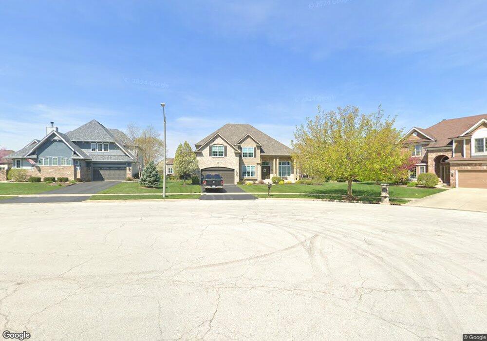
484 Mount Ct North Aurora, IL 60542
Estimated Value: $613,000 - $794,000
--
Bed
--
Bath
--
Sq Ft
0.33
Acres
About This Home
This home is located at 484 Mount Ct, North Aurora, IL 60542 and is currently estimated at $705,838. 484 Mount Ct is a home with nearby schools including Goodwin Elementary School, Jewel Middle School, and West Aurora High School.
Ownership History
Date
Name
Owned For
Owner Type
Purchase Details
Closed on
Jan 22, 2016
Sold by
Gladstone Builders & Developers Inc
Bought by
Reale Joseph A and Reale Eileen
Current Estimated Value
Purchase Details
Closed on
Dec 30, 2008
Sold by
Acquisitions Llc
Bought by
Dkk Land Investors Llc
Home Financials for this Owner
Home Financials are based on the most recent Mortgage that was taken out on this home.
Original Mortgage
$1,330,000
Interest Rate
5.96%
Mortgage Type
Purchase Money Mortgage
Create a Home Valuation Report for This Property
The Home Valuation Report is an in-depth analysis detailing your home's value as well as a comparison with similar homes in the area
Home Values in the Area
Average Home Value in this Area
Purchase History
| Date | Buyer | Sale Price | Title Company |
|---|---|---|---|
| Reale Joseph A | $448,000 | Premier Title | |
| Gladstone Builders & Developers Inc | -- | Premier Title | |
| Dkk Land Investors Llc | $4,844,000 | Chicago Title Insurance Co |
Source: Public Records
Mortgage History
| Date | Status | Borrower | Loan Amount |
|---|---|---|---|
| Previous Owner | Dkk Land Investors Llc | $1,330,000 |
Source: Public Records
Tax History Compared to Growth
Tax History
| Year | Tax Paid | Tax Assessment Tax Assessment Total Assessment is a certain percentage of the fair market value that is determined by local assessors to be the total taxable value of land and additions on the property. | Land | Improvement |
|---|---|---|---|---|
| 2024 | $11,637 | $170,811 | $25,484 | $145,327 |
| 2023 | $11,313 | $155,029 | $23,129 | $131,900 |
| 2022 | $11,064 | $144,887 | $21,616 | $123,271 |
| 2021 | $10,747 | $137,412 | $20,501 | $116,911 |
| 2020 | $10,706 | $134,771 | $20,107 | $114,664 |
| 2019 | $10,818 | $130,000 | $19,395 | $110,605 |
| 2018 | $12,770 | $146,861 | $18,656 | $128,205 |
| 2017 | $12,087 | $135,000 | $18,041 | $116,959 |
| 2016 | $11,552 | $125,422 | $17,516 | $107,906 |
| 2015 | -- | $164 | $164 | $0 |
| 2014 | -- | $159 | $159 | $0 |
| 2013 | -- | $156 | $156 | $0 |
Source: Public Records
Map
Nearby Homes
- 460 Prairie Ridge Ln
- 448 Prairie Ridge Ln
- 444 Prairie Ridge Ln
- 459 Prairie Ridge Ln
- 426 Prairie Ridge Ln
- 413 N Sycamore Ln
- 427 Prairie Ridge Ln
- 523 Mallard Point Dr Unit 1
- 572 Quail Ln
- 341 Pheasant Hill Dr
- 451 Pheasant Hill Dr
- 344 Hilltop Dr
- 442 Mallard Point Dr
- 503 Redwood Ct
- 438 Mallard Point Dr
- 355 Hilltop Dr
- 302 Pin Oak Dr
- 504 Dogwood Ct
- 791 Cottonwood Dr
- 218 Timber Oaks Dr
- 480 Mount Ct
- 488 Mount Ct
- 445 N Sycamore Ln
- 449 N Sycamore Ln
- 441 N Sycamore Ln
- 476 Mount Ct
- 453 N Sycamore Ln
- 487 Mount Ct
- 437 N Sycamore Ln
- 483 Mount Ct
- 457 N Sycamore Ln
- 479 Mount Ct
- 472 Mount Ct
- 433 N Sycamore Ln
- 475 Mount Ct
- 456 Prairie Ridge Ln
- 429 N Sycamore Ln
- 471 Mount Ct
- 464 Prairie Ridge Ln
- 448 N Sycamore Ln