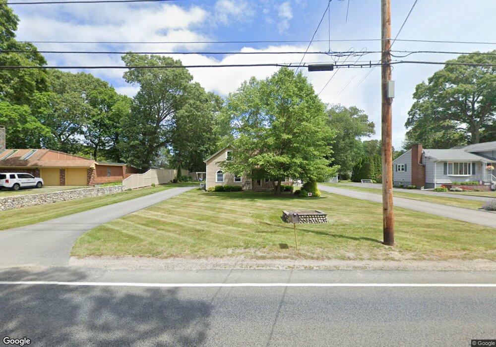
484 Sanford Rd Westport, MA 02790
North Westport NeighborhoodEstimated Value: $515,000 - $539,251
3
Beds
--
Bath
1,487
Sq Ft
$352/Sq Ft
Est. Value
About This Home
This home is located at 484 Sanford Rd, Westport, MA 02790 and is currently estimated at $523,417, approximately $351 per square foot. 484 Sanford Rd is a home located in Bristol County with nearby schools including Alice A. Macomber Primary School, Westport Elementary School, and Westport Middle-High School.
Ownership History
Date
Name
Owned For
Owner Type
Purchase Details
Closed on
Apr 2, 1987
Sold by
Bernier Eugene
Bought by
Borden Barry A
Current Estimated Value
Create a Home Valuation Report for This Property
The Home Valuation Report is an in-depth analysis detailing your home's value as well as a comparison with similar homes in the area
Home Values in the Area
Average Home Value in this Area
Purchase History
| Date | Buyer | Sale Price | Title Company |
|---|---|---|---|
| Borden Barry A | $72,000 | -- |
Source: Public Records
Mortgage History
| Date | Status | Borrower | Loan Amount |
|---|---|---|---|
| Open | Borden Barry A | $45,000 | |
| Closed | Borden Barry A | $10,322 | |
| Closed | Borden Barry A | $6,500 | |
| Closed | Borden Barry A | $66,500 |
Source: Public Records
Tax History Compared to Growth
Tax History
| Year | Tax Paid | Tax Assessment Tax Assessment Total Assessment is a certain percentage of the fair market value that is determined by local assessors to be the total taxable value of land and additions on the property. | Land | Improvement |
|---|---|---|---|---|
| 2025 | $3,640 | $488,600 | $189,300 | $299,300 |
| 2024 | $2,159 | $279,300 | $172,800 | $106,500 |
| 2023 | $2,769 | $339,300 | $157,700 | $181,600 |
| 2022 | $2,711 | $319,700 | $157,700 | $162,000 |
| 2021 | $2,525 | $292,900 | $130,900 | $162,000 |
| 2020 | $2,189 | $259,700 | $125,900 | $133,800 |
| 2019 | $2,086 | $252,200 | $125,900 | $126,300 |
| 2018 | $1,842 | $225,400 | $123,600 | $101,800 |
| 2017 | $1,748 | $219,300 | $119,800 | $99,500 |
| 2016 | $1,705 | $215,600 | $116,100 | $99,500 |
| 2015 | $1,621 | $204,400 | $118,600 | $85,800 |
Source: Public Records
Map
Nearby Homes
- 478 Sanford Rd
- 488 Sanford Rd
- 10 D Dr
- 19 R Dr
- 492 Sanford Rd
- 16 D Dr
- 481 Sanford Rd
- 23 R Dr
- 22 D Dr
- 477 Sanford Rd
- 477 Sanford Rd Unit 1
- Lot 1 Sanford Rd
- Lot 2 Sanford Rd
- 0 Sanford Rd Unit 73027363
- 0 Sanford Rd Unit 73012298
- 0 Sanford Rd Unit 72996867
- . Sanford Rd
- 18H Sanford Rd
- 18 Sanford Rd
- 0 Sanford Rd Unit 72836955