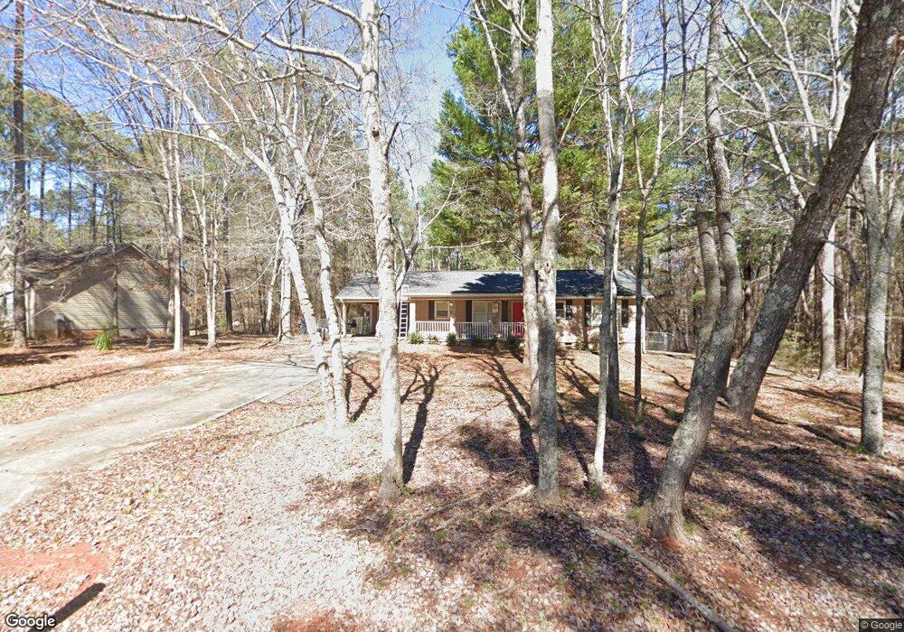
484 Whip-Poor-will Rd Monticello, GA 31064
Jasper County NeighborhoodEstimated Value: $227,590 - $329,000
--
Bed
1
Bath
1,532
Sq Ft
$173/Sq Ft
Est. Value
About This Home
This home is located at 484 Whip-Poor-will Rd, Monticello, GA 31064 and is currently estimated at $265,398, approximately $173 per square foot. 484 Whip-Poor-will Rd is a home located in Jasper County with nearby schools including Jasper County Primary School, Washington Park Elementary School, and Jasper County Middle School.
Ownership History
Date
Name
Owned For
Owner Type
Purchase Details
Closed on
May 23, 2019
Sold by
Anderson Debra Sue
Bought by
Ashe Steven Blake
Current Estimated Value
Home Financials for this Owner
Home Financials are based on the most recent Mortgage that was taken out on this home.
Original Mortgage
$104,274
Outstanding Balance
$92,668
Interest Rate
4.75%
Mortgage Type
FHA
Estimated Equity
$172,730
Purchase Details
Closed on
Jun 2, 2006
Sold by
Anderson Robert E
Bought by
Anderson Debra Sue
Create a Home Valuation Report for This Property
The Home Valuation Report is an in-depth analysis detailing your home's value as well as a comparison with similar homes in the area
Home Values in the Area
Average Home Value in this Area
Purchase History
| Date | Buyer | Sale Price | Title Company |
|---|---|---|---|
| Ashe Steven Blake | $107,500 | -- | |
| Anderson Debra Sue | -- | -- |
Source: Public Records
Mortgage History
| Date | Status | Borrower | Loan Amount |
|---|---|---|---|
| Open | Ashe Steven Blake | $104,274 |
Source: Public Records
Tax History Compared to Growth
Tax History
| Year | Tax Paid | Tax Assessment Tax Assessment Total Assessment is a certain percentage of the fair market value that is determined by local assessors to be the total taxable value of land and additions on the property. | Land | Improvement |
|---|---|---|---|---|
| 2024 | $1,947 | $68,720 | $3,600 | $65,120 |
| 2023 | $1,885 | $66,280 | $2,600 | $63,680 |
| 2022 | $1,739 | $56,040 | $2,600 | $53,440 |
| 2021 | $1,617 | $46,640 | $1,040 | $45,600 |
| 2020 | $1,562 | $43,520 | $1,040 | $42,480 |
| 2019 | $1,404 | $36,600 | $800 | $35,800 |
| 2018 | $1,309 | $33,320 | $800 | $32,520 |
| 2017 | $1,235 | $30,560 | $800 | $29,760 |
| 2016 | $1,135 | $27,240 | $800 | $26,440 |
| 2015 | $1,034 | $23,120 | $400 | $22,720 |
| 2014 | $837 | $17,840 | $400 | $17,440 |
Source: Public Records
Map
Nearby Homes
- 350 Hummingbird Dr
- 118 Turtle Cove Throughway
- 128 Turtle Cove
- 170 Loon Trail
- 111 Turtle Cove Throughway
- 128 Turtle Cove Trailway
- 94 Bunting Ct
- 0 Waxwing Dr Unit 10518396
- 76 Killdeer Ln
- 56 Starling Dr
- 281 Mockingbird Dr
- 238 W Mourning Dove
- 458 Falcon Cir
- 114 Heron Ct
- 235 Waxwing Dr
- 0 Robin Ct Unit 10527408
- 1019 Whippoorwill Rd
- 389 Waxwing Dr
- 15 Egret Ct
- 575 Starling Dr
- 484 Whippoorwill Rd
- 496 Whippoorwill Rd
- 28 Oriole Cir
- 432 Whippoorwill Rd
- 0 Oriole Cir Unit 8388818
- 0 Oriole Cir Unit 8341858
- 0 Oriole Cir Unit LT 2 2845873
- 0 Oriole Cir Unit 20 3097984
- 0 Oriole Cir Unit 7 3097980
- 0 Oriole Cir Unit 3 3097979
- 0 Oriole Cir Unit LOT 2 7186951
- 0 Oriole Cir Unit 19 8063738
- 0 Oriole Cir Unit 10555117
- 0 Oriole Cir Unit 10555113
- 0 Oriole Cir Unit 10214567
- 0 Oriole Cir Unit 20139803
- 0 Oriole Cir Unit 8976592
- 0 Oriole Cir Unit Lot 20 9009055
- 0 Oriole Cir Unit 8977128
- 0 Oriole Cir Unit 8977099