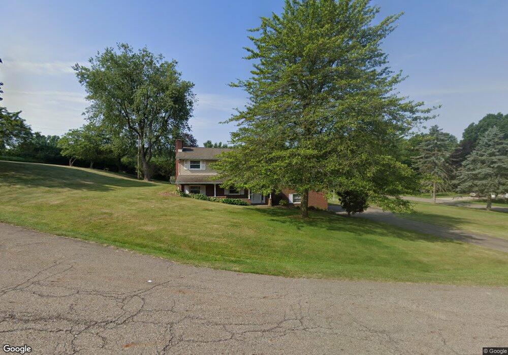
4840 Glenennis Cir NW Canton, OH 44708
Estimated Value: $252,000 - $323,000
3
Beds
3
Baths
2,106
Sq Ft
$133/Sq Ft
Est. Value
About This Home
This home is located at 4840 Glenennis Cir NW, Canton, OH 44708 and is currently estimated at $280,326, approximately $133 per square foot. 4840 Glenennis Cir NW is a home located in Stark County with nearby schools including Avondale Elementary School, Oakwood Middle School, and GlenOak High School.
Ownership History
Date
Name
Owned For
Owner Type
Purchase Details
Closed on
Dec 22, 2010
Sold by
Cumo Joseph M
Bought by
Rook Kimberly J
Current Estimated Value
Home Financials for this Owner
Home Financials are based on the most recent Mortgage that was taken out on this home.
Original Mortgage
$114,831
Outstanding Balance
$75,635
Interest Rate
4.16%
Mortgage Type
FHA
Estimated Equity
$204,691
Create a Home Valuation Report for This Property
The Home Valuation Report is an in-depth analysis detailing your home's value as well as a comparison with similar homes in the area
Home Values in the Area
Average Home Value in this Area
Purchase History
| Date | Buyer | Sale Price | Title Company |
|---|---|---|---|
| Rook Kimberly J | $123,000 | Attorney |
Source: Public Records
Mortgage History
| Date | Status | Borrower | Loan Amount |
|---|---|---|---|
| Open | Rook Kimberly J | $114,831 |
Source: Public Records
Tax History Compared to Growth
Tax History
| Year | Tax Paid | Tax Assessment Tax Assessment Total Assessment is a certain percentage of the fair market value that is determined by local assessors to be the total taxable value of land and additions on the property. | Land | Improvement |
|---|---|---|---|---|
| 2025 | -- | $78,750 | $21,560 | $57,190 |
| 2024 | -- | $78,750 | $21,560 | $57,190 |
| 2023 | $3,011 | $64,270 | $17,750 | $46,520 |
| 2022 | $3,001 | $64,270 | $17,750 | $46,520 |
| 2021 | $3,014 | $64,270 | $17,750 | $46,520 |
| 2020 | $2,990 | $56,080 | $15,300 | $40,780 |
| 2019 | $2,857 | $56,080 | $15,300 | $40,780 |
| 2018 | $2,821 | $56,080 | $15,300 | $40,780 |
| 2017 | $2,667 | $49,770 | $12,810 | $36,960 |
| 2016 | $2,675 | $49,770 | $12,810 | $36,960 |
| 2015 | $2,685 | $49,770 | $12,810 | $36,960 |
| 2014 | $663 | $47,680 | $12,290 | $35,390 |
| 2013 | $1,307 | $47,680 | $12,290 | $35,390 |
Source: Public Records
Map
Nearby Homes
- 4549 20th St NW
- 1805 Dunkeith Dr NW
- 2450 Larchmoor Pkwy NW
- 0 Dunkeith Dr NW Unit 5083845
- 2622 Glenmont Rd NW
- 4558 17th St NW
- 4546 Earlington Cir NW Unit 25
- 4543 Saint James Cir NW Unit 258
- 0 Birkdale St NW Unit 5122150
- 4727 15th St NW
- 4719 15th St NW
- 4579 Morgate Cir NW
- VL Woodlawn Ave NW
- 4581 Morgate Cir NW
- 5606 Hensley St NW
- 2887 Charing Cross Rd NW
- 2421 Brentwood Rd NW
- 4703 Hills And Dales Rd NW Unit 304
- 2818 Marlin Ave NW
- 4513 11th St NW
- 2044 Crosshaven Rd NW
- 4841 Glenennis Cir NW
- 4828 Glenennis Cir NW
- 2065 Crosshaven Rd NW
- 4861 Drumcliff Dr NW
- 2049 Crosshaven Rd NW
- 4847 Drumcliff Dr NW
- 4831 Glenennis Cir NW
- 2101 Crosshaven Rd NW
- 2120 Crosshaven Rd NW
- 4825 Drumcliff Dr NW
- 2100 Duncannon Ave NW
- 2201 Crosshaven Rd NW
- 4824 Castlebar St NW
- 2200 Duncannon Ave NW
- 2050 Duncannon Ave NW
- 2031 Woodlawn Ave NW
- 2023 Woodlawn Ave NW
- 2101 Woodlawn Ave NW
- 1944 Crosshaven Rd NW