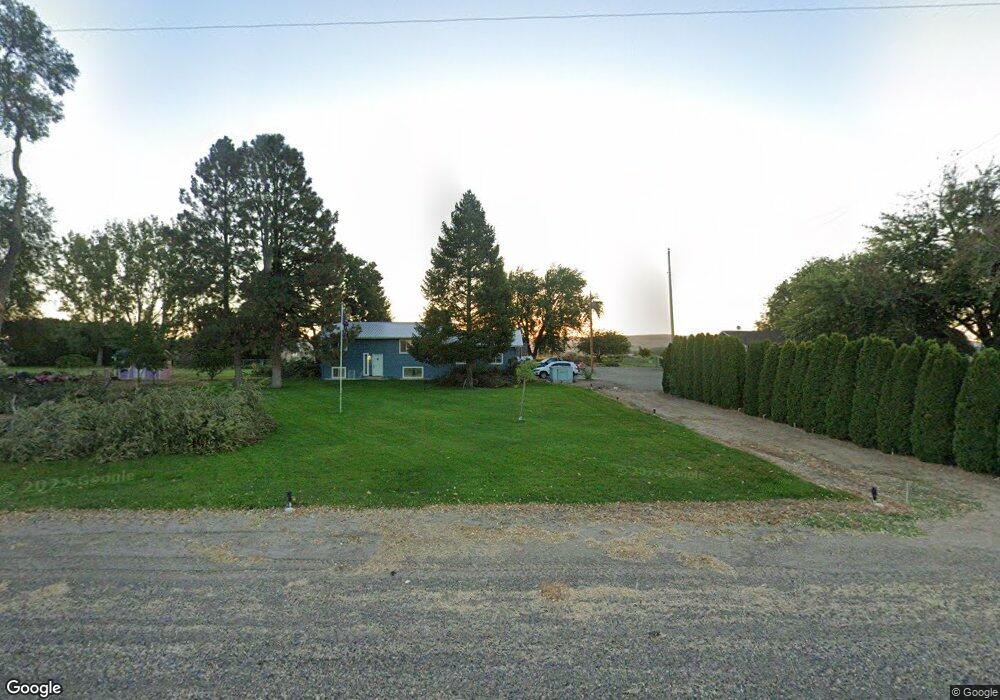
4842 Highway 201 Ontario, OR 97914
Estimated Value: $335,000 - $363,556
3
Beds
2
Baths
1,064
Sq Ft
$328/Sq Ft
Est. Value
About This Home
This home is located at 4842 Highway 201, Ontario, OR 97914 and is currently estimated at $349,278, approximately $328 per square foot. 4842 Highway 201 is a home located in Malheur County with nearby schools including Ontario High School, River of Life Christian School, and Treasure Valley Seventh-Day Adventist School.
Ownership History
Date
Name
Owned For
Owner Type
Purchase Details
Closed on
Aug 22, 2022
Sold by
Halcom Paula K
Bought by
Halcom Toby J
Current Estimated Value
Purchase Details
Closed on
Aug 18, 2020
Sold by
Fife Dennis O and Fife Merlyn
Bought by
Halcom Toby J and Halcom Paula K
Home Financials for this Owner
Home Financials are based on the most recent Mortgage that was taken out on this home.
Original Mortgage
$164,000
Interest Rate
3%
Mortgage Type
New Conventional
Create a Home Valuation Report for This Property
The Home Valuation Report is an in-depth analysis detailing your home's value as well as a comparison with similar homes in the area
Home Values in the Area
Average Home Value in this Area
Purchase History
| Date | Buyer | Sale Price | Title Company |
|---|---|---|---|
| Halcom Toby J | -- | -- | |
| Halcom Toby J | $205,000 | Pioneer Title Co |
Source: Public Records
Mortgage History
| Date | Status | Borrower | Loan Amount |
|---|---|---|---|
| Previous Owner | Halcom Toby J | $164,000 |
Source: Public Records
Tax History Compared to Growth
Tax History
| Year | Tax Paid | Tax Assessment Tax Assessment Total Assessment is a certain percentage of the fair market value that is determined by local assessors to be the total taxable value of land and additions on the property. | Land | Improvement |
|---|---|---|---|---|
| 2024 | $2,182 | $203,723 | $37,512 | $166,211 |
| 2023 | $2,152 | $197,790 | $33,240 | $164,550 |
| 2022 | $2,106 | $192,030 | $34,516 | $157,514 |
| 2021 | $2,069 | $186,437 | $32,608 | $153,829 |
| 2020 | $2,397 | $181,007 | $33,862 | $147,145 |
| 2019 | $2,340 | $175,735 | $34,544 | $141,191 |
| 2018 | $2,205 | $170,617 | $35,854 | $134,763 |
| 2017 | $2,102 | $165,648 | $34,292 | $131,356 |
| 2016 | $2,079 | $160,824 | $36,741 | $124,083 |
| 2015 | $1,998 | $156,140 | $35,670 | $120,470 |
| 2014 | $1,927 | $150,400 | $35,670 | $114,730 |
Source: Public Records
Map
Nearby Homes
- 246 Evergreen Rd
- 4977 Oregon 201
- 185 Douglas Rd
- 4705 Oregon 201
- TBD TAXLOT1004 Kimball Rd
- 11700 Highway 95
- TBD Highway 95
- 0 Tbd Highway 95
- 101 N 9th St
- TBD NE 21st Ave
- 10947 Iowa Ave
- 12230 Highway 95
- 4627 Quail Ln
- 2338 NE 19th Ave
- 2689 NE 25th Ave
- 11483 Hill Rd
- 1522 River St
- 406 15th Ave N
- 1336 N 1st St
- 350 Snowmoody Way
- 4842 Oregon 201
- 4838 Highway 201
- 161 Fir Rd
- 4834 Highway 201
- 4858 Highway 201
- 4832 Highway 201
- 4832 Oregon 201
- 4830 Highway 201
- 4830 Oregon 201
- 162 Fir Rd
- 4826 Highway 201
- 4822 Highway 201
- 4813 Highway 201
- 4819 Highway 201
- 153 Grove Rd
- 4839 Elderberry Ln
- 184 Evergreen Rd
- 4875 Grove Rd
- 4875 Court Rd
- 4797 Highway 201