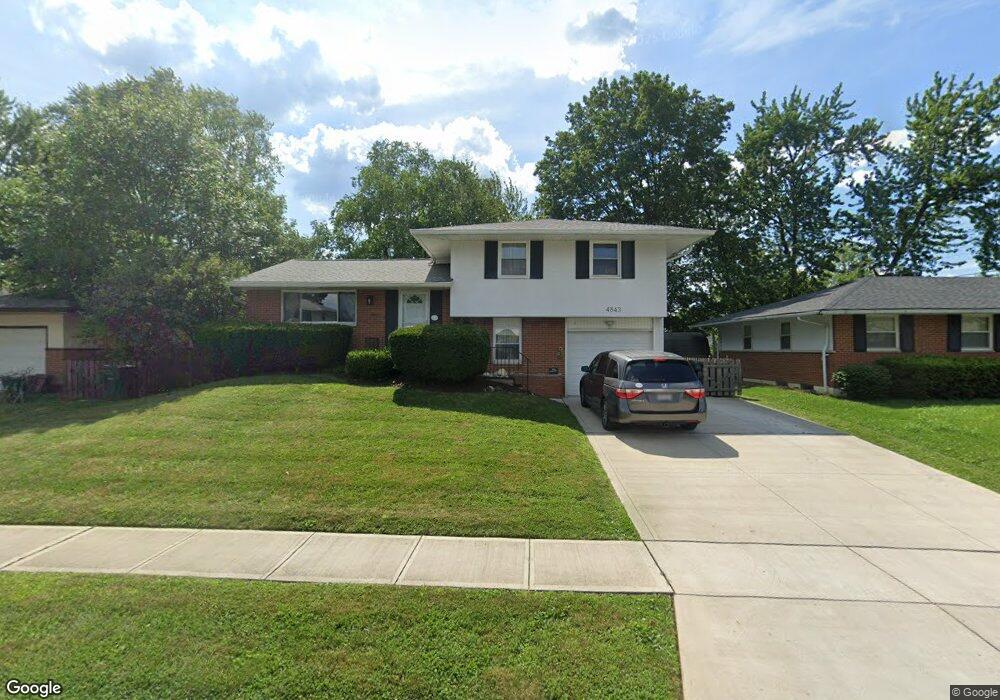
4843 Colonel Perry Dr Columbus, OH 43229
Woodward Park NeighborhoodEstimated Value: $231,000 - $283,000
4
Beds
2
Baths
1,100
Sq Ft
$230/Sq Ft
Est. Value
About This Home
This home is located at 4843 Colonel Perry Dr, Columbus, OH 43229 and is currently estimated at $253,163, approximately $230 per square foot. 4843 Colonel Perry Dr is a home located in Franklin County with nearby schools including Valley Forge Elementary School, Woodward Park Middle School, and Northland High School.
Ownership History
Date
Name
Owned For
Owner Type
Purchase Details
Closed on
Dec 15, 2017
Sold by
Weisgarber Sherry
Bought by
Weisgarber Sherry and Deese Eric S
Current Estimated Value
Purchase Details
Closed on
Oct 30, 2006
Sold by
Crowell Doug and Crowell Ann C
Bought by
Weisgarber Sherry
Home Financials for this Owner
Home Financials are based on the most recent Mortgage that was taken out on this home.
Original Mortgage
$107,000
Outstanding Balance
$62,500
Interest Rate
6.36%
Mortgage Type
Stand Alone First
Estimated Equity
$190,663
Purchase Details
Closed on
May 1, 1991
Purchase Details
Closed on
Sep 1, 1979
Create a Home Valuation Report for This Property
The Home Valuation Report is an in-depth analysis detailing your home's value as well as a comparison with similar homes in the area
Home Values in the Area
Average Home Value in this Area
Purchase History
| Date | Buyer | Sale Price | Title Company |
|---|---|---|---|
| Weisgarber Sherry | -- | None Available | |
| Weisgarber Sherry | -- | Nordic Titl | |
| -- | $74,900 | -- | |
| -- | $52,400 | -- |
Source: Public Records
Mortgage History
| Date | Status | Borrower | Loan Amount |
|---|---|---|---|
| Open | Weisgarber Sherry | $107,000 |
Source: Public Records
Tax History
| Year | Tax Paid | Tax Assessment Tax Assessment Total Assessment is a certain percentage of the fair market value that is determined by local assessors to be the total taxable value of land and additions on the property. | Land | Improvement |
|---|---|---|---|---|
| 2025 | $3,447 | $75,220 | $21,810 | $53,410 |
| 2024 | $3,447 | $75,220 | $21,810 | $53,410 |
| 2023 | $3,404 | $75,215 | $21,805 | $53,410 |
| 2022 | $2,730 | $51,380 | $12,180 | $39,200 |
| 2021 | $2,735 | $51,380 | $12,180 | $39,200 |
| 2020 | $2,739 | $51,380 | $12,180 | $39,200 |
| 2019 | $2,588 | $39,200 | $9,730 | $29,470 |
| 2018 | $2,265 | $39,200 | $9,730 | $29,470 |
| 2017 | $2,261 | $39,200 | $9,730 | $29,470 |
| 2016 | $2,145 | $32,380 | $9,030 | $23,350 |
| 2015 | $1,947 | $32,380 | $9,030 | $23,350 |
| 2014 | $1,952 | $32,380 | $9,030 | $23,350 |
| 2013 | $1,014 | $34,090 | $9,520 | $24,570 |
Source: Public Records
Map
Nearby Homes
- 4818 Colonel Perry Dr
- 4795 Colonel Perry Dr
- 4909-4911 Karl Rd
- 1485 Norma Rd
- 4866 Woodthrush Way
- 1294 Maize Ct
- 4852 Snowbird Cir Unit 13B
- 1680 Pin Oak Dr
- 5092 Riverbirch Dr N
- 1349 Redwood Ct
- 1944 Coghill Dr
- 5352 Hazelwood Rd
- 1167 Reed Circle Dr
- 1638 Arrowood Loop N
- 1510 Matthias Dr
- 1071 Loring Rd
- 1437 Matthias Dr
- 2064 Waymont Rd
- 1116 Marland Dr N
- 1172 Matthias Dr
- 4835 Colonel Perry Dr
- 4851 Colonel Perry Dr
- 4827 Colonel Perry Dr
- 4856 Bourke Rd
- 4848 Bourke Rd
- 1491 Urban Dr
- 4861 Colonel Perry Dr
- 1483 Urban Dr
- 4840 Bourke Rd
- 4844 Colonel Perry Dr
- 4821 Colonel Perry Dr
- 4836 Colonel Perry Dr
- 4832 Bourke Rd
- 4868 Bourke Rd
- 4828 Colonel Perry Dr
- 4860 Colonel Perry Dr
- 4813 Colonel Perry Dr
- 4824 Bourke Rd
- 4868 Colonel Perry Dr
- 1506 Urban Dr
Your Personal Tour Guide
Ask me questions while you tour the home.