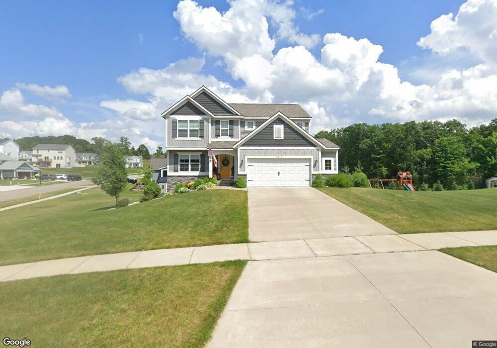
4844 Roaming Dr NE Grand Rapids, MI 49525
Northview NeighborhoodEstimated Value: $450,380 - $553,000
4
Beds
3
Baths
2,198
Sq Ft
$232/Sq Ft
Est. Value
About This Home
This home is located at 4844 Roaming Dr NE, Grand Rapids, MI 49525 and is currently estimated at $510,345, approximately $232 per square foot. 4844 Roaming Dr NE is a home located in Kent County with nearby schools including West Oakview Elementary School, North Oakview Elementary School, and East Oakview Elementary School.
Ownership History
Date
Name
Owned For
Owner Type
Purchase Details
Closed on
Sep 27, 2016
Sold by
Roersma & Wurn Builders Inc
Bought by
Taylor James and Taylor Kelli
Current Estimated Value
Home Financials for this Owner
Home Financials are based on the most recent Mortgage that was taken out on this home.
Original Mortgage
$223,426
Outstanding Balance
$178,947
Interest Rate
3.43%
Mortgage Type
New Conventional
Estimated Equity
$331,398
Purchase Details
Closed on
May 6, 2016
Sold by
Coit Avenue Gravel Company Inc
Bought by
Roersma & Wurn Builders Inc
Create a Home Valuation Report for This Property
The Home Valuation Report is an in-depth analysis detailing your home's value as well as a comparison with similar homes in the area
Home Values in the Area
Average Home Value in this Area
Purchase History
| Date | Buyer | Sale Price | Title Company |
|---|---|---|---|
| Taylor James | $279,283 | None Available | |
| Roersma & Wurn Builders Inc | $100,000 | Attorney |
Source: Public Records
Mortgage History
| Date | Status | Borrower | Loan Amount |
|---|---|---|---|
| Open | Taylor James | $223,426 |
Source: Public Records
Tax History Compared to Growth
Tax History
| Year | Tax Paid | Tax Assessment Tax Assessment Total Assessment is a certain percentage of the fair market value that is determined by local assessors to be the total taxable value of land and additions on the property. | Land | Improvement |
|---|---|---|---|---|
| 2025 | $3,672 | $202,400 | $0 | $0 |
| 2024 | $3,672 | $195,400 | $0 | $0 |
| 2023 | $3,513 | $188,100 | $0 | $0 |
| 2022 | $5,196 | $182,600 | $0 | $0 |
| 2021 | $5,061 | $170,100 | $0 | $0 |
| 2020 | $3,236 | $155,200 | $0 | $0 |
| 2019 | $4,843 | $154,700 | $0 | $0 |
| 2018 | $4,843 | $143,300 | $0 | $0 |
| 2017 | $4,776 | $25,000 | $0 | $0 |
| 2016 | $114 | $22,500 | $0 | $0 |
| 2015 | $126 | $22,500 | $0 | $0 |
Source: Public Records
Map
Nearby Homes
- 5073 Coit Ave NE
- 5011 Coit Ave NE
- 4750 Hunsberger Ave NE
- 4372 Hunsberger Ave NE
- 2233 Airway St NE
- 2285-2289 Airway St NE
- 2289 Airway St NE
- 2285 Airway St NE
- 1940 Eldon St NE
- 4148 Chadwick Ave NE
- 4847 Ridgeline Dr NE
- 4611 Plainfield Ave NE
- 5788 W River Dr NE
- 5605 Coit Ave NE
- 980 River Rock Dr NE
- 4683 Rockvalley Dr NE Unit 2
- 5555 Skyway Dr NE
- 3886 Vineyard Ave NE
- 5741 Coit Ave NE
- 4785 Rockvalley Dr NE
- 1718 Solitude Dr NE
- 4828 Roaming Dr NE
- 1711 Solitude Dr NE
- 4812 Roaming Dr NE
- 1726 Solitude Dr NE
- 1717 Solitude Dr NE
- 4796 Roaming Dr NE
- 1734 Solitude Dr NE
- 1720 Solitude Ct
- 4801 Roaming Dr NE
- 1743 Solitude Dr NE
- 4780 Roaming Dr NE
- 1728 Solitude Ct
- 1723 Solitude Ct
- 4787 Roaming Dr NE
- 1769 Solitude Dr NE
- 1742 Solitude Dr NE
- 1777 Solitude Dr NE
- 1771 Bluehill Dr NE
- 4764 Roaming Dr NE