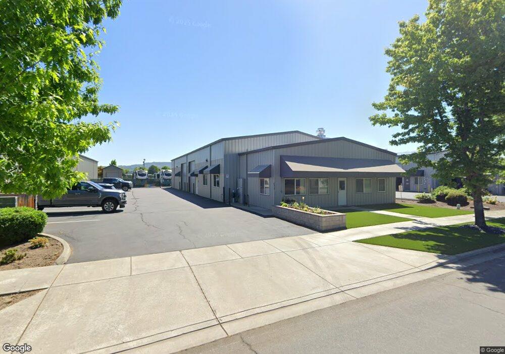
4848 Airway Dr Central Point, OR 97502
Estimated Value: $868,001
--
Bed
--
Bath
6,200
Sq Ft
$140/Sq Ft
Est. Value
About This Home
This home is located at 4848 Airway Dr, Central Point, OR 97502 and is currently estimated at $868,001, approximately $140 per square foot. 4848 Airway Dr is a home located in Jackson County with nearby schools including Wilson Elementary School, Hedrick Middle School, and North Medford High School.
Ownership History
Date
Name
Owned For
Owner Type
Purchase Details
Closed on
May 18, 2015
Sold by
Environmental Technical Resources Llc
Bought by
4848 Airway Drive Llc
Current Estimated Value
Home Financials for this Owner
Home Financials are based on the most recent Mortgage that was taken out on this home.
Original Mortgage
$376,000
Outstanding Balance
$62,611
Interest Rate
3.67%
Mortgage Type
Commercial
Estimated Equity
$805,390
Purchase Details
Closed on
Jan 25, 2007
Sold by
Airway Industrial Park Llc
Bought by
Environmental Technical Resources Llc
Home Financials for this Owner
Home Financials are based on the most recent Mortgage that was taken out on this home.
Original Mortgage
$570,000
Interest Rate
6.11%
Mortgage Type
Commercial
Create a Home Valuation Report for This Property
The Home Valuation Report is an in-depth analysis detailing your home's value as well as a comparison with similar homes in the area
Home Values in the Area
Average Home Value in this Area
Purchase History
| Date | Buyer | Sale Price | Title Company |
|---|---|---|---|
| 4848 Airway Drive Llc | $470,000 | First American | |
| Environmental Technical Resources Llc | $627,076 | Lawyers Title Ins |
Source: Public Records
Mortgage History
| Date | Status | Borrower | Loan Amount |
|---|---|---|---|
| Open | 4848 Airway Drive Llc | $376,000 | |
| Previous Owner | Environmental Technical Resources Llc | $570,000 |
Source: Public Records
Tax History Compared to Growth
Tax History
| Year | Tax Paid | Tax Assessment Tax Assessment Total Assessment is a certain percentage of the fair market value that is determined by local assessors to be the total taxable value of land and additions on the property. | Land | Improvement |
|---|---|---|---|---|
| 2025 | $9,706 | $669,250 | $209,290 | $459,960 |
| 2024 | $9,706 | $649,760 | $203,190 | $446,570 |
| 2023 | $9,408 | $638,590 | $197,270 | $441,320 |
| 2022 | $8,928 | $613,590 | $197,270 | $416,320 |
| 2021 | $8,697 | $595,720 | $191,520 | $404,200 |
| 2020 | $8,513 | $578,370 | $185,940 | $392,430 |
| 2019 | $8,312 | $545,180 | $175,260 | $369,920 |
| 2018 | $8,099 | $529,310 | $170,160 | $359,150 |
| 2017 | $7,953 | $529,310 | $170,160 | $359,150 |
| 2016 | $8,005 | $498,940 | $160,390 | $338,550 |
| 2015 | $7,694 | $498,940 | $160,390 | $338,550 |
| 2014 | $7,559 | $470,310 | $151,180 | $319,130 |
Source: Public Records
Map
Nearby Homes
- 4824 Airway Dr Unit 371W06BB410
- 862 Enterprise Dr
- 4676 Industry Dr
- 4702 Industry Dr
- 5156 Peace Ln
- 1141 Helicopter Way
- 1151 Helicopter Way
- 1250 Vilas Rd
- 1182 E Justice Rd
- 5011 Highway 62
- 2453 Crater Lake Hwy
- 4595 Table Rock Rd
- 4399 Table Rock Rd
- 223 Ridgeway Ave
- 4692 Crater Lake Ave Unit 600
- 2457 Coker Butte Rd
- 4404 Biddle Rd
- 4251 Table Rock Rd
- 2770 Parkwood Village Ln
- 201 Orchardview Cir
- 4586 Airway Dr
- 4856 Airway Dr Unit 101
- 4856 Airway Dr Unit 102
- 4856 Airway Dr Unit B
- 4856 Airway Dr
- 4888 Airway Dr
- 4896 Airway Dr
- 4778 Airway Dr
- 4880 Airway Dr
- 4864 Airway Dr
- 4840 Airway Dr
- 0 Airway Dr
- 4832 Airway Dr
- 4824 Airway Dr
- 4824 Airway Dr
- 4857 Airway
- 4841 Airway Dr
- 4849 Airway Dr Unit 103
- 4849 Airway Dr Unit 101
- 4872 Airway Dr