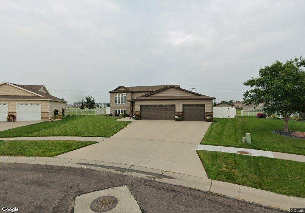
4849 47th Ave S Fargo, ND 58104
Osgood NeighborhoodEstimated Value: $410,000 - $454,815
4
Beds
3
Baths
2,610
Sq Ft
$165/Sq Ft
Est. Value
About This Home
This home is located at 4849 47th Ave S, Fargo, ND 58104 and is currently estimated at $431,704, approximately $165 per square foot. 4849 47th Ave S is a home located in Cass County with nearby schools including Osgood Elementary School, Liberty Middle School, and West Fargo Sheyenne High School.
Ownership History
Date
Name
Owned For
Owner Type
Purchase Details
Closed on
Oct 21, 2019
Sold by
Doster Marvis A
Bought by
Hunt Rodney J and Hunt Kari L
Current Estimated Value
Home Financials for this Owner
Home Financials are based on the most recent Mortgage that was taken out on this home.
Original Mortgage
$289,000
Outstanding Balance
$253,179
Interest Rate
3.5%
Mortgage Type
New Conventional
Estimated Equity
$178,525
Purchase Details
Closed on
Jun 26, 2014
Sold by
Baker Luke A and Baker Heather M
Bought by
Doster Marvis A
Home Financials for this Owner
Home Financials are based on the most recent Mortgage that was taken out on this home.
Original Mortgage
$228,000
Interest Rate
4.2%
Mortgage Type
New Conventional
Purchase Details
Closed on
Sep 25, 2009
Sold by
Brad Paul Enterprises Inc
Bought by
Baker Luke A and Baker Heather M
Home Financials for this Owner
Home Financials are based on the most recent Mortgage that was taken out on this home.
Original Mortgage
$214,370
Interest Rate
5.19%
Mortgage Type
New Conventional
Purchase Details
Closed on
Jan 6, 2009
Sold by
Level 1 A Investments Llc
Bought by
Brad Paul Enterprises Inc
Create a Home Valuation Report for This Property
The Home Valuation Report is an in-depth analysis detailing your home's value as well as a comparison with similar homes in the area
Home Values in the Area
Average Home Value in this Area
Purchase History
| Date | Buyer | Sale Price | Title Company |
|---|---|---|---|
| Hunt Rodney J | $320,000 | Title Co | |
| Doster Marvis A | $285,000 | None Available | |
| Baker Luke A | -- | -- | |
| Brad Paul Enterprises Inc | -- | -- |
Source: Public Records
Mortgage History
| Date | Status | Borrower | Loan Amount |
|---|---|---|---|
| Open | Hunt Rodney J | $289,000 | |
| Previous Owner | Doster Marvis A | $228,000 | |
| Previous Owner | Baker Luke A | $214,370 |
Source: Public Records
Tax History Compared to Growth
Tax History
| Year | Tax Paid | Tax Assessment Tax Assessment Total Assessment is a certain percentage of the fair market value that is determined by local assessors to be the total taxable value of land and additions on the property. | Land | Improvement |
|---|---|---|---|---|
| 2024 | $7,414 | $213,600 | $51,100 | $162,500 |
| 2023 | $7,650 | $205,000 | $48,000 | $157,000 |
| 2022 | $7,526 | $191,600 | $48,000 | $143,600 |
| 2021 | $7,028 | $170,300 | $48,000 | $122,300 |
| 2020 | $6,822 | $165,350 | $48,000 | $117,350 |
| 2019 | $6,668 | $165,350 | $30,000 | $135,350 |
| 2018 | $6,552 | $165,350 | $30,000 | $135,350 |
| 2017 | $6,336 | $161,650 | $30,000 | $131,650 |
| 2016 | $5,761 | $146,950 | $30,000 | $116,950 |
| 2015 | $5,889 | $146,950 | $20,400 | $126,550 |
| 2014 | $5,801 | $137,650 | $20,400 | $117,250 |
| 2013 | $5,449 | $127,650 | $20,400 | $107,250 |
Source: Public Records
Map
Nearby Homes
- 4450 48th St S
- 4281 Estate Dr S
- 4272 51st St S
- 4723 Clock Tower Ln S
- 4807 51st Ave S
- 4775 Townsite Place S
- 4812 51st Ave S
- 4758 Townsite Place S
- 4764 51st Ave S
- 4127 52nd St S
- 4110 52nd St S
- 4394 46th Ave S Unit B
- 4891 Foxtail Ln S
- 5861 Wildflower Dr S
- 9350 & 9124 57th St S
- 4868 Bluebell Loop S
- 5466 Justice Dr S
- 3712 49th St S
- 6023 Wildflower Dr S
- 4318 39 1 2 Ave S
- 4861 47th Ave S
- 4835 47th Ave S
- 4873 47th Ave S
- 4827 47th Ave S
- 4862 47th Ave S
- 4887 47th Ave S
- 4815 47th Ave S
- 4844 47th Ave S
- 5002 45th Ave S
- 4988 45th Ave S
- 4872 48th Ave S
- 4803 47th Ave S
- 4962 45th Ave S
- 4828 47th Ave S
- 4861 48th Ave S
- 4930 45th Ave S
- 4845 48th Ave S
- 5020 45th Ave S
- 4812 47th Ave S
- 4795 47th Ave S