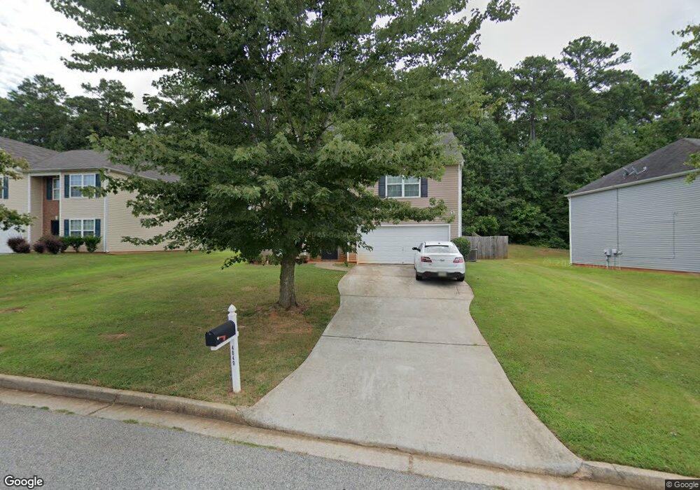
4849 Wexford Trail Atlanta, GA 30349
Estimated Value: $271,000 - $331,000
5
Beds
4
Baths
2,240
Sq Ft
$131/Sq Ft
Est. Value
About This Home
This home is located at 4849 Wexford Trail, Atlanta, GA 30349 and is currently estimated at $294,384, approximately $131 per square foot. 4849 Wexford Trail is a home located in Fulton County with nearby schools including Liberty Point Elementary School, Camp Creek Middle School, and Langston Hughes High School.
Ownership History
Date
Name
Owned For
Owner Type
Purchase Details
Closed on
Oct 1, 2008
Sold by
Mlmi Surf Trust 2005 & Ab3
Bought by
Mitchell Darryl
Current Estimated Value
Home Financials for this Owner
Home Financials are based on the most recent Mortgage that was taken out on this home.
Original Mortgage
$84,781
Outstanding Balance
$56,188
Interest Rate
6.36%
Mortgage Type
FHA
Estimated Equity
$238,196
Purchase Details
Closed on
Oct 2, 2007
Sold by
Armstrong Roger C
Bought by
Mlmi Surf Trust 2005 & Ab3
Purchase Details
Closed on
Apr 25, 2005
Sold by
Forrest Homes Inc
Bought by
Armstrong Roger C
Home Financials for this Owner
Home Financials are based on the most recent Mortgage that was taken out on this home.
Original Mortgage
$166,500
Interest Rate
6.85%
Mortgage Type
New Conventional
Create a Home Valuation Report for This Property
The Home Valuation Report is an in-depth analysis detailing your home's value as well as a comparison with similar homes in the area
Home Values in the Area
Average Home Value in this Area
Purchase History
| Date | Buyer | Sale Price | Title Company |
|---|---|---|---|
| Mitchell Darryl | $85,900 | -- | |
| Mlmi Surf Trust 2005 & Ab3 | $159,900 | -- | |
| Armstrong Roger C | $185,000 | -- |
Source: Public Records
Mortgage History
| Date | Status | Borrower | Loan Amount |
|---|---|---|---|
| Open | Mitchell Darryl | $84,781 | |
| Previous Owner | Armstrong Roger C | $166,500 |
Source: Public Records
Tax History Compared to Growth
Tax History
| Year | Tax Paid | Tax Assessment Tax Assessment Total Assessment is a certain percentage of the fair market value that is determined by local assessors to be the total taxable value of land and additions on the property. | Land | Improvement |
|---|---|---|---|---|
| 2025 | $4,408 | $114,440 | $31,880 | $82,560 |
| 2023 | $3,230 | $114,440 | $31,880 | $82,560 |
| 2022 | $3,477 | $88,680 | $18,800 | $69,880 |
| 2021 | $2,914 | $72,800 | $15,120 | $57,680 |
| 2020 | $2,843 | $69,880 | $14,680 | $55,200 |
| 2019 | $2,245 | $56,840 | $8,920 | $47,920 |
| 2018 | $2,208 | $55,480 | $8,720 | $46,760 |
| 2017 | $1,444 | $35,440 | $3,600 | $31,840 |
| 2016 | $1,445 | $35,440 | $3,600 | $31,840 |
| 2015 | $1,449 | $35,440 | $3,600 | $31,840 |
| 2014 | $1,235 | $28,640 | $4,800 | $23,840 |
Source: Public Records
Map
Nearby Homes
- 5565 Mason Rd Unit REAR
- 4861 Wexford Trail
- 4830 Station Ln
- 4832 Station Ln Unit 12
- 4834 Station Ln
- 4834 Station Ln Unit 13
- 4836 Station Ln Unit 14
- 4838 Station Ln Unit 15
- 4838 Station Ln
- 4840 Station Ln
- 4822 Station Ln
- 4818 Station Ln
- 4817 Station Ln Unit 32
- 4814 Station Ln
- 4837 Station Ln
- 4813 Station Ln
- 4811 Station Ln
- 4855 Station Ln
- 310 Wolf Downs Way
- Cecil Plan at The Enclave at Stonewall Station
- 4843 Wexford Trail
- 4855 Wexford Trail
- 4837 Wexford Trail
- 4837 Wexford Trail Unit 4837
- 4844 Wexford Trail
- 4850 Wexford Trail
- 4856 Wexford Trail
- 4867 Wexford Trail
- 4831 Wexford Trail
- 5575 Mason Rd
- 4832 Wexford Trail
- 4825 Wexford Trail
- 4874 Wexford Trail
- 4873 Wexford Trail
- 5468 Sierra Trail
- 5460 Sierra Trail
- 5456 Sierra Trail
- 5456 Sierra Tr
- 5452 Sierra Tr
- 5452 Sierra Trail