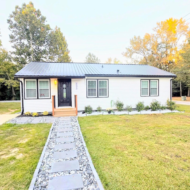

485 Allen Dr Sumter, SC 29150
Crosswell NeighborhoodEstimated payment $1,183/month
Highlights
- Ranch Style House
- Neighborhood Views
- Separate Outdoor Workshop
- No HOA
- Workshop
- Eat-In Kitchen
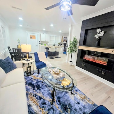
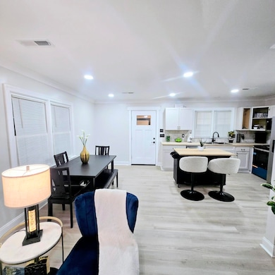
About This Home
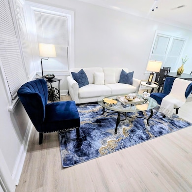
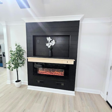
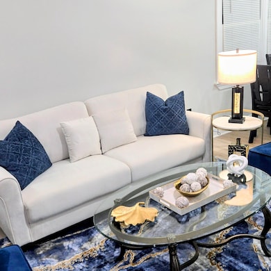
This immaculate 3 bedroom, 2 bath home has been completely remodeled with a ton of upgrades! Large corner lot with no backyard neighbors! Beautiful back deck, enclosed back porch, & outdoor fire pit area! Carport & detached garage! New paint & flooring throughout! New tankless water heater, New HVAC system, All New plumbing and electrical wiring, New metal roof, All New Windows, & much more!

Home Details
Home Type
- Single Family
Est. Annual Taxes
- $887
Year Built
- Built in 1956
Lot Details
- 9,583 Sq Ft Lot
- Landscaped
Parking
- 1 Carport Space
Home Design
- Ranch Style House
- Metal Roof
- Vinyl Siding
Interior Spaces
- 1,100 Sq Ft Home
- Insulated Windows
- Workshop
- Luxury Vinyl Tile Flooring
- Neighborhood Views
- Crawl Space
- Washer and Electric Dryer Hookup
Kitchen
- Eat-In Kitchen
- Range
- Microwave
- Dishwasher
Bedrooms and Bathrooms
- 3 Bedrooms
- 2 Full Bathrooms
Outdoor Features
- Fire Pit
- Exterior Lighting
- Separate Outdoor Workshop
- Stoop
Schools
- Crosswell Drive Elementary School
- Chestnut Oaks Middle School
- Sumter High School
Utilities
- Central Air
- Heat Pump System
- Cable TV Available
Community Details
- No Home Owners Association
- Oakdale Subdivision
Listing and Financial Details
- Auction
- Assessor Parcel Number 2480803029
Map
Home Values in the Area
Average Home Value in this Area
Tax History
| Year | Tax Paid | Tax Assessment Tax Assessment Total Assessment is a certain percentage of the fair market value that is determined by local assessors to be the total taxable value of land and additions on the property. | Land | Improvement |
|---|---|---|---|---|
| 2024 | $887 | $2,220 | $220 | $2,000 |
| 2023 | $887 | $2,220 | $220 | $2,000 |
| 2022 | $879 | $2,220 | $220 | $2,000 |
| 2021 | $822 | $2,220 | $220 | $2,000 |
| 2020 | $822 | $2,020 | $220 | $1,800 |
| 2019 | $825 | $2,040 | $220 | $1,820 |
| 2018 | $828 | $2,040 | $220 | $1,820 |
| 2017 | $832 | $2,040 | $220 | $1,820 |
| 2016 | $821 | $2,040 | $220 | $1,820 |
| 2015 | $864 | $2,210 | $310 | $1,900 |
| 2014 | $864 | $2,210 | $310 | $1,900 |
| 2013 | -- | $2,210 | $310 | $1,900 |
Property History
| Date | Event | Price | List to Sale | Price per Sq Ft |
|---|---|---|---|---|
| 11/25/2025 11/25/25 | Price Changed | $210,000 | -2.3% | $191 / Sq Ft |
| 10/24/2025 10/24/25 | For Sale | $215,000 | -- | $195 / Sq Ft |
Purchase History
| Date | Type | Sale Price | Title Company |
|---|---|---|---|
| Deed | -- | None Listed On Document | |
| Deed | $65,000 | None Listed On Document |
Mortgage History
| Date | Status | Loan Amount | Loan Type |
|---|---|---|---|
| Closed | $110,000 | Construction | |
| Previous Owner | $64,000 | Seller Take Back |
Source: Sumter Board of REALTORS®
MLS Number: 200897
APN: 248-08-03-029
Disclaimer: Certain information contained herein is derived from information provided by parties other than Homes.com. All information provided is deemed reliable, but is not guaranteed to be accurate and should be independently verified.
![]() The data relating to real estate for sale on this web site comes in part from the Internet Data exchange (“IDX”) program of the Sumter Board of Realtors. IDX information is provided exclusively for consumers' personal, non-commercial use and may not be used for any purpose other than to identify prospective properties consumers may be interested in purchasing. Listings held by brokerage firms other than Ten-X are indicated by detailed information about them such as the name of the listing firms.
The data relating to real estate for sale on this web site comes in part from the Internet Data exchange (“IDX”) program of the Sumter Board of Realtors. IDX information is provided exclusively for consumers' personal, non-commercial use and may not be used for any purpose other than to identify prospective properties consumers may be interested in purchasing. Listings held by brokerage firms other than Ten-X are indicated by detailed information about them such as the name of the listing firms.
Information deemed reliable but not guaranteed.
Copyright© 2025 Sumter Board of Realtors. All Rights Reserved.
- 530 S Pike Pike E
- 736 Wen-Le Dr
- 508 Church St Unit 508 B
- 25 W Charlotte Ave Unit 1
- 41 W Charlotte Ave
- 326 N Magnolia St
- 7 Burgess Ct
- 915 Miller Rd
- 901 Miller Rd
- 7 Harby Ave
- 91 Radcliff Dr
- 620 Dillon Trace St
- 610 Archdale Dr Unit D
- 115 Engleside St Unit A
- 115 Engleside St Unit B
- 22 Hackberry Ct
- 121 Gayle St
- 970 Jessamine Trail
- 1953 Coral Way
- 1001 Jessamine Trail