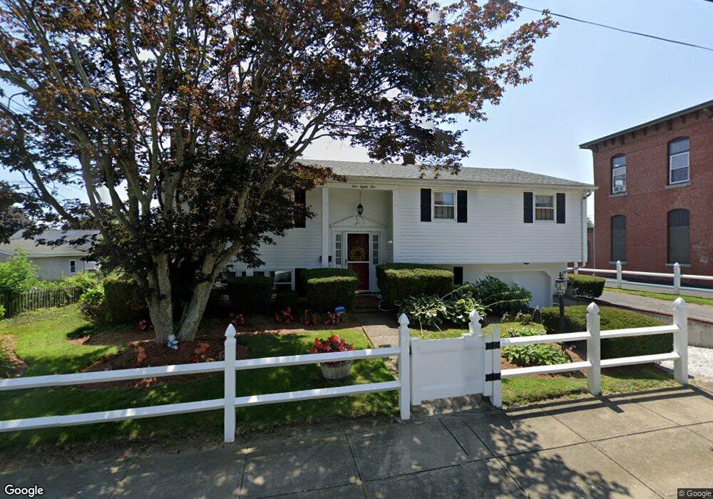
485 Anthony St Fall River, MA 02721
Maplewood NeighborhoodEstimated Value: $448,472 - $466,000
3
Beds
2
Baths
1,966
Sq Ft
$233/Sq Ft
Est. Value
About This Home
This home is located at 485 Anthony St, Fall River, MA 02721 and is currently estimated at $457,618, approximately $232 per square foot. 485 Anthony St is a home located in Bristol County with nearby schools including Letourneau Elementary School, Talbot Innovation School, and B M C Durfee High School.
Ownership History
Date
Name
Owned For
Owner Type
Purchase Details
Closed on
May 17, 2021
Sold by
Souza Ft
Bought by
Dolores Souza Ft
Current Estimated Value
Purchase Details
Closed on
Oct 4, 2004
Sold by
Souza Dolores and Souza James
Bought by
Souza Dolores Life Est
Purchase Details
Closed on
Jan 30, 1970
Bought by
Souza James and Souza Dolores
Create a Home Valuation Report for This Property
The Home Valuation Report is an in-depth analysis detailing your home's value as well as a comparison with similar homes in the area
Home Values in the Area
Average Home Value in this Area
Purchase History
| Date | Buyer | Sale Price | Title Company |
|---|---|---|---|
| Dolores Souza Ft | -- | None Available | |
| Souza Dolores Life Est | -- | -- | |
| Souza James | -- | -- |
Source: Public Records
Mortgage History
| Date | Status | Borrower | Loan Amount |
|---|---|---|---|
| Previous Owner | Souza James | $75,000 | |
| Previous Owner | Souza James | $50,000 |
Source: Public Records
Tax History Compared to Growth
Tax History
| Year | Tax Paid | Tax Assessment Tax Assessment Total Assessment is a certain percentage of the fair market value that is determined by local assessors to be the total taxable value of land and additions on the property. | Land | Improvement |
|---|---|---|---|---|
| 2025 | $4,061 | $354,700 | $118,600 | $236,100 |
| 2024 | $3,656 | $318,200 | $116,300 | $201,900 |
| 2023 | $3,585 | $292,200 | $104,800 | $187,400 |
| 2022 | $3,166 | $250,900 | $98,900 | $152,000 |
| 2021 | $3,119 | $225,500 | $94,400 | $131,100 |
| 2020 | $3,039 | $210,300 | $90,100 | $120,200 |
| 2019 | $3,126 | $214,400 | $94,200 | $120,200 |
| 2018 | $3,070 | $210,000 | $94,900 | $115,100 |
| 2017 | $2,926 | $209,000 | $94,900 | $114,100 |
| 2016 | $2,812 | $206,300 | $97,800 | $108,500 |
| 2015 | $2,681 | $205,000 | $97,800 | $107,200 |
| 2014 | $2,579 | $205,000 | $97,800 | $107,200 |
Source: Public Records
Map
Nearby Homes
- 415 Anthony St
- 1441 Stafford Rd
- 55 Kennedy St
- 186 Spencer St
- 475 Ludlow St
- 495 Chicago St
- 125 Carl St
- 478 Tucker St
- 59 Denver St
- 217 Napoleon St
- 539 Aetna St
- 191 Glasgow St Unit 2
- 142 Norman St
- 59 Wayne St
- 256 Rhode Island Ave
- 0 Stafford Rd Unit 1393774
- 0 Stafford Rd Unit 73431501
- 311 S Oxford St
- 143 Meeson St
- 248 Jefferson St
- 507 Anthony St
- 1206 Stafford Rd Unit 1208
- 1190 Stafford Rd Unit 1-3
- 1190 Stafford Rd Unit B
- 1190 Stafford Rd Unit 3
- 1190 Stafford Rd Unit 2
- 1190 Stafford Rd Unit 1
- 84 Progress St
- 98 Progress St
- 480 Anthony St
- 1212 Stafford Rd
- 496 Anthony St
- 1214 Stafford Rd Unit 2nd floor Stafford r
- 1214 Stafford Rd
- 1158 Stafford Rd
- 525 Anthony St
- 1232 Stafford Rd
- 514 Anthony St
- 1187 Stafford Rd
- 531 Anthony St