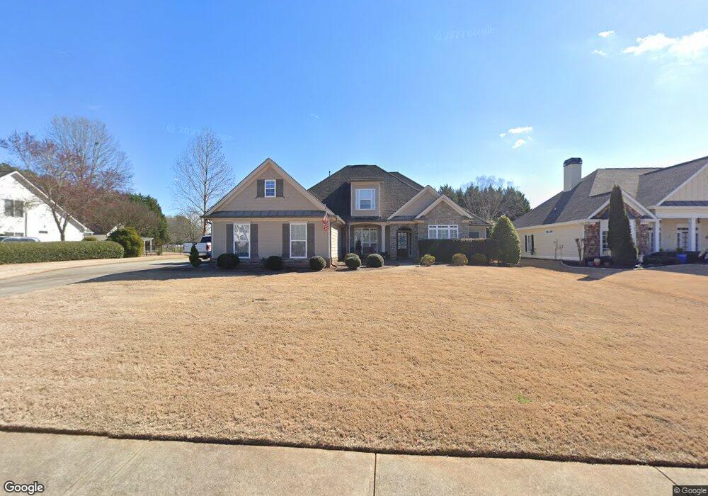
485 Creekside Dr Monroe, GA 30655
Estimated Value: $497,607 - $631,000
Studio
--
Bath
2,701
Sq Ft
$208/Sq Ft
Est. Value
About This Home
This home is located at 485 Creekside Dr, Monroe, GA 30655 and is currently estimated at $560,902, approximately $207 per square foot. 485 Creekside Dr is a home located in Walton County with nearby schools including Walnut Grove Elementary School, Youth Middle School, and Walnut Grove High School.
Ownership History
Date
Name
Owned For
Owner Type
Purchase Details
Closed on
May 19, 2021
Sold by
Ray Martha Francis
Bought by
Ray Danny Rogers
Current Estimated Value
Purchase Details
Closed on
Mar 28, 2006
Sold by
Clm Inv Llc
Bought by
Ray Danny and Ray Martha
Home Financials for this Owner
Home Financials are based on the most recent Mortgage that was taken out on this home.
Original Mortgage
$100,000
Interest Rate
6.25%
Mortgage Type
New Conventional
Purchase Details
Closed on
Dec 29, 2004
Sold by
Turner Land Dev Inc
Bought by
Clm Inv Llc
Home Financials for this Owner
Home Financials are based on the most recent Mortgage that was taken out on this home.
Original Mortgage
$396,000
Interest Rate
5.66%
Create a Home Valuation Report for This Property
The Home Valuation Report is an in-depth analysis detailing your home's value as well as a comparison with similar homes in the area
Home Values in the Area
Average Home Value in this Area
Purchase History
| Date | Buyer | Sale Price | Title Company |
|---|---|---|---|
| Ray Danny Rogers | -- | -- | |
| Ray Danny | $290,400 | -- | |
| Clm Inv Llc | $440,000 | -- |
Source: Public Records
Mortgage History
| Date | Status | Borrower | Loan Amount |
|---|---|---|---|
| Previous Owner | Ray Danny | $100,000 | |
| Previous Owner | Clm Inv Llc | $396,000 |
Source: Public Records
Tax History
| Year | Tax Paid | Tax Assessment Tax Assessment Total Assessment is a certain percentage of the fair market value that is determined by local assessors to be the total taxable value of land and additions on the property. | Land | Improvement |
|---|---|---|---|---|
| 2025 | $1,411 | $197,560 | $40,000 | $157,560 |
| 2024 | $1,411 | $183,280 | $34,000 | $149,280 |
| 2023 | $1,382 | $179,720 | $34,000 | $145,720 |
| 2022 | $1,328 | $163,360 | $26,000 | $137,360 |
| 2021 | $1,328 | $139,160 | $20,000 | $119,160 |
| 2020 | $1,356 | $134,560 | $20,000 | $114,560 |
| 2019 | $3,995 | $125,560 | $20,000 | $105,560 |
| 2018 | $3,996 | $125,560 | $20,000 | $105,560 |
| 2017 | $4,006 | $116,280 | $20,000 | $96,280 |
| 2016 | $3,405 | $101,320 | $20,000 | $81,320 |
| 2015 | $3,274 | $95,920 | $20,000 | $75,920 |
| 2014 | $3,351 | $95,800 | $0 | $0 |
Source: Public Records
Map
Nearby Homes
- 543 Sterling Water Dr
- 3055 Kari Brook Ln
- Riley A.3 2 Side Entry Plan at Nunnally Farm Rd
- 492 Nunnally Farm Rd
- 6212 Waters Edge Dr
- 172 Iroquois Ct
- 635 Nunnally Farm Rd
- 2112 Meadowood Cove
- 235 Bella Dr
- 3000 Amber Way
- 182 Bella Dr
- 182 Bella Dr
- 43 Belmont Ct
- Edgefield Plan at Pinehurst Estates
- Roanoke Plan at Pinehurst Estates
- Charleston Plan at Pinehurst Estates
- Waverly Plan at Pinehurst Estates
- Colfax Plan at Pinehurst Estates
- McDowell Plan at Pinehurst Estates
- 4335 Lakeside Blvd Unit 6
- 483 Creekside Dr
- 487 Creekside Dr
- 486 Creekside Dr
- 481 Creekside Dr
- 480 Creekside Dr
- 571 Sterling Water Dr
- 479 Creekside Dr
- 568 Sterling Water Dr
- 588 Sterling Water Dr
- 400 Nunnally Farm Rd
- 569 Sterling Water Dr
- 478 Creekside Dr
- 477 Creekside Dr
- 464 Lakeshore Dr
- 566 Sterling Water Dr Unit 32
- 566 Sterling Water Dr
- 567 Sterling Water Dr
- 475 Creekside Dr
- 462 Lakeshore Dr
- 565 Sterling Water Dr
Your Personal Tour Guide
Ask me questions while you tour the home.