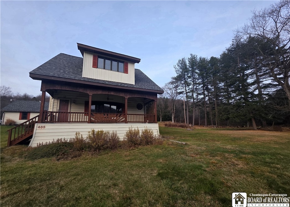
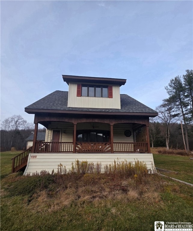
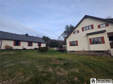
485 Derrick Rd Derrick City, PA 16727
Estimated payment $1,251/month
Highlights
- Indoor Spa
- Wood Flooring
- 2 Car Detached Garage
- 1.88 Acre Lot
- Separate Formal Living Room
- Skylights
About This Home
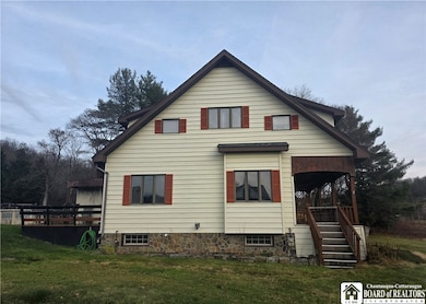
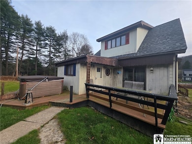
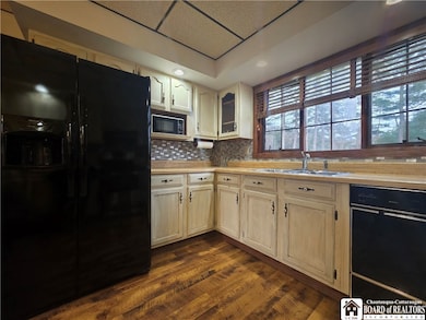
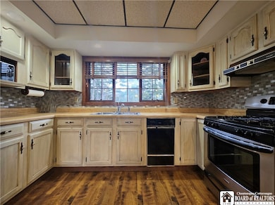
Set on 1.88 acres of peaceful countryside, this 3-bedroom, 2-bath home offers the perfect blend of rustic charm and everyday convenience. With one full bath on each floor—including an upstairs retreat featuring a soaking tub beneath a skylight—comfort is built into every corner. Inside, hardwood floors add warmth and character while central air keeps the home comfortable year round. A thoughtful layout makes living and entertaining easy. Relax on the front porch or host gathering on the back deck. Enjoy summer fun in the pool or unwind in the hot tub on the back deck. A 3-car heated garage with electric and workshop along with attic space provides room for projects, storage, and hobbies. There is plenty of space here for gardening, play or just taking in the views. Just minutes from town amenities and an easy drive to Olean via Olean Road, this property offers the ideal mix of country living and convenience.
Listing Agent
Listing by Howard Hanna Professionals - Olean Brokerage Phone: 716-229-9819 License #10401356931 Listed on: 12/01/2025

Home Details
Home Type
- Single Family
Est. Annual Taxes
- $2,554
Year Built
- Built in 1920
Lot Details
- 1.88 Acre Lot
- Irregular Lot
Parking
- 2 Car Detached Garage
- Gravel Driveway
- Shared Driveway
Home Design
- Block Foundation
- Stone Foundation
- Vinyl Siding
Interior Spaces
- 1,135 Sq Ft Home
- 2-Story Property
- Woodwork
- Ceiling Fan
- Skylights
- Separate Formal Living Room
- Indoor Spa
- Pull Down Stairs to Attic
Kitchen
- Country Kitchen
- Breakfast Bar
- Gas Cooktop
- Dishwasher
Flooring
- Wood
- Carpet
Bedrooms and Bathrooms
- 3 Bedrooms
- 2 Full Bathrooms
- Soaking Tub
Laundry
- Laundry Room
- Laundry on main level
Basement
- Basement Fills Entire Space Under The House
- Sump Pump
Utilities
- Forced Air Heating and Cooling System
- Gas Water Heater
Listing and Financial Details
- Tax Lot 384
- Assessor Parcel Number 21-025-217-00
Map
Home Values in the Area
Average Home Value in this Area
Tax History
| Year | Tax Paid | Tax Assessment Tax Assessment Total Assessment is a certain percentage of the fair market value that is determined by local assessors to be the total taxable value of land and additions on the property. | Land | Improvement |
|---|---|---|---|---|
| 2025 | $2,554 | $62,880 | $13,480 | $49,400 |
| 2024 | $2,476 | $62,880 | $13,480 | $49,400 |
| 2023 | $2,476 | $62,880 | $13,480 | $49,400 |
| 2022 | $2,476 | $62,880 | $13,480 | $49,400 |
| 2021 | $2,476 | $62,880 | $13,480 | $49,400 |
| 2020 | $2,476 | $62,880 | $13,480 | $49,400 |
| 2019 | $2,476 | $57,140 | $13,480 | $43,660 |
| 2018 | $22 | $57,140 | $13,480 | $43,660 |
| 2017 | -- | $57,140 | $13,480 | $43,660 |
| 2016 | $2,121 | $57,140 | $13,480 | $43,660 |
| 2015 | $786 | $57,140 | $13,480 | $43,660 |
| 2014 | $786 | $57,140 | $13,480 | $43,660 |
Property History
| Date | Event | Price | List to Sale | Price per Sq Ft |
|---|---|---|---|---|
| 12/02/2025 12/02/25 | Price Changed | $198,000 | +4.8% | $174 / Sq Ft |
| 12/01/2025 12/01/25 | For Sale | $189,000 | -- | $167 / Sq Ft |
Purchase History
| Date | Type | Sale Price | Title Company |
|---|---|---|---|
| Deed | -- | None Listed On Document | |
| Deed | $149,900 | None Available | |
| Interfamily Deed Transfer | -- | None Available |
Mortgage History
| Date | Status | Loan Amount | Loan Type |
|---|---|---|---|
| Previous Owner | $119,920 | Purchase Money Mortgage |
Source: Chautauqua-Cattaraugus Board of REALTORS®
MLS Number: R1653081
APN: 007-015344
Disclaimer: Certain information contained herein is derived from information provided by parties other than Homes.com. All information provided is deemed reliable, but is not guaranteed to be accurate and should be independently verified.
![]() IDX information is provided exclusively for personal, non-commercial use, and may not be used for any purpose other than to identify prospective properties consumers may be interested in purchasing. Information is deemed reliable but not guaranteed.
IDX information is provided exclusively for personal, non-commercial use, and may not be used for any purpose other than to identify prospective properties consumers may be interested in purchasing. Information is deemed reliable but not guaranteed.