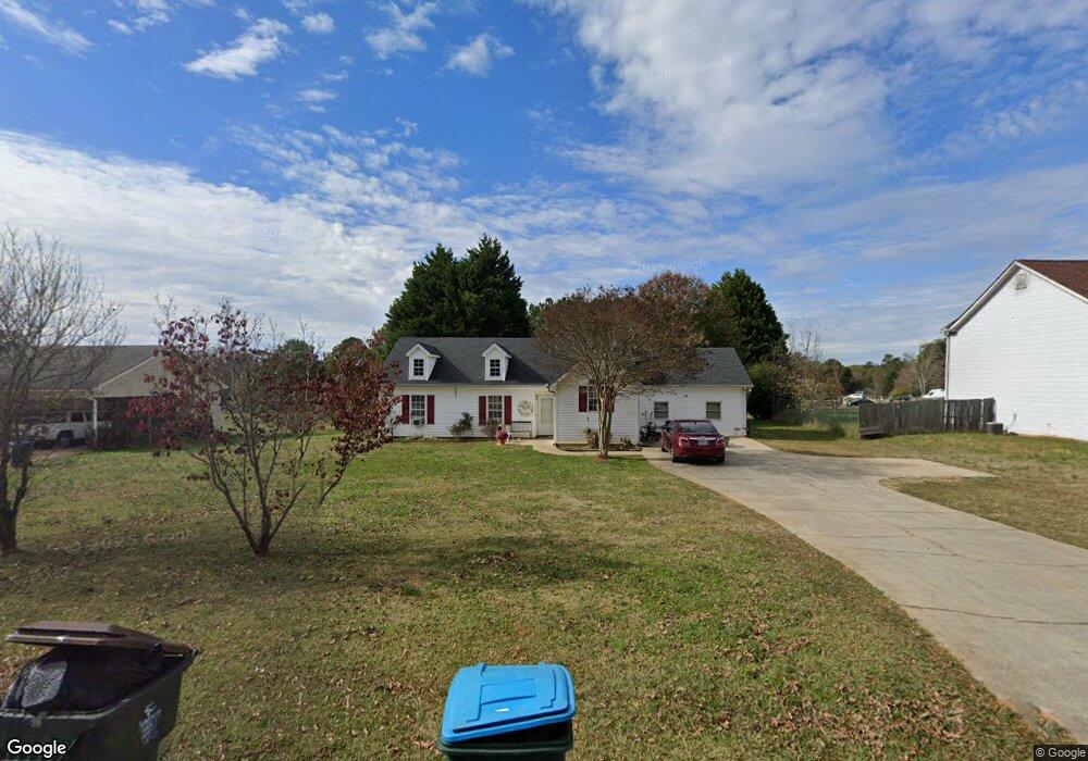
485 Hammond Rd Unit 1 Statham, GA 30666
Estimated Value: $290,552 - $335,000
3
Beds
2
Baths
1,668
Sq Ft
$183/Sq Ft
Est. Value
About This Home
This home is located at 485 Hammond Rd Unit 1, Statham, GA 30666 and is currently estimated at $305,638, approximately $183 per square foot. 485 Hammond Rd Unit 1 is a home located in Barrow County with nearby schools including Statham Elementary School, Bear Creek Middle School, and Winder-Barrow High School.
Ownership History
Date
Name
Owned For
Owner Type
Purchase Details
Closed on
Jun 6, 2006
Sold by
Deweese Stephen P and Deweese Toni G
Bought by
Stewart Giovanna N
Current Estimated Value
Home Financials for this Owner
Home Financials are based on the most recent Mortgage that was taken out on this home.
Original Mortgage
$123,068
Outstanding Balance
$72,070
Interest Rate
6.5%
Mortgage Type
FHA
Estimated Equity
$233,568
Purchase Details
Closed on
Nov 30, 2000
Sold by
Ware Norris and Ware Kamala
Bought by
Deweese Stephen P
Home Financials for this Owner
Home Financials are based on the most recent Mortgage that was taken out on this home.
Original Mortgage
$98,900
Interest Rate
7.82%
Mortgage Type
New Conventional
Create a Home Valuation Report for This Property
The Home Valuation Report is an in-depth analysis detailing your home's value as well as a comparison with similar homes in the area
Home Values in the Area
Average Home Value in this Area
Purchase History
| Date | Buyer | Sale Price | Title Company |
|---|---|---|---|
| Stewart Giovanna N | $125,000 | -- | |
| Deweese Stephen P | $98,900 | -- |
Source: Public Records
Mortgage History
| Date | Status | Borrower | Loan Amount |
|---|---|---|---|
| Open | Stewart Giovanna N | $123,068 | |
| Previous Owner | Deweese Stephen P | $98,900 |
Source: Public Records
Tax History Compared to Growth
Tax History
| Year | Tax Paid | Tax Assessment Tax Assessment Total Assessment is a certain percentage of the fair market value that is determined by local assessors to be the total taxable value of land and additions on the property. | Land | Improvement |
|---|---|---|---|---|
| 2024 | $1,894 | $63,610 | $12,000 | $51,610 |
| 2023 | $1,634 | $63,610 | $12,000 | $51,610 |
| 2022 | $1,499 | $50,679 | $12,000 | $38,679 |
| 2021 | $1,605 | $50,679 | $12,000 | $38,679 |
| 2020 | $1,615 | $50,679 | $12,000 | $38,679 |
| 2019 | $1,639 | $50,679 | $12,000 | $38,679 |
| 2018 | $1,296 | $44,232 | $12,000 | $32,232 |
| 2017 | $1,390 | $39,830 | $12,000 | $27,830 |
| 2016 | $1,156 | $40,492 | $12,000 | $28,492 |
| 2015 | $1,169 | $40,825 | $12,000 | $28,825 |
| 2014 | $934 | $35,039 | $5,880 | $29,159 |
| 2013 | -- | $30,995 | $5,880 | $25,115 |
Source: Public Records
Map
Nearby Homes
- 67 Defilippe Dr
- 97 Defilippe Dr
- 129 Purackal Ln
- 227 Dove Field Dr Unit 84
- 247 Dove Field Dr Unit 83
- 267 Dove Field Dr Unit 82
- 287 Dove Field Dr
- 287 Dove Field Dr Unit 81
- 2054 Jana Ln
- 305 Dove Field Dr Unit 80
- 619 Graham Campbell Ln
- 341 Graham Campbell Ln
- 1880 Oakley Trail
- 2641 Oakley Trail
- 2661 Oakley Trail
- 2540 Oakley Trail
- 2671 Oakley Trail
- 2665 Oakley Trail
- 564 Peters St
- 139 Goldshore Way
- 481 Hammond Rd
- 481 Hammond Rd Unit 1
- 491 Hammond Rd
- 499 Hammond Rd
- 2006 Rachael Dr Unit 2
- 473 Hammond Rd
- 2008 Rachael Dr
- 482 Hammond Rd
- 507 Hammond Rd
- 488 Hammond Rd Unit 1
- 2007 Rachael Dr Unit 2
- 469 Hammond Rd Unit 1
- 469 Hammond Rd
- 494 Hammond Rd
- 2138 Broad St Unit 1
- 470 Hammond Rd
- 2146 Broad St Unit 1
- 2010 Rachael Dr
- 2010 Rachael Dr Unit 2
- 2136 Broad St Unit 1