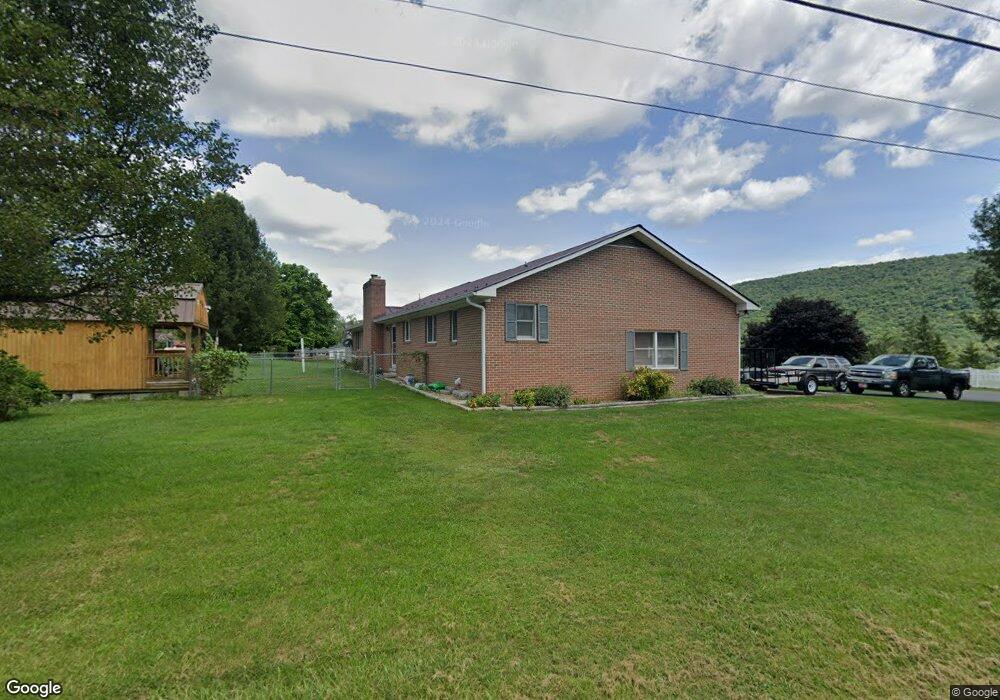
485 High St Franklin, WV 26807
Estimated Value: $231,000 - $291,000
3
Beds
3
Baths
1,832
Sq Ft
$140/Sq Ft
Est. Value
About This Home
This home is located at 485 High St, Franklin, WV 26807 and is currently estimated at $256,990, approximately $140 per square foot. 485 High St is a home with nearby schools including Pendleton County Middle/High School.
Create a Home Valuation Report for This Property
The Home Valuation Report is an in-depth analysis detailing your home's value as well as a comparison with similar homes in the area
Home Values in the Area
Average Home Value in this Area
Tax History Compared to Growth
Tax History
| Year | Tax Paid | Tax Assessment Tax Assessment Total Assessment is a certain percentage of the fair market value that is determined by local assessors to be the total taxable value of land and additions on the property. | Land | Improvement |
|---|---|---|---|---|
| 2025 | $803 | $106,440 | $15,120 | $91,320 |
| 2024 | $782 | $104,220 | $14,640 | $89,580 |
| 2023 | $725 | $98,100 | $12,720 | $85,380 |
| 2022 | $707 | $96,120 | $12,720 | $83,400 |
| 2021 | $698 | $95,100 | $12,720 | $82,380 |
| 2020 | $684 | $93,660 | $11,520 | $82,140 |
| 2019 | $763 | $102,360 | $13,380 | $88,980 |
| 2018 | $721 | $98,040 | $16,260 | $81,780 |
| 2017 | $702 | $96,240 | $16,740 | $79,500 |
| 2016 | $708 | $96,240 | $17,220 | $79,020 |
| 2015 | $594 | $90,960 | $15,240 | $75,720 |
| 2014 | $594 | $84,180 | $15,900 | $68,280 |
Source: Public Records
Map
Nearby Homes
- 222 Dyer Ave
- 405 N Main St
- 0 Route 220 Hwy
- 0 Anderson Hill Unit WVPT2001082
- 646 N Main St
- TBD U S Route 33
- 137 Elm St
- 164 Eldon Heights
- 139 Glover Dr
- 0 Entry Mountain Rd Unit WVPT2000596
- 789 Upper South Branch Rd
- 232 Hawks Ridge Rd
- 120 Galen Hedrick Rd
- 1537 Hidden Valley Rd
- 0 Rt 5 10 (Buffalo Hills Road)
- 3383 Petersburg Pike
- 3496 Petersburg Pike
- 873 Arlie Simmons Rd
- 1453 Dry Run Rd
- 255 Troublesome Valley Rd