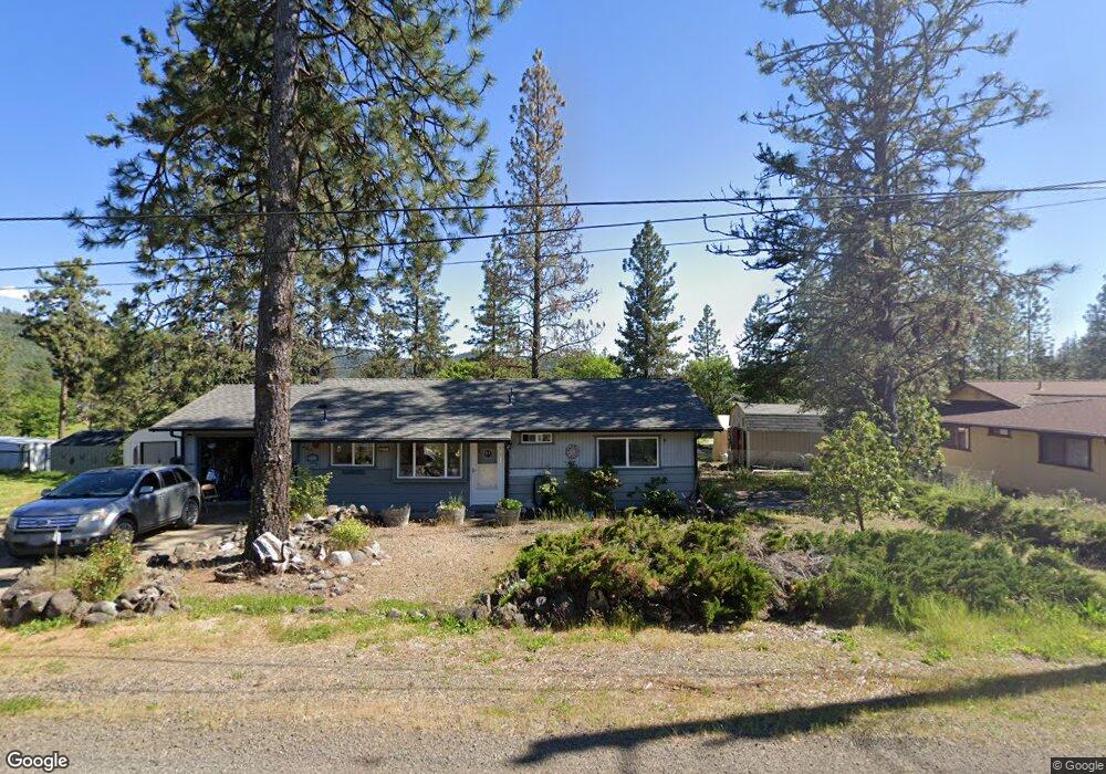
485 Hudspeth Ln Shady Cove, OR 97539
Estimated Value: $274,000 - $319,000
2
Beds
1
Bath
988
Sq Ft
$303/Sq Ft
Est. Value
About This Home
This home is located at 485 Hudspeth Ln, Shady Cove, OR 97539 and is currently estimated at $299,224, approximately $302 per square foot. 485 Hudspeth Ln is a home located in Jackson County with nearby schools including Shady Cove School, Eagle Point Middle School, and White Mountain Middle School.
Ownership History
Date
Name
Owned For
Owner Type
Purchase Details
Closed on
Mar 25, 2021
Sold by
Smith Mcbeth Kimberly and Armstrong Karen
Bought by
Mcbeth Kevin and Smith Mcbeth Kimberly
Current Estimated Value
Home Financials for this Owner
Home Financials are based on the most recent Mortgage that was taken out on this home.
Original Mortgage
$16,480
Interest Rate
2.73%
Mortgage Type
New Conventional
Purchase Details
Closed on
May 21, 2020
Sold by
Smith Mcbeth Earl H
Bought by
Smith Mcbeth Kimberly L
Create a Home Valuation Report for This Property
The Home Valuation Report is an in-depth analysis detailing your home's value as well as a comparison with similar homes in the area
Home Values in the Area
Average Home Value in this Area
Purchase History
| Date | Buyer | Sale Price | Title Company |
|---|---|---|---|
| Mcbeth Kevin | -- | Ticor Title Company Of Or | |
| Smith Mcbeth Kimberly L | -- | None Available |
Source: Public Records
Mortgage History
| Date | Status | Borrower | Loan Amount |
|---|---|---|---|
| Closed | Mcbeth Kevin | $16,480 |
Source: Public Records
Tax History Compared to Growth
Tax History
| Year | Tax Paid | Tax Assessment Tax Assessment Total Assessment is a certain percentage of the fair market value that is determined by local assessors to be the total taxable value of land and additions on the property. | Land | Improvement |
|---|---|---|---|---|
| 2025 | $2,011 | $165,960 | $81,740 | $84,220 |
| 2024 | $2,011 | $161,130 | $79,360 | $81,770 |
| 2023 | $1,944 | $156,440 | $77,050 | $79,390 |
| 2022 | $1,827 | $156,440 | $77,050 | $79,390 |
| 2021 | $1,773 | $151,890 | $74,810 | $77,080 |
| 2020 | $1,911 | $147,470 | $72,640 | $74,830 |
| 2019 | $1,885 | $139,010 | $68,480 | $70,530 |
| 2018 | $1,875 | $134,970 | $66,490 | $68,480 |
| 2017 | $1,713 | $134,970 | $66,490 | $68,480 |
| 2016 | $1,649 | $127,230 | $62,670 | $64,560 |
| 2015 | $1,543 | $123,240 | $67,520 | $55,720 |
| 2014 | $1,534 | $119,940 | $59,070 | $60,870 |
Source: Public Records
Map
Nearby Homes
- 0 Pinetop Terrace Unit 220161538
- 1027 Chevney Way
- 551 Hudspeth Ln
- 635 Sarma Dr
- 124 Hudspeth Ln
- 62 Erickson Ave Unit A-B
- 30 Dion Ct Unit 3
- 640 Sarma Dr
- 234 Williams Ln
- 110 Cora Dr
- 22071 Highway 62 Unit 54
- 975 Old Ferry Rd
- 202 White Oak Way
- 205 Madrone Ln
- 1755 Old Ferry Rd
- 23159 Highway 62
- 7431 Rogue River Dr
- 1060 Anglers Place
- 838 Ragsdale Rd
- 1090 Anglers Place
- 525 Hudspeth Ln
- 480 Hudspeth Ln
- 522 Hudspeth Ln
- 490 Hudspeth Ln
- 545 Hudspeth Ln
- 530 Hudspeth Ln
- 535 Hudspeth Ln
- 0 Pinetop Terrace Unit 102966265
- 0 Pinetop Terrace Unit 220125571
- 400 Hudspeth Ln
- 705 Hudspeth Ln
- 702 Hudspeth Ln
- 553 Hudspeth Ln
- 547 Hudspeth Ln
- 536 Hudspeth Ln
- 457 Hudspeth Ln
- 394 Pinetop Terrace
- 120 Kathleen Terrace
- 500 Skyline Dr
- 510 Skyline Dr