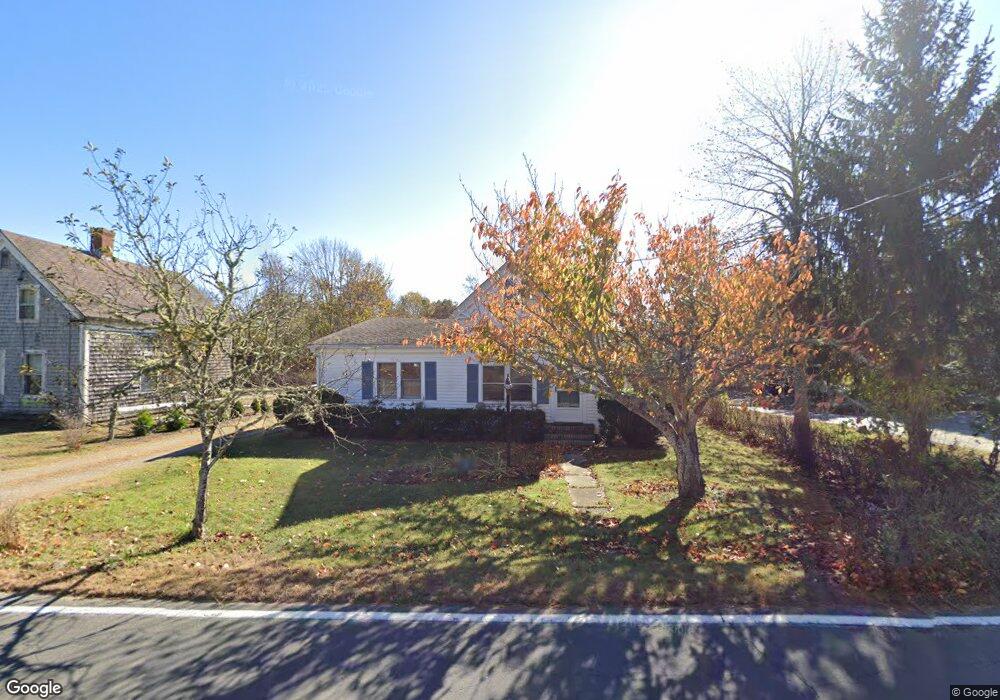
485 Main St Harwich, MA 02645
Northwest Harwich NeighborhoodEstimated Value: $527,000 - $556,000
2
Beds
1
Bath
1,089
Sq Ft
$496/Sq Ft
Est. Value
About This Home
This home is located at 485 Main St, Harwich, MA 02645 and is currently estimated at $540,680, approximately $496 per square foot. 485 Main St is a home located in Barnstable County with nearby schools including Harwich Elementary School, Chatham Elementary School, and Monomoy Regional Middle School.
Ownership History
Date
Name
Owned For
Owner Type
Purchase Details
Closed on
Sep 29, 2017
Sold by
Kolb-Cauble Gretchen A
Bought by
Minns Brian
Current Estimated Value
Home Financials for this Owner
Home Financials are based on the most recent Mortgage that was taken out on this home.
Original Mortgage
$251,750
Outstanding Balance
$210,676
Interest Rate
3.89%
Mortgage Type
New Conventional
Estimated Equity
$330,004
Purchase Details
Closed on
Apr 11, 1996
Sold by
Est Hopson Bruce T and Crowell William D
Bought by
Kolb Gretchen A
Home Financials for this Owner
Home Financials are based on the most recent Mortgage that was taken out on this home.
Original Mortgage
$78,213
Interest Rate
7.39%
Mortgage Type
Purchase Money Mortgage
Purchase Details
Closed on
May 12, 1992
Sold by
Financial Enterprises
Bought by
Hopson Bruce T
Home Financials for this Owner
Home Financials are based on the most recent Mortgage that was taken out on this home.
Original Mortgage
$55,000
Interest Rate
8.91%
Mortgage Type
Purchase Money Mortgage
Create a Home Valuation Report for This Property
The Home Valuation Report is an in-depth analysis detailing your home's value as well as a comparison with similar homes in the area
Home Values in the Area
Average Home Value in this Area
Purchase History
| Date | Buyer | Sale Price | Title Company |
|---|---|---|---|
| Minns Brian | $265,000 | -- | |
| Kolb Gretchen A | $87,000 | -- | |
| Hopson Bruce T | $64,000 | -- |
Source: Public Records
Mortgage History
| Date | Status | Borrower | Loan Amount |
|---|---|---|---|
| Open | Minns Brian | $251,750 | |
| Previous Owner | Hopson Bruce T | $100,000 | |
| Previous Owner | Hopson Bruce T | $78,213 | |
| Previous Owner | Hopson Bruce T | $55,000 |
Source: Public Records
Tax History Compared to Growth
Tax History
| Year | Tax Paid | Tax Assessment Tax Assessment Total Assessment is a certain percentage of the fair market value that is determined by local assessors to be the total taxable value of land and additions on the property. | Land | Improvement |
|---|---|---|---|---|
| 2025 | $2,496 | $422,300 | $174,700 | $247,600 |
| 2024 | $2,404 | $398,700 | $164,900 | $233,800 |
| 2023 | $2,319 | $349,300 | $149,900 | $199,400 |
| 2022 | $2,311 | $284,900 | $130,300 | $154,600 |
| 2021 | $2,171 | $252,400 | $118,500 | $133,900 |
| 2020 | $2,167 | $248,200 | $119,500 | $128,700 |
| 2019 | $2,124 | $245,000 | $114,900 | $130,100 |
| 2018 | $1,883 | $214,000 | $92,100 | $121,900 |
| 2017 | $1,715 | $191,200 | $72,800 | $118,400 |
| 2016 | $1,690 | $186,300 | $72,800 | $113,500 |
| 2015 | $1,628 | $181,500 | $71,300 | $110,200 |
| 2014 | $1,548 | $176,500 | $69,200 | $107,300 |
Source: Public Records
Map
Nearby Homes
- 2 Bassett Woods Rd
- 12 Old Campground Rd
- 18 Old Campground
- 13 6 Penny Ln
- 13 Six Penny Ln
- 116 Sisson Rd
- 135 Sisson Rd
- 2 Englewood Dr Unit D-7
- 7 Tonis Way
- 116 Parallel St
- 25 Robbins Rd
- 11 Windjammer Rd
- 50 Oak St
- 159 Pleasant Lake Ave
- 6 Sassafras Ln
- 307 Bank St
- 213 S Westgate Rd
- 303 Bank St
- 292 Route 28 Unit 7
- 44 Beriah Brooks Rd