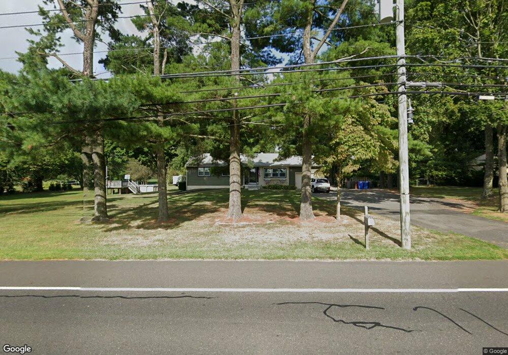
485 Main St Southampton, NJ 08088
Estimated Value: $413,000 - $487,000
3
Beds
2
Baths
1,442
Sq Ft
$307/Sq Ft
Est. Value
About This Home
This home is located at 485 Main St, Southampton, NJ 08088 and is currently estimated at $442,175, approximately $306 per square foot. 485 Main St is a home located in Burlington County with nearby schools including Southampton Twp School No 1, Southampton Twp School No 2, and Southampton Twp School No 3.
Ownership History
Date
Name
Owned For
Owner Type
Purchase Details
Closed on
Apr 29, 2010
Sold by
Ohara Robert M and Ohara Kathleen M
Bought by
Deviney David and Deviney Natalie
Current Estimated Value
Home Financials for this Owner
Home Financials are based on the most recent Mortgage that was taken out on this home.
Original Mortgage
$255,102
Outstanding Balance
$171,486
Interest Rate
5.11%
Mortgage Type
New Conventional
Estimated Equity
$270,689
Create a Home Valuation Report for This Property
The Home Valuation Report is an in-depth analysis detailing your home's value as well as a comparison with similar homes in the area
Home Values in the Area
Average Home Value in this Area
Purchase History
| Date | Buyer | Sale Price | Title Company |
|---|---|---|---|
| Deviney David | $250,000 | First American Title Ins Co |
Source: Public Records
Mortgage History
| Date | Status | Borrower | Loan Amount |
|---|---|---|---|
| Open | Deviney David | $255,102 |
Source: Public Records
Tax History Compared to Growth
Tax History
| Year | Tax Paid | Tax Assessment Tax Assessment Total Assessment is a certain percentage of the fair market value that is determined by local assessors to be the total taxable value of land and additions on the property. | Land | Improvement |
|---|---|---|---|---|
| 2025 | $7,340 | $222,500 | $70,000 | $152,500 |
| 2024 | $7,069 | $222,500 | $70,000 | $152,500 |
| 2023 | $7,069 | $222,500 | $70,000 | $152,500 |
| 2022 | $6,820 | $222,500 | $70,000 | $152,500 |
| 2021 | $6,671 | $222,500 | $70,000 | $152,500 |
| 2020 | $6,524 | $222,500 | $70,000 | $152,500 |
| 2019 | $6,384 | $222,500 | $70,000 | $152,500 |
| 2018 | $6,234 | $222,500 | $70,000 | $152,500 |
| 2017 | $6,257 | $222,500 | $70,000 | $152,500 |
| 2016 | $6,123 | $222,500 | $70,000 | $152,500 |
| 2015 | $5,930 | $222,500 | $70,000 | $152,500 |
| 2014 | $5,720 | $222,500 | $70,000 | $152,500 |
Source: Public Records
Map
Nearby Homes
- 8 -10 Church
- 111 Newbolds Corner Rd
- 209 Village Ln
- 214 Buddtown Rd
- 0 Ongs Hat Rd Unit NJBL2021664
- 3 Sherry Ann Dr
- 55 James Ave
- 19 Sunset Blvd
- 204 Ridge Rd
- 155 Ridge Rd
- 103 Fox Chase Ct
- 517 Ridge Rd
- The Oakton Plan at East Gate at Wexford
- The Ashton Plan at East Gate at Wexford
- The Marigold Plan at East Gate at Wexford
- The Laurelton Plan at East Gate at Wexford
- 001 Fieldstone Dr
- 692 Eayrestown Rd
- 2405 Route 206
- 309 Eayrestown Rd
- 487 Main St
- 483 Main St
- 489 Main St
- 481 Main St
- 491 Main St
- 441 Main St
- 103 Newbolds Corner Rd
- 439 Main St
- 105 Newbolds Corner Rd
- 461 Main St
- 437 Main St
- 104 Newbolds Corner Rd
- 507 Main St
- 106 Newbolds Corner Rd
- 107 Newbolds Corner Rd
- 509 Main St
- 108 Newbolds Corner Rd
- 110 Newbolds Corner Rd
- 511 Main St
- 2 Pemberton Rd